Oklahoma historical congressional district maps
I've been watching politics for a very long time, going back to my childhood, so it's funny to observe the media's new-found concern about gerrymandering -- the practice of manipulating election district boundaries to benefit one party over another. The media's concern seems to have emerged with the growing dominance of the Republican Party in state legislatures and governor's mansions. (If that chart went further back, into the '70s and '80s, Democrat-dominated state governments would show up in greater numbers.) Suddenly, there are calls to take redistricting away from the politicians and put it in the hands of judges or computers or appointed commissions, or some combination of the three.
But a recently released, comprehensive archive of historical congressional district boundaries reveals that Democrats had no scruples against partisan gerrymanders when they had control of the process. Scholars at the University of California at Los Angeles have developed digital shapefiles of congressional districts going all the way back to 1789 and the 1st Congress. A Github site has the files organized by state and Congress; click on a link and you'll see an interactive map overlaying OpenStreetMap. You can zoom in and see how the old boundaries overlay towns and streets. More readily accessible, but without the interactive capabilities, is a Wikipedia page showing Oklahoma congressional district maps going back to 1972.
I had unsuccessfully been looking for old district maps for ages. I can't tell you how excited I was to find these.
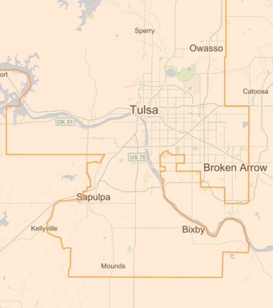
As I said, I've been watching this process for a very long time. I remember 1982, when the Democrats in the Legislature, with Governor Nigh's approval, cut heavily Republican south Tulsa out of the 1st Congressional District, in order to improve incumbent Democrat Congressman Jim Jones's chances of survival, and shifted those voters into the heavily Democrat 2nd District, where their votes would be a tiny GOP drop in a big Democrat ocean. In that same redistricting, the Democrats at the State Capitol had the African-American neighborhoods of northeastern Oklahoma City share a congressman with the Panhandle and the wheat fields and cotton fields of western Oklahoma -- all to protect the Democrat incumbent in that district.
District 5, once compactly encompassing part of Oklahoma County, was stretched for hundreds of miles to take in Republican concentrations around Guthrie and Bartlesville. The Wall Street Journal mocked the District's twisted boundaries as "Mickey's Enchanted Kingdom" in honor of incumbent Republican Mickey Edwards. The new boundaries gave Edwards a very safe seat, while making it harder for Republicans to get elected in other districts.
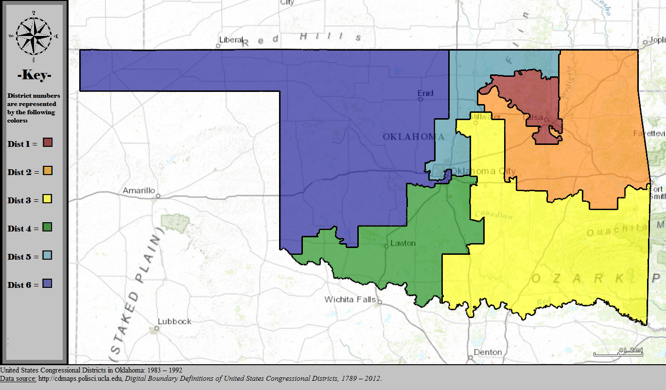
The resulting map contained the impact of growing Republican sentiment in the state, inspired by Ronald Reagan and the leftward shift of the national Democrat party, limiting the GOP to a single seat out of six.
I also remember walking blocks in 1988 for Jerry Riley, who was running for the open Senate 37 seat. That district consisted mainly of the rural and blue collar areas of western Tulsa County, but the boundaries crossed the river to take in a sliver of land between 21st and 56th Streets west of Peoria, including the luxury apartment building at 2300 Riverside. The story I heard was that the Democrat incumbent at the time of redistricting wanted to continue to represent the common people but preferred not to live among them.
These events inspired me to submit an op-ed to the Tulsa Tribune, published on May 31, 1991, opposing the practice of protecting incumbents in redistricting and urging an approach that focused on communities of interest and natural boundaries. I suggested an independent redistricting commission that would include unsuccessful candidates, the use of nested districts to make it harder to draw boundaries favoring an incumbent, and ratification by statewide referendum.
Although Republicans swept control of Oklahoma's congressional delegation in the 1990s, legislative redistricting protected rural Democrat incumbents by adding to each district just enough population from the growing suburbs to keep them viable. That tactic delayed the GOP takeover of the State House until 2004 and the State Senate until 2008. Term limits and the continued shift of the national Democrat Party to the Left ultimately overcame the Democrat advantage built into the maps.
Here's a map showing the State House districts drawn after the 2000 census, but colored to show party status after the 2010 election. Here's the State Senate district map following the 2000 census.
When they had control of the process, Democrats dismissed calls for redistricting reform as so much partisan whining by the GOP. They only seem to have warmed to the idea now that the shoe is on the other foot.
MORE:
Here are direct links to interactive versions of each Oklahoma congressional map since statehood. The dates refer to the election years affected; add 1 year to get the start of the corresponding congressional term. I've added notes after some of the links:
- Oklahoma congressional districts, 1907, 1908, 1910 elections (60th-62nd Congresses): Oklahoma was assigned 5 congressional seats at statehood.
- Oklahoma congressional districts, 1912 election (63rd Congress): Oklahoma was apportioned three additional seats, but these were elected at-large for one term.
- Oklahoma congressional districts, 1914 - 1930 elections (64th-72nd Congresses): The legislature got around to redrawing the district lines in time for the 1914 election. Congress failed to approve reapportionment after the 1920 census, so Oklahoma's lines were not redrawn.
- Oklahoma congressional districts, 1932 - 1940 elections (73rd-77th Congresses): Oklahoma's 1920s oil boom earned the state a 9th seat, but this was elected at-large; district boundaries did not change.
- Oklahoma congressional districts, 1942 - 1950 elections (78th-82nd Congresses): Dust Bowl emigration cost Oklahoma that at-large seat; boundaries of the 8 remaining districts were not changed.
- Oklahoma congressional districts, 1952 - 1966 elections (83rd-90th Congresses): Further outmigration cost Oklahoma two more seats. District lines had to be redrawn for the first time since 1914. Since the number of congressmen did not change in 1960, the legislature left the map alone.
- Oklahoma congressional districts, 1968 - 1970 elections (91st-92nd Congresses): This map reflects judicially-controlled redistricting to equal-population districts, pursuant to the Voting Rights Act
- Oklahoma congressional districts, 1972 - 1980 elections (93rd-97th Congresses): At time of redistricting, Republicans held districts 1 and 6 only. Long-time District 1 Republican incumbent Page Belcher had won the 1970 election by a narrow margin over Democrat Jim Jones, then opted to retire. The new boundaries added Democrats to and removed Republicans from the district; and Jones won the open District 1 seat in 1972, beating former Tulsa mayor Jim Hewgley by 11 percentage points.
- Oklahoma congressional districts, 1982 - 1990 elections (98th-102nd Congresses): At time of redistricting, Mickey Edwards of CD 5 was the only Republican in the Oklahoma delegation, but growing enthusiasm for Ronald Reagan and the Republican Party in Oklahoma forced boundary adjustments to protect vulnerable Democrat incumbents, like Jim Jones in CD 1 and Glenn English in CD 6.
- Oklahoma congressional districts, 1992 - 2000 elections (103rd-107th Congresses): At time of redistricting, Republican Mickey Edwards still held CD 5, and Republican Jim Inhofe had picked up CD 1 in 1986, when Jim Jones chose to challenge Sen. Don Nickles, so lines were drawn to pack as many Republicans as possible into those two districts.
- Oklahoma congressional districts, 2002 - 2010 elections (108th-112nd Congresses): After being on the bubble in the previous census, Oklahoma finally lost its 6th seat. At time of redistricting, five of six seats were held by Republicans; Democrat Brad Carson held the CD 2. 3rd District incumbent Wes Watkins retired prior to redistricting, avoiding the need to assign two incumbents to the same district.
STILL MORE:
thirty-thousand.org makes the case for a larger Congress, closer to the constitutional ideal of 30,000 people per seat. The site recounts the 1929 law that froze the number of House members at 435 and the negative effects of that decision.
0 TrackBacks
Listed below are links to blogs that reference this entry: Oklahoma historical congressional district maps.
TrackBack URL for this entry: https://www.batesline.com/cgi-bin/mt/mt-tb.cgi/7669