Oklahoma History: February 2010 Archives
Getting caught up:
Early last month (best defined as the very cold windy period between the big Christmas snowstorm and the big late January ice storm), I had two back-to-back business trips, both involving graveyard-shift hours, separated by less than a day at home. The first trip was to Altus AFB, in southwestern Oklahoma.
Altus and I go back 22 years, with trips to work on C-141 and KC-135 simulators in (approximately) 1987, 1996, 1997, 2000, 2006, and 2007. While there's one fastest way between here and there -- I-44 to Lawton then US 62 to Altus, there are plenty of other paths, and I took as many as I could to see as much of southwest Oklahoma as I could -- Cordell, Hobart, Hollis, Granite, Gotebo, Burns Flat (once home to an Air Force Base of its own), Clinton, Weatherford. When I learned at the 1998 National Preservation Conference that Oklahoma had one of the top Main Street small-town revitalization programs in the nation, I could believe it because I'd seen the results in many of these towns.
If I didn't have time to get too far off the straightest route, there were still some interesting but brief diversions along the way. US 62 is now straight as a string from west of Lawton to Altus, but before the 1970s, US 62 followed the railroad and the terrain and passed through several towns: Cache, Indiahoma, Snyder, and Headrick. Most of that old US 62 alignment still exists as county-maintained roads; the Snyder loop is still a designated highway -- US 62 Business.
My very favorite piece of this old road was a four-mile segment, beginning 10.5 miles east of the center of Altus, looping off to the south, through Headrick, then across the North Fork of the Red River and a railroad before rejoining the main road west of Snyder. This piece of road nicks the northwest corner of Tillman County -- an important fact to which I'll return later.
Here's what I wrote about it after a trip three years ago, in a blog entry about the scenic route between Altus and Medicine Park that I started but never finished until tonight:
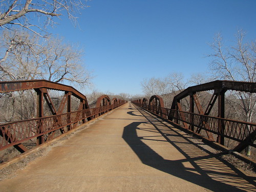
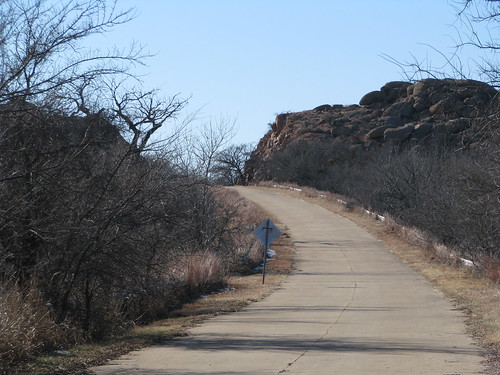
The road skirts the northern edge of the little town then winds through some some rocky hills and over a long pony truss bridge across the North Fork of the Red River, followed by a through truss bridge over a railroad. The old concrete roadbed, the old style bridges, the pale orange rocks, and the mesquite trees combine to look like a fading slide from a summer vacation out west circa 1947.
The concrete of this old road is in exceptionally good condition, and as I prepared to head back to Tulsa at the end of my most recent visit, I was looking forward to driving it.
But there was a problem:
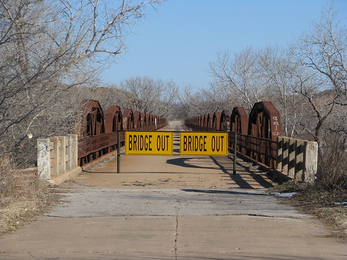
The problem became an opportunity. While I had driven this road several times before, I had only seen it at 35 or 40 miles per hour. It was a sunny, cold day, but I was bundled up and the wind wasn't too bad, so I decided to go for a walk.
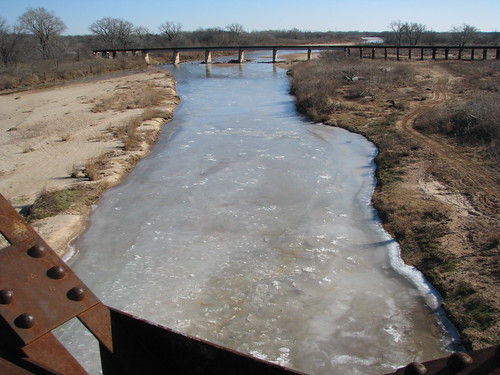
The walk gave me a nice view of the North Fork of the Red River, once claimed by Texas to be the main branch of the river and therefore the border between Texas and Indian Territory. To the west, between the two forks of the Red and the 100th Meridian was Greer County, Texas. A U. S. Supreme Court decision in 1896 proclaimed that this land belonged to Oklahoma. (Here's Texas' side of the story.)
The shallow river was still mostly ice. This photo is looking south toward the BNSF (formerly Frisco) tracks.
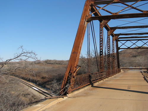
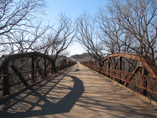
The bridge and road are actually in very good condition, but the railroad overpass beyond it is closed and in need of repair.
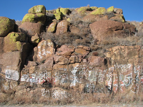
With the railroad overpass closed, the river bridge (when it was open) formed a very lengthy cul-de-sac, a fact that seemed to have been noted by the area's unruly youths:
According to the Oklahoma Bridges website, the river bridge was closed in October 2009. Built in 1929, the bridge has 23 trusses, is 1,924 feet long. The posted weight limit is 17 tons. It was US 62 until a new, more direct alignment between Altus and the river was opened in 1970.
Regarding the railroad overpass, the Oklahoma Bridges website says:
The left endpost looks as though it was struck, as all the concrete guard rail is missing on the north side of the west approach, and the cover plate on the endpost is damaged. Despite these deficiencies, the bridge was given satisfactory and fair marks in its 2007 inspection. Despite this, and despite the fact it is a heavy bridge, Tillman County decided to close this bridge on Oct. 26, 2009....We at Oklahoma Bridges are hopeful that repairs will be made to this bridge and that it will be reopened. Its closure has also affected another nearby bridge, the Old US 62 North Fork Red River Bridge, which was also closed by neighboring Jackson County because, with this overpass bridge closed, the river bridge dead ends.
So back to the car:
(After the 1.5" of ice they got in late January, I'll bet those trees aren't overhanging the road anymore.)
And back down the highway...
... to my next adventure:

Click any of the above photos to see bigger versions and to explore the rest of my Flickr photoset of my southwest Oklahoma trip, including photos of a monument to the vanished APCO refinery in Cyril and interesting buildings in downtown Altus (before the massive ice storm that knocked power out for more than a week).