Shepherd's Historical Atlas
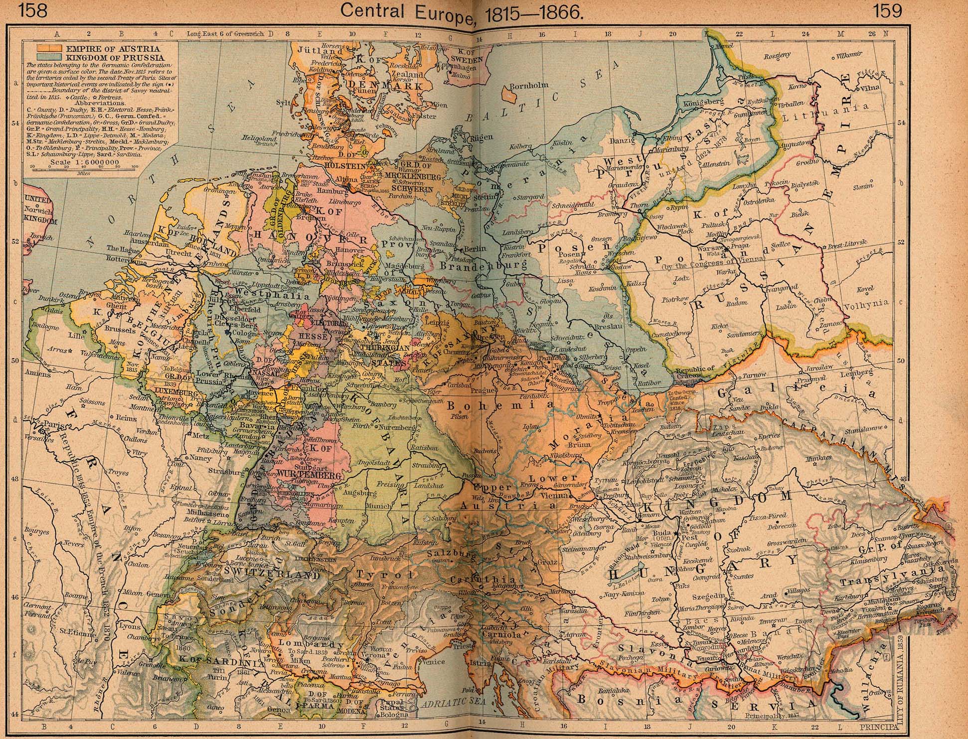
The University of Texas has a wonderful online collection of maps, both current and historical. One of the treasures to be found is the complete contents of Shepherd's Historical Atlas -- both 1923 and 1926 editions. I remember time spent poring over these detailed maps, marveling at the complexity of pre-unification Germany and wondering about the claims of the 13 colonies to western territories. (And Jefferson's proposal to organize the Northwest Territories as 10 states. Interesting that the proposed state of Metropotamia today has one of America's highest concentrations of Mesopotamians.)