Maps: November 2003 Archives
Andrew Sullivan links to this fascinating map, showing the balance of contributions to Republican and Democrat presidential candidates by three-digit zip code region. You can also look at the same data by state and by county and see for each candidate where their money is coming from -- just use the pulldown menu to change candidates. Elsewhere on the site are rankings showing who's pulling money from the grassroots and the fat cats. Bush draws well from both grassroots -- measured by the number of small donations -- and fatcats. Lieberman and Kerry have the wealthiest donors on average.
So far most of the money donated from Oklahoma is going to Democrats, particularly Lieberman, Dean, and Edwards.
The Tulsa County Assessor's office has online maps showing school districtboundaries and municipal boundaries. More impressive is the collection of maps showing subdivision boundaries, lot and block numbers, and lot dimensions. Each square mile is an Adobe Acrobat file.
It's nice to have those maps there, but I'm really impressed with SAGIS, the Savannah Area Geographic Information System, which allows for zooming in and out, and you can click on a lot and find out who owns it, what it's worth, how big the lot is, how it's zoned, and even who the city alderman and county commissioner are for that location. Another click takes you to the property card, with the physical characteristics of the buildings on the property. You can control layers of information on the map, and see property lines and zoning lines overlaid on an aerial photo. This is a great tool for property owners and potential buyers and investors. I hope we can get something like this for Tulsa very soon.
See a strange area code on caller ID? The website of NANPA (the North America Numbering Plan Administration) is the place to search for information about area codes, find up-to-date area code maps for North America, and up-to-date info on recent and upcoming area code splits, and on the dialing rules in each area. Where can I use 10-digit dialing? Where must I dial all 10 digits?
Remarkably, 13 states -- mostly in the Mountain West and in New England -- and DC still are managing with a single area code.
And here's a site with the history of area code numbering. Oklahoma became a two-area code state when 918 was created in 1953 (mandatory in 1954). The rationale behind the original numbering -- most populous areas got the fewest pulses -- New York had the most favorable area code, then Chicago and Los Angeles.
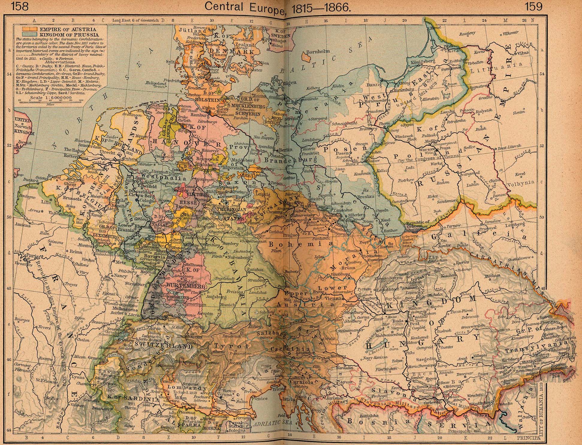
The University of Texas has a wonderful online collection of maps, both current and historical. One of the treasures to be found is the complete contents of Shepherd's Historical Atlas -- both 1923 and 1926 editions. I remember time spent poring over these detailed maps, marveling at the complexity of pre-unification Germany and wondering about the claims of the 13 colonies to western territories. (And Jefferson's proposal to organize the Northwest Territories as 10 states. Interesting that the proposed state of Metropotamia today has one of America's highest concentrations of Mesopotamians.)