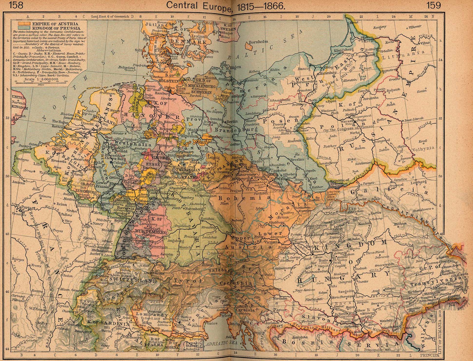
The University of Texas has a wonderful online collection of maps, both current and historical. One of the treasures to be found is the complete contents of Shepherd's Historical Atlas -- both 1923 and 1926 editions. I remember time spent poring over these detailed maps, marveling at the complexity of pre-unification Germany and wondering about the claims of the 13 colonies to western territories. (And Jefferson's proposal to organize the Northwest Territories as 10 states. Interesting that the proposed state of Metropotamia today has one of America's highest concentrations of Mesopotamians.)
« A week of bleatage: Chernobog, the Atkins diet, the Hokey Pokey, K-TEL records | Main | Official area code maps »
Shepherd's Historical Atlas

About
This page contains a single entry from the blog posted on November 4, 2003 12:12 AM.
The previous post in this blog was A week of bleatage: Chernobog, the Atkins diet, the Hokey Pokey, K-TEL records.
The next post in this blog is Official area code maps.
For the latest entries, visit the main page, which also has links to archives by month and by category.
Contact
BlogAds
Blog Ad Swap
Support BatesLine
BatesLine is PayPal Verified
Recent Posts
- A succinct and well-linked rationale for voting no
- 4.0 frustration
- Sign suppression
- Both sides now
- Joel Kotkin on civic improvement schemes and city policy
- Steed on voter apathy and lobbyist power
- Upgrade in progress
- Elections are still a spectator sport in Delaware County
- Letters to the editor self-selection
- More bridges to nowhere
Search
Powered by
Movable Type Publishing Platform 4.0
Movable Type Publishing Platform 4.0