Maps: November 2023 Archives
What was here? Who owned it? What did it look like? There are a number of resources available for reconstructing Oklahoma's geographical past, and they're easier to use than ever. These are my go-tos when researching the history of a neighborhood or answering questions about the past. This is an encyclopedic article, so if you're on the home page, you'll have to click the "Continue reading" link to see all of it.
These links will take you to specific sections of this article:
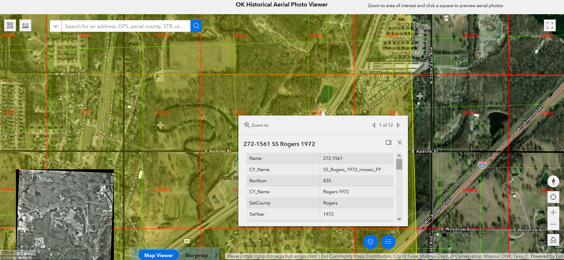
- Oklahoma Historical Aerial Digitization Project: Geotagged historical aerial photos going back to the 1930s
- Oklahoma Aerial Photo Inventory: A broader collection of imagery, including some not yet geotagged
- EarthExplorer: US Geological Survey aerial imagery: Higher resoution aerial photos from the 1950s through the 1970s, plus satellite and other imagery
- topoView: US Geological Survey historical topographical maps: Maps for Oklahoma from 1901
- US Bureau of Land Management Land Records: Township survey plats of Indian Territory from the 1890s, with field notes from the surveyors
- Oklahoma State University McCasland Maps Collection: Includes historical county highway maps as early as 1937, plus USGS topo quads not in the topoView collection
- WPA 1936 land ownership and valuation maps: Interactive statewide browser
- Tulsa Sanborn Fire Insurance Maps at Library of Congress: Building-by-building detail from Tulsa's earliest days through 1915, 1939, and 1962
- Tulsa Census Enumeration District and Census Tract Maps: Base street maps and boundaries of statistical neighborhoods
- Tulsa County Clerk Subdivision Plats and Deed Indexes
- Tulsa County Assessor Static Section Maps
- Miscellaneous Maps of Tulsa
Continue reading Tulsa and Oklahoma historical maps and aerial photos.