
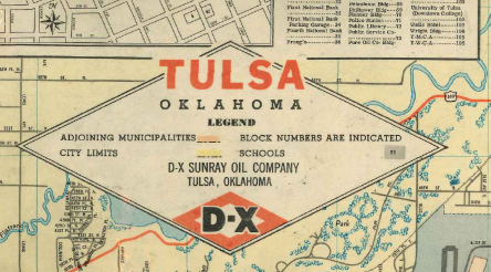
This may help stir some memories of late '50s Tulsa. Reader John Brandon sent along a scan of a 1958 service station map of the City of Tulsa. He got it as an eleven-year-old, and he marked it up (in black crayon) to show changed city limits resulting from annexation and the recently proposed freeway network. Click this link to open or download the 4 MB PDF of the 1958 D-X map of Tulsa.
(It's nice to find a kindred spirit. I was (and am) fond of collecting and annotating maps, too.)
On the back of the map is a downtown grid, showing the location of important buildings, a map showing the route of the Tulsa Tour, and a county map, which shows the small cities and the locations of several rural schools, like East Central (then at Admiral and Garnett) and Rentie (81st and Harvard).
Here are some interesting things I noticed; please add your observations in the comments:
- On the county map, the N-S section line roads east of Memorial aren't named and go up in increments of 17, not 16 as they do today.
- I'm pretty sure that U.S. 169 came down Boston from 11th Street to connect to Boulder Park Rd and the 21st Street bridge. This map shows it coming down Baltimore Ave.
- On the county map, no Yale between 71st and 81st. No 61st between Sheridan and Memorial.
- The intersection of 31st and Yale, evidently designed to avoid two grade crossings of the M. K. & T. tracks.
- Alsuma (51st & Mingo) is still a separate town with its own street names.
- Other odd street names: Braniff Hills and Broadmoor Hills south of Southern Hills Country Club. Hidden Hill at... well, I'll let you find Hidden Hill.
- Where does downtown stop? It's a lot harder to tell without the Inner Dispersal Loop.
MORE MAPS: John Brandon was kind enough to scan some specific parts of the map:
The central Tulsa part of the main map (939 KB)
The map's cover (1.39 MB)
Downtown inset showing major buildings (845 KB)
Tulsa County map (619 KB)
Tulsa Tour route map (1019 KB)

Comments (4)
1958???
Service (gasoline) stations actually provided service. What a novel idea!
All service was FULL-SERVICE. The service station attendant (UNIFORMED!) pumped your gas, checked your oil and tire pressure, and cleaned your windshield.
Gasoline ranged from $0.24 - $0.36 per gallon (What we today are now paying 1,000% more for gasoline!)
They GAVE AWAY free city and state maps.
They gave away free calendars, pens, dinner glasses, plates (collect the whole set), placemats, etc. as promotional items. Collect the entire set (and keep coming back!).
They gave away GREEN STAMPS with every purchase.
Each oil company had their own individual credit cards. You'd need a credit card wallet big enough to hold a credit card from every major oil company and every local department store to take a long motoring trip. There were NO Visa or MasterCards.
Oklahoma still had PROHIBITION. Bootleggers delivered a "lug" of booze to your house if you wanted the hard stuff.
Birth control pills had not been invented. Nor had AIDS.
Oklahomans were already dangerously infected, however, with Tag Agents, Turnpikes, Abstract Companies, duplicative state college & university systems, a wasteful plethora of independent school districts each with its very own School Board, Sales-Taxes-on-Groceries, and Gene Stipe-variety crooked politicians. Gene Stipe in fact.
In Oklahoma, some things don't ever change........ although it appears we are about to be cured of Gene Stipe shortly.
Posted by Bob | May 23, 2007 12:56 PM
Posted on May 23, 2007 12:56
I enjoyed the Sand Springs insert. I've only lived here 14 years and it was cool to see how much has changed.
Posted by theotherguy | May 24, 2007 1:53 PM
Posted on May 24, 2007 13:53
Did I mention that combined Tulsa City/County/State sales tax was $0.03 cents on the dollar in 1958?
Only $0.02 if you purchased in the unincorporated areas of Tulsa County.
Today, in Tulsa we pay $0.08517 on each dollar we spend.
That's progress........huh?
Posted by Bob | May 24, 2007 2:43 PM
Posted on May 24, 2007 14:43
That's fantastic! How interesting--where my house is now was way out in the country back then!
Posted by Rocks In My Dryer | May 25, 2007 12:31 PM
Posted on May 25, 2007 12:31