Main

Tulsa 1957 Archives

August 2, 2007

Tulsa 1957: A porch swing on East 5th Place

I've been meaning to post this for some time. S. Lee, a regular commenter here, commented a while back that in the late '50s his family lived near Longfellow Elementary School, which used to be at 6th & Peoria. When he was born, the family lived at 1012 E. 5th Pl., between Madison and Norfolk, next door to a "very nice lady" named Mrs. Anna D. Aurandt, who lived at 1014 E. 5th Pl. Mrs. Aurandt had a son named Paul who had worked for KVOO, then moved away to seek his fortune in radio.

On one of Paul's visits home, S. Lee's father snapped a photo of Mrs. Aurandt and her boy.

S. Lee wrote:

I wish I could tell you more about E. 5th Pl., but I was too young to remember much more than the lady next door was a nice lady who sometimes had treats for me. My late dad took a wonderful picture of Paul and his mother in a porch swing. My mother still has it. My dad was pastor at the 1st Church Of God (Anderson) at 5th and Madison which is now in the middle of the expressway. The church was forced to moved to the building at 3rd and Trenton which was later bought by Leon Russell.

Assuming I'm not totally dazed and confused, I think [Tulsa Whirled editorial page editor] Ken Neal had some association with the 5th and Madison church -- youth or music leader; something like that. You'll have to ask him about it next time you see him. I know how you two pal around all the time. (snort snort).

In another comment:

My dad usually took slides -- which can be transferred to print. He eventually did get a nice print made and sent to Paul who responded with a warm and grateful letter. I'll have to check to see if there is another print that can be scanned or if the slide can be located.

S. Lee scanned a print he found and sent it to me with permission to post it. He said he is pretty sure it is not the picture he was thinking of but it is a photo of Mrs. Aurandt and son.

paulharvey1957.jpg

Mrs. Aurandt and her son Paul Harvey Aurandt.

And now you know the Rest of the Story.

He doesn't seem to have aged much.

MORE: From the 1957 Polk Directory, we learn that Mrs. Aurandt had two boarders in her two-story home: Mrs. Sadie Karcher (1014 rear) and Harry H. Porter (1014 1/2). Her phone number was DIamond 3-3992.

July 22, 2007

Tulsa 1957: Frank's Pig Stand

In a previous entry I mentioned a new book of historic photos of Tulsa, and one photo in particular of a tree-shaded Art Deco cafe that looked very inviting. It was a photo of Frank's Pig Stand, 1437 S. Boston Ave., and it was still there in 1957, but not any more, of course. Here's the picture I saw, from the Beryl Ford Collection, dated approximately 1947:


Frank's Pig Stand, Tulsa

Here are some other photos of Frank's:

Same time as picture above, from the south
A wider view of the north side, winter/early spring
A wider view of the south side, winter/early spring

Those photos are on the Tulsa Library's website. I am happy that the Beryl Ford Collection is on the web, but I wish higher-resolution scans were available -- there are fascinating details that are visible in the originals that you can't make out at the resolution on the library's website. I also wish there were a geographical and temporal way to browse. Flickr would handle multiple resolutions for each photo and provides a very slick way to map each photo. The Google Maps API adds a temporal dimension -- you can add a year slider to a map and set up a start and end date for each object, so that the objects appear or disappear depending on the point in time you've selected.

July 17, 2007

Tulsa People notes local blogs

I came across an item about Tulsa-based blogs while looking for info about Tulsa's Coliseum -- the stories were on the same page in the April 2007 Tulsa People.

Writer Andy Wheeler mentions this blog and two others: Indie Tulsa, which spotlights locally owned businesses and Alternative Tulsa, an left-leaning anonymous political blog. Included in the list of blogs is a non-blog, the Voices of Tulsa forum, founded and run by MeeCiteeWurkor.

It looked like they intended to do a monthly feature of Tulsa-related web links, but I don't see that it continued in more recent issues.

But there was this piece, in their Tulsarama-themed June edition, showing how the price of a home, a gallon of gas, college tuition, a postage stamp, and a movie ticket had changed since 1957. Family income rose faster than the official rate of inflation, and University of Tulsa tuition rose at five times the rate of inflation. (A year at TU would be $4,334 today if it had kept pace with the cost of living. Instead it's $20,669.)

According to the Bureau of Labor Statistics online Consumer Price Index calculator, 100.00 in 1957 has the same buying power as 735.54 in 2007.

June 23, 2007

City Hall move; Buried Car recap; Tulsarama revisited

My UTW column this week was also about the proposal to move City Hall to One Technology Center at 100 S. Cincinnati. Most of the questions I posed were raised in one form or another, and most were answered, although I won't say that my fears were allayed. (Don Himelfarb couldn't answer my question about the true operating costs of the first year, operating in both old and new facilities.)

I had two related feature stories in the issue, a report on the unearthing and unveiling of the buried car, and a look back at the Tulsarama! celebration in 1957 -- it was a huge city-wide celebration, plagued by at least as much rain as we've seen so far this year. It was much more than burying a time capsule and a car.

I'm pleased with the way the Tulsarama! story came out, but it isn't the comprehensive Tulsa 1957 story I wanted to do. I just ran out of time and couldn't get my arms around it. I have gathered a ton of material, looking through old city directories and planning documents, and receiving the reminiscences of Tulsans who were around in 1957. The article I wrote just scratches the surface, and I intend to provide more here and hopefully in future feature stories. The story of the major comprehensive planning effort that began in 1957 is a story that we need to know as we begin assembling yet another comprehensive plan.

Also in the current issue, Brian Ervin has a story on the difference of opinion about how many police officers Tulsa needs, with the Mayor and her interim police chief on one side and the Fraternal Order of Police on the other side.

UPDATE: Regarding the Belvedere, reader Richard Randall offered this interesting (and frightening) perspective:

We wonder why all of the bridges in Tulsa (and Oklahoma) are falling apart. Most of them were designed and built around the same time as the vault (give or take some years) by some of the same engineers. It seems to show just how well they designed and built some things back then and today, when it is built by the cheapest bidder. Growing up my dad had always talked about how bad the car would look when it came out (He worked at his dads construction company at the time the vault was built). He knew that the vault would fill up with water, by the design they used. Had they looked to the oil industry, they would have learned that water will find a way into anything. The best thing to use would have been a 1 to 2-inch steel box welded shut and encased in concrete. This would have withstood the fifty years. They did seem to grasp that idea a little bit. The time capsule was steel, (not sure if it was welded shut). Everything in it was in great condition.

Not only that, but the same engineers were probably responsible for designing the Civic Center's leaky and crumbling subterranean garage. (Maybe not crumbling any more. I haven't heard a report of falling concrete in some time.) One of the interesting facts that emerged in today's Council meeting about the proposed City Hall move -- about $16 million of that $24 million in deferred maintenance is related to the underground parking garage.

June 22, 2007

Miss Belvedere has a winner

The winning guess from 50 years ago has been identified. Someone named R. E. Humbertson, place of birth Cumberland, Maryland, date of birth July 8, 1921, guessed that Tulsa's population in 2007 would be 384,743. He was off by 2,286; the official Census Bureau estimate, as of June 1, 2007, was 382,457. The next nearest guess belonged to Mrs. Houston I. Shirley, Jr., who guessed 385,555.

The tally was dependent on a paper log of submitted entries and a few postcards. A roll of what may have been microfilm was presented to the Tulsa Historical Society. After being soaked in distilled water for three days, it was found to contain -- nothing.

It surprises me that only 812 guesses were submitted. Of that number, 25 were illegible.The median guess was 691,829. 148 people guessed a population of a million or higher. Only 68 people guessed a number less than the actual result.

The 1957 Polk Directory, using information supplied by the Tulsa Chamber of Commerce, reported an estimated population of 254,100, and a land area of 41.03 sq. mi. The city is now more than four times as big in land area (182.7 sq. mi.), and if we had maintained the same population density, the population would be 1,131,466.

I suspect that, if you were to measure the population today within the city's 1957 boundaries, you'd be at about 120,000, less than half.

At the announcement, at East Tulsa Dodge, it was mentioned that we don't have the 1957 address for any of the entries -- just name, date of birth, and place of birth. (In some cases, we only had Mrs. plus the husband's name.) Event chairman Sharon King Davis asked whether anyone had a 1957 phone book, so we could find out where Mr. or Mrs. Humbertson lived. I said try the library. Central Library not only has phone books for most years going back to the 'teens, but they have at least one city directory for each year. Someone else noted that there was a directory in the time capsule. It would be interesting to look up Humbertson in 1956 and subsequent years and see when the name disappears.

It does appear that our Mr. Humbertson has found his way to his own eternal time capsule, and did so many years ago. The Social Security Death Index has the following entry:

Name Birth Death Last Residence Last Benefit SSN Issued
RAYMOND HUMBERTSON 08 Jul 1921 May 1979 22204 (Arlington, Arlington, VA) 22204 (Arlington, Arlington, VA) 215-16-4982 Maryland

If that's not a match, it's an impressive coincidence. The next step would be to see if there are any probate records in Arlington County that would indicate the existence of heirs.

The organizers have very thoughtfully posted the list of entries from the Buried Car website. Here's a direct link (Microsoft Excel format). I found a couple of names I recognized; maybe you will, too.

June 18, 2007

The rise and fall of Greenwood

I've been so busy creating content for this coming week's Urban Tulsa Weekly that I haven't had time to link the current issue's column. It's about what I call the Greenwood Gap Theory, the widely-held notion that nothing happened in Tulsa's one-time African-American commercial district between the 1921 Race Riot and the late '80s construction of the OSU-Tulsa campus.


greenwoodpolksample.JPGTo fill the gap, I look at the historical record provided by aerial photos, street directories, and oral histories, all of which reveal that Greenwood was rebuilt after the riot, better than before in the view of many, but it was government action -- in the form of urban renewal and freeway construction -- that produced the empty lots in the '70s which OSU-Tulsa replaced.

An annotated aerial view of Deep Greenwood (the part of the district extending a few blocks north of Greenwood and Archer) from 1951 accompanies the story. Here's a larger version of the graphic for your perusal (1 MB PDF). (The scan of the aerial photo was done by INCOG at a cost of $35. INCOG has aerial photos of the entire county taken at roughly 10 year intervals.) And this photoset contains the pages from the 1957 Polk City Directory for N. Greenwood Avenue, showing the businesses, churches, and residences in house number order. Specifically they are pages 357 through 360.

June 15, 2007

Unearthed car photos

My photos of this afternoon's unearthing and tonight's unveiling are currently being uploaded to Flickr. You'll find them in the Tulsa's Buried Car photo set. Included are photos of the time capsule contents, which came out in pristine condition.

IMG_1730

This web page has photos of the crypt with the amount of water that was found in it when it was first opened.

The official buriedcar.com website has a gallery of photos of the vault and the 1957 burial.

KOTV has video of last night's unveiling.

Not so bel-vedere?

Somehow I was able to go through the arena floor to the north loading dock where workers were detaching the 1957 Plymouth Belvedere from its skids and other workers were using a circular saw and a hammer and chisel to open the time capsule.

When they hosed off the undercarriage, the water that dripped down to the ground was the color of Oklahoma City dirt.

Even if it is soggier than Ted Kennedy's car and as rusty as Davy Jones' locker, the Belvedere has served its purpose. It has been the focal point of Tulsa's statehood centennial celebration, and it has drawn press and visitors from all over the world.

###

Speaking of press from all over the world -- I've been surprised that the organizers didn't do a better job helping press find out where they were supposed to be. Last night at the credentialing welcome party at the Tulsa Press Club, there was no sign outside on Boston Avenue pointing visiting reporters there. (Doesn't help that Boston Ave. looks like a war zone.) There were no signs indicating press parking and entrances. The press packet listed the north YMCA lot as the press parking area, but there seemed to be no way to get to it from any direction. And there were no signs pointing to the press reception area in the basement of the convention center.

###

The MC at the noon excavation was fired retired KRMG morning host John Erling, the favorite mouthpiece of the old Tulsa establishment. He got the nod to MC the arena groundbreaking and the inauguration of Kathy Taylor. Erling is a relative newcomer -- he arrived in Tulsa in 1976. Why not ask a Tulsa media personality who was around in 1957 -- someone like Lee Woodward (he moved here in 1957) or Clayton Vaughn or Don Woods or Dick Schmitz or Frank Morrow or any number of old-time Tulsa radio and TV types who frequent TulsaTVMemories.com?

An imagined conversation 50 years ago today

"You know, there really ought to be a drain at the bottom of this thing, just in case any water gets in."

"Whaddya mean, in case any water gets in? It's a pool liner, it's designed to keep water on one side. And we're sealing it in an airtight plastic bag -- space age technology. Anyway, it's too late to change anything even if we wanted to."

"You're right. And it's not like we're going to be around in 50 years when they pull it out of the ground."

June 6, 2007

Washington 1957: Mr. Novak Goes to Washington

It isn't Tulsa, but it is 50 years ago:

On Monday morning May 13, 1957, I entered the Washington bureau of the Associated Press in the old Evening Star building on Pennsylvania Avenue, a 26-year-old reporter transferred from Indianapolis where I had reported on the Indiana legislature for the AP. I was immediately sent to Capitol Hill, and soon was helping cover the Kennedy brothers' investigation of Teamsters boss Jimmy Hoffa, defended by Edward Bennett Williams. What a start for 50 years in Washington that continue today.

My $125 weekly paycheck was hardly enough to get by, but drinks were cheap in the Members Bar of the National Press Club (restricted to males, as was the club itself), and the small steak there sold for $1.25. I resorted to group living, in a large Georgetown house owned by a Foreign Service officer who was in Costa Rica as ambassador. I paid $100 rent a month. My housemates included two United Press reporters and two CIA employees (one overt and one covert).

It is highly unlikely to find journalists and intelligence operatives cohabiting today, reflecting the kinder, gentler nation's capital a half century ago. Then, as now, a Congress controlled by Democrats with a one-vote margin in the Senate confronted a Republican president. But they opposed each other courteously in 1957. I had arrived in Washington in a pause preceding party polarization, the civil rights revolution, racial riots, student unrest, assassinations, two impeachment proceedings, Vietnam, Watergate and Iraq.

Washington then was still the town of Southern efficiency and Northern charm, shabby and not resembling today's sleek metropolis. The government was much smaller and far less intrusive. The $76.7 billion federal budget ($585 billion in current dollars) compares with the 2007 figures of $2.7 trillion. But even those relatively modest figures spawned an assault on President Dwight D. Eisenhower's budget by Senate Majority Leader Lyndon B. Johnson.

Read the rest of Novak's reminiscences of then vs. now.

And if you arrived in Tulsa about the time that Mr. Novak arrived in Washington, I'd love to know what you remember about it. I'm still working on my story about Tulsa in 1957 -- it'll run after the unearthing of the Belvedere and will include coverage of that event -- so there's still time to send me your reminiscences.

May 31, 2007

Tulsa 1957: Restaurant map

As I mentioned in my initial Tulsa 1957 post, I wanted to be able to create maps showing where things were back then. I finally figured out a relatively easy way to do it, using Google Earth, and I found a number of online tools to minimize the amount of development work I would need to do.

My first exercise was to create a KML file showing all of the more than 400 restaurants listed in the classified section of the 1957 Polk Directory of Tulsa. The usual GIGO warning applies. If the Polk Directory was wrong, the file will be wrong.

I would like to add, but have not yet added, non-duplicate entries from the Southwestern Bell Yellow Pages. I'm limited there because a quarter of a page from the "Cafes" section of the 1957 phone book was torn out.

Google Earth makes it possible to include all sorts of information in a map -- with enough time and energy, you could include images of newspaper and phone book ads and building photos.

To build the file I used Excel to enter name and address, then used an online tool called BatchGeocode to convert each address to a latitude and longitude and to create a KML file, which Google Earth can read. I had to do a bit of tweaking to get the icons I wanted, and the Geocoder had trouble with some addresses that no longer exist (e.g., the 100 block of South Main, the 500 block of East Brady and East Cameron). (I pre-modified Sapulpa Rd and Sand Springs Rd addresses to the modern day names of Southwest Blvd and Charles Page Blvd.) For some reason, Pennington's Drive-In wound up in the south Atlantic Ocean, but I fixed it.

Google Maps can load and display small KML files, but not a KML file with 400 entries. So you'll need to have Google Earth installed on your PC to get the full effect. In Google Earth, you'll be able to hover over an icon to see the name, and click on it to see the address. Here again is the link to the KML file of Tulsa's restaurants in 1957 which you can download and use in Google Earth.

For those without, and until I can figure a dynamic way to display the map online, I've provided some screenshots from Google Earth below the fold. One is zoomed out to show the location of all restaurants in the city, the other is zoomed in to provide more detail between Pine and 36th, Union and Harvard.

A cool idea for future implementation: Google Earth is able to display a fourth-dimension -- time. If you could compile the restaurant listings for each year, you'd be able to move the time slider back and forth and watch as one restaurant replaces another, and as restaurants move out toward the suburbs. What an amazing way that would be to visualize the development and undevelopment of the city over time.

Speaking of undevelopment, notice some of the clusters of restaurants. There are eateries on nearly every block downtown, and there's a linear cluster extending north of the expressway -- that's Greenwood -- the Black Wall Street of America. There's a cluster along Quanah / Southwest Blvd in west Tulsa (another urban renewal removal). Sheridan Road was the key commercial link between the airport and the rest of the city.

I hope to post more KML files in the future, covering places like drug stores, groceries, churches, beer joints, bowling alleys, and movie theaters. It would speed up the process if some of my readers were willing to help transcribe phone book entries. I'm not quite set up to accept help, but in the not too distant future, I will be able to send you an image of a page from the Polk Directory and a template Excel spreadsheet for you to fill in. Let me know if you'd be willing to help in that way by e-mailing me at blog at batesline dot com.

And as always, if seeing the name of an obscure restaurant stirs some memories, drop me a line and tell me about it.

Pictures after the jump:

Continue reading "Tulsa 1957: Restaurant map" »

May 25, 2007

Tulsa 1957: American Airlines Convair crash near Owasso

One of the unusual events of 1957 was the January 6th crash of an American Airlines Convair 240 en route from Joplin to Tulsa. The plane was west of Owasso on approach to Tulsa Municipal Airport. Three crew and seven passengers were aboard. One passenger was killed. The cause of the crash:

Struck trees, hit the ground, and slid 500 ft. after landing short of the runway in rapidly deteriorating condtions. The captain's lack of alertness in allowing the first officer to continue an instrument descent to an altitude too low to permit terrain clearance.

Here is a link to the coverage and photos of the crash from the January 10, 1957, edition of the Collinsville News.

May 22, 2007

1958 D-X Map of Tulsa

This may help stir some memories of late '50s Tulsa. Reader John Brandon sent along a scan of a 1958 service station map of the City of Tulsa. He got it as an eleven-year-old, and he marked it up (in black crayon) to show changed city limits resulting from annexation and the recently proposed freeway network. Click this link to open or download the 4 MB PDF of the 1958 D-X map of Tulsa.

(It's nice to find a kindred spirit. I was (and am) fond of collecting and annotating maps, too.)

DXMapLogo.png

On the back of the map is a downtown grid, showing the location of important buildings, a map showing the route of the Tulsa Tour, and a county map, which shows the small cities and the locations of several rural schools, like East Central (then at Admiral and Garnett) and Rentie (81st and Harvard).

Here are some interesting things I noticed; please add your observations in the comments:

  • On the county map, the N-S section line roads east of Memorial aren't named and go up in increments of 17, not 16 as they do today.
  • I'm pretty sure that U.S. 169 came down Boston from 11th Street to connect to Boulder Park Rd and the 21st Street bridge. This map shows it coming down Baltimore Ave.
  • On the county map, no Yale between 71st and 81st. No 61st between Sheridan and Memorial.
  • The intersection of 31st and Yale, evidently designed to avoid two grade crossings of the M. K. & T. tracks.
  • Alsuma (51st & Mingo) is still a separate town with its own street names.
  • Other odd street names: Braniff Hills and Broadmoor Hills south of Southern Hills Country Club. Hidden Hill at... well, I'll let you find Hidden Hill.
  • Where does downtown stop? It's a lot harder to tell without the Inner Dispersal Loop.

MORE MAPS: John Brandon was kind enough to scan some specific parts of the map:

The central Tulsa part of the main map (939 KB)
The map's cover (1.39 MB)
Downtown inset showing major buildings (845 KB)
Tulsa County map (619 KB)
Tulsa Tour route map (1019 KB)

Tulsa 1957 request

I'm working on a story in connection with the upcoming unearthing of the 1957 Plymouth Belvedere time capsule, and I need your help. I want to convey to readers who weren't around then what Tulsa was like and how it was different 50 years ago.

If you lived or worked or visited Tulsa in 1957, whether you were a child, a teenager, or a grown-up, I want to hear your memories. You don't have to be able to remember anything earth-shattering. I'm looking for things like favorite places to eat out, your school, your neighborhood (particularly if you lived just north of downtown, in Greenwood, west of Denver downtown, or in the Locust Park area), teen hangouts, where you shopped for groceries, what you did for fun in the summer time. If you remember anything about the big events of that year -- such as the massive May flood, the car burial, the Tulsarama semi-centennial celebration -- I'd like to hear about that, too.

My deadline is the day after Memorial Day, so the sooner I hear from you, the better.

You can post your memories as a comment on this entry or e-mail me at blog at batesline dot com. If you'd rather talk to me than write to me, e-mail me your phone number, and I'll give you a call. Thanks very much.

May 13, 2007

Greenwood 1957

This entry was inspired by a recent comment by the president of Langston University. I'll say no more now, as I will address the comment in this week's Urban Tulsa Weekly column, but here are some interesting facts I gleaned from analyzing the 1957 edition of Polk's City Directory.

For out of towners and newcomers to Tulsa: Greenwood Avenue was Main Street for Tulsa's African-American community prior to urban "renewal." A few commercial buildings remain at the corner of Greenwood and Archer, and a handful of churches still stand, but most everything else was demolished. The land at the southern end of Greenwood stood vacant for many years until it was designated for a state college campus, now the Tulsa campus of Oklahoma State University. The storefronts at the northern end were replaced with late '70s, early '80s suburban style homes.

It's hard to imagine what Greenwood was like just 50 years ago. This may give you some sense of the place.

In 1957 on Greenwood Ave. in Tulsa, there were nine grocery stores in the mile between Archer and Pine Streets, along with five drug stores, six variety/sundry/dry goods stores, a meat market, a confectionery, a bakery, a florist, a hardware store, a jeweler, a radio and TV store, two record stores, two appliance stores, two thrift shops, four gas stations, and a hardware store.

There were also 21 barber and/or beauty shops, four shoe repair shops, four shoe shine parlors, three tailors, a photographer, an upholstery shop, and eight dry cleaners.

Greenwood Ave. had five physicians, four dentists, a chiropractor, five law offices, two real estate offices, two insurance agencies,a newspaper (the Oklahoma Eagle), and seven churches.

There were two fraternal lodges, a dance hall (the Dreamland), a nightclub (the Flamingo), eight bars, a movie theater (the Rex), 19 restaurants (including three places with barbecue in the name and three chili parlors), and four pool halls.

There were eight hotels, 11 apartment buildings, 13 rooming houses.

That only counts businesses on Greenwood Ave. and doesn't include other streets and avenues in the district, which went as far west as Detroit and as far east as the Midland Valley and Santa Fe tracks.

If you want specifics about what businesses were where, you can see for yourself by looking at pp. 357-360 of Polk's 1957 directory of Tulsa.

March 15, 2007

Tulsa 1957: Here to stay?

Man-on-the-street interviews from the March 11, 1957, Tulsa Tribune on the subject of rock 'n' roll's staying power. I'm guessing these comments were gleaned somewhere in downtown Tulsa, from the presence of a Central High School student and the fact that Mrs. Dearston is adorned with a very lovely hat -- the sort one would wear to go shopping in the city. Note the scarves -- must have been a windy day.

Curbstone Opinion
Rock 'N' Roll Losing Popularity?
Majority Quizzed Here Say Not

Young people are going to keep on "rocking and rolling," believe a majority of this week's Curbstoners. They see -- and hear -- no let up from the teen-age craze.

The question: Is rock 'n' roll on the way out? Experts say it is beginning to get ragged around the edges."

Tribune-19570311-Curbstone.JPG

Miss Glynna Eastering of 1144 S. Troost Ave., a nurse: "No, I don't think it is. My friends and I still love to listen to it, and it seems to me it is just as popular as ever. I certiainly like it as much."

Mrs. Imogene Coats of Salina, Okla., a teacher: "I don't think rock 'n' roll is dying out; not from the reaction in our school. When we have assemblies, that's all the students want. Our school has a little combo, and the boys and girls will sit and listen to them play those songs for hours."

Dan Coco, of 215 W. Tecumseh St., a Central High School student: "Yes, I do think it's going out. It's not the fad now it was because it's all turning into the same thing. Every song sounds alike. Some of the students are still crazy about it, but most of the ordinary girls and boys are losing their enthusiasm for it."

Mrs. Howard Dearston of Bixby, housewife: "I hope so. It doesn't look as if it is, however. I think it is just a phase as the charleston was with us."

Mrs. George Graff Jr., of 4107 S. New Haven Pl., housewife and teacher: "I have a teenage daughter, and I don't really think it is ending. The young people just like it too well. After all, it's an outlet for their anxieties and emotions."

Charles Harris of 3919 W. 8th St., seaman stationed with the Coast Guard in Alaska: "Yes, I think rock 'n' roll is on the way out. The charleston always is making a comeback and fading out, ever since the '20s, and I think this music will do the same. The waltzes and rhythm tunes are coming in again now. Rock 'n' roll is really losing its popularity in Alaska."

You mean it wasn't named to honor Lewis Meyer?

From the March 11, 1957, Tulsa Tribune we learn which Lewis gave his name to Tulsa's Lewis Avenue:

Services for Mrs. Elizabeth Bell Lewis, widow of S. R. (Buck) Lewis, pioneer Tulsa attorney and real estate developer for whom Lewis Avenue was named, will be at 3 p.m. Tuesday in the Musgrove Funeral Home at Claremore.

Burial will be in Woodlawn Cemetery there.

Mrs. Lewis, 84, died in a Claremore convalescent home Saturday after an illness of six months. She lived in Tulsa for many years before returning to her native Claremore last fall.

Her husband died in February, 1950. He had lived in Tulsa since 1887 and was a Democratic Party leader for many years.

He organized the Cherokee Land Co., a real estate firm which developed the Cherokee Heights Addition north of Archer Street and west of Lewis Ave. He also helped write a three-volume "History of Tulsa" and wrote "History of the Cherokees."

Mrs. Lewis was a first cousin of the late Will Rogers, former state Sen. Clu Gulager of Muskogee and the late John Gulager, Muskogee County judge, and a second cousin of former state Sen. Dennis Bushyhead of Claremore.

She was a sister of Mrs. A. V. Robinson of Claremore.

March 14, 2007

Tulsa 1957: "Where Beauty Is Everybody's Business"

From the June 1957 edition of Reader's Digest, pp. 69-71:

Tulsa, Okla., is an outstanding example of the crusade for beautification
that is sweeping the country
Where Beauty Is Everybody's Business

Condensed from National Municipal Review
Daniel Longwell

AMERICA is on a beautification crusade.

The unsightly scars and utilitarian bleakness which in the past have blighted U. S. towns and cities in the wake of industrial expansion and the automobile are no longer accepted as the inevitable result of progress. Indeed, all across the land millions of dollars are being spent annually to make this country truly "America the Beautiful," and foremost among the movement's supporters is modern industry.

Since 1950 the volume of nursery and landscaping businesses has doubled -- to 750 million dollars annually. The biggest increase has been in industrial landscaping, which tripled in four years. But homeowners, too, are planting more than ever before. The sale of flower seeds and plants has increased at least 50 percent since 1950, and the demand for lawn seed has doubled. Garden clubs are growing: the National Council of State Garden Clubs now lists 385,000 members in 45 states, up ten percent last year alone. Intensive beautification projects are under way in many U. S. cities.

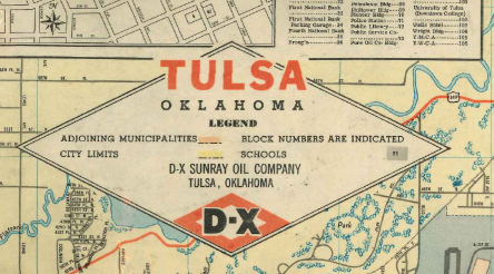
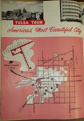
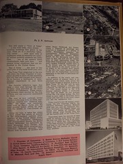
One of the cities working hardest at its beauty program is Tulsa, Okla., (pop. 185,000) which, although it is a growing industrial community, has already started calling itself "America's Most Beautiful City."

Located on the Arkansas River at the foot of the Osage hills, Tulsa enjoys a beautiful natural setting. It is a young city (Oklahoma as a state will be just 50 years old in November), and so has few run-down sections. Its light industries are fueled by gas, hence there is no smoke to darken its clear blue skies or begrime its modern buildings and tree-lined streets. Not only are the streets washed down every night but gutters are regularly scrubbed by hand.

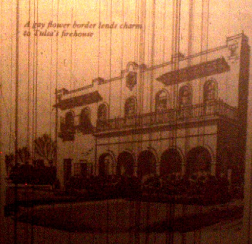
Entering Tulsa from its attractively landscaped airport (maintained by the city park department), one cannot but be impressed with its clean skyline cutting the horizon in the distance. Soon you are driving past a city firehouse decorated with flowers and shrubs, or you may pass the drive-in addition to the Fourth National Bank. Its plantings are a sight to behold at any season, but in the spring especially, when thousands come to view the bank's tulips. In the residential section you drive past well kept lawns and gardens and catch a glimpse of the Municipal Rose Garden, which rosarians say is one of the best in the United States.

Tulsa is an acknowledged leader in industrial landscaping. A special Chamber of Commerce committee not only gives awards for industrial planting but seeks out incoming businesses and urges landscaping and beautification. The local Public Service company has screened its 17 transformer stations with evergreens. One service station has hundreds of Floribunda rosebushes (each customer receives a bloom), and a restaurant spent $15,000 last year on decorative plantings. Utica Square, a landscaped shopping center, won the first national award ever given by the American Association of Nurserymen* to a U. S. shopping center.

[* This Association gave The Reader's Digest a national award in 1955 for the landscaping of its main offices.]

Most of all, Tulsa is a city of gardeners who are determined to make not only their own streets and homes beautiful but every facet of their city as well. Almost every garden club has a city-beautification project -- the maintenance of a roadside park, for example, or the planting of a local schoolyard. The Garden Center, focus of all garden activity, was behind the drive that last year got 10,000 dogwood trees planted throughout the city.

Tulsa is proud of its handsome Garden Center, the only one in the United States financed by a municipal bond issue. Purchased only two years ago, the Center has 3000 members and serves as the meeting place for the varied activities of some 140 garden clubs. And it isn't big enough -- an $85,000 addition is now being built by the city park board.

The Center's spacious rooms are busy all day and many evenings with special lectures and exhibits, with meetings of men's and women's garden clubs and their flower shows. In one month last year 4000 people attended 12 meetings and 19 flower shows at the center.

Most Tulsans take care of their own yards and flowers. One outstanding garden is that of George Cunningham, general attorney for Shell Oil. "Eleven years ago," his wife says, "George didn't know a dandelion from a spirea, and now look..."

Sice he is raising day lilies for the national Hemerocallis show (to be held in June), Cunningham has a few hundred on his half-acre lot, including some "guest plants" that growers sent him last year to mature for this year's exhibit. He also has over 200 azaleas in his yard, including 13 varieties. There are Camellia japonica, Chinese dogwood, mountain laurel and holly. All plants are neatly labeled, a custom many Tulsa gardeners follow in their zeal for horticultural education.

The Show -- the flower show, that is -- has become the big thing in Tulsa. The Men's Rose Club show and the gladiolus and dahlia shows always attract city-wide attention. The local papers, radio and TV give such shows as much attention as they do baseball.

Why is Tulsa so garden conscious? The most logical explanation, perhaps, is that youthful industries have been drawn to the city -- aviation and skills allied to oil. The young scientists and technicians who move their can usually afford a little more land than they had before, a little better house, a hobby.

A young wife explains how a garden club grows: "We have these big back yards and no fences. We are all planting, and some of us get to talking about our garden problems over coffee in the patio. Someone suggests we start a garden club, so we do. We meet monthly at one another's homes -- and finally we get so many members we can't all get in one house. So we help some of the newcomers form another club."

These clubs -- often with gay names like Hoe 'n' Hope, Plan 'n' Ponder, and Yard Birds -- tend to become the nucleus of all civic drives in Tulsa, and to assume neighborly duties far beyond gardening interests. Tulsa, as a result, is one of the more neighborly towns in the country. And that, in turn, is the source of the spirit of a city which proudly claims the title of "America's Most Beautiful." It is a spirit, certainly, which any town or city not already on the beautification bandwagon might well emulate.

Illustration of the 18th & Boston fire station. Caption: 'A gay flower border lends charm to Tulsa's firehouse.'

National Municipal Review (May, '57), © 1957 by National Municipal League, Carl H. Pforzheimer Bldg., 47 E. 68 St., New York 21, N. Y.

February 2, 2007

Forgotten Tulsa: Locust Grove Park

I found a very heartwarming thread over on TulsaNow's public forum. Someone calling himself "Hometown" has posted memories and photos from the neighborhood southeast of downtown which was displaced by the construction of the southeastern interchange of the Inner Dispersal Loop. The neighborhood linked together the south edge of downtown -- home to car dealerships and churches -- with the 15th Street (Cherry Street) commercial district, the Tracy Park, Gunboat Park, Maple Ridge North, and South Boston neighborhoods. And the heart of the neighborhood was a grove of locust trees that became a city park, Locust Grove Park.

Hometown's description includes details of the park that he gathered from old maps and newspaper stories and his own memories of living nearby.

Some of my very first memories are of Locust Grove Park. In 1959 we lived on 14th between Cincinnati and Detroit. I was six years old. I can remember sitting in our small front yard at dusk and watching a group of square dancers under the lights of the basketball court. The women wore layers of petticoats causing their colorful skirts to puff out and swirl around. A man with a fiddle called out the dance moves.

It’s hard now to imagine that children played in the park and around the neighborhood with little or no supervision. We would take off and walk blocks into downtown or over to the Gunboat neighborhood or further to Tracy Park. But we spent most of our time in Locust Grove Park.

He has a picture of himself in front of the park's recreation center in 1959, in front of his house on 14th Street between Cincinnati and Detroit in 1960, and the next house he lived in, on Norfolk Ave. in Tracy Park, in 1960 -- the houses in the background of the photo were demolished for the construction of the east leg of the IDL (I-444 / US 75).

Other people who remember that place and time are chiming in with memories of their own. Hometown promises more photos and more memories in the future.

This is exactly the sort of recording and sharing of memories that I had hoped would emerge in this centennial year. (It was the topic of my column in this week's UTW.)

Hometown's tagline on the TulsaNow forum is "Tulsa's best days are ahead of us." If that's to be true, we need to remember the good days that once were. We need to remember what Tulsa was like before our leaders began to shred it to pieces, so that we can, to whatever extent possible, repair the damage that was done.

January 31, 2007

River revue

The big story I've been working on is finally in print. This week's Urban Tulsa Weekly cover story is the epic tale of a century -- yes, a century -- of Tulsa's plans to do something interesting with the Arkansas River.

This story was a blast to research. UTW's Holly Wall and Siara Jacobs rounded up copies of articles and documents from the 1968 and 1976 plans from the very helpful folks at the River Parks Authority. I spent hours paging through Central Library's "vertical files" and repository of old planning documents. I had far more material than I could use. I was helped immensely by a conversation with architect Rex Ball, whose firm developed the 1968 River Lakes Park plan, and by my long acquaintance with Jim Hewgley III, who was Streets Commissioner when the Zink Lake low-water dam was built by Mayor Jim Inhofe.

It's my intention to scan and upload much of the research material and to provide some sort of bibliography to help anyone else who might want to do further research.

plan_for_central_tulsa-marina

In the story I mention a river concept presented very briefly in a 1959 document called A Plan for Central Tulsa:

A page of that study was devoted to "The Marina," a concept for the river between 11th and 21st Streets. The accompanying illustration showed an artificial lagoon for boats near 15th and Riverside, a floating restaurant and boat club just to the south, a "picnic island" accessible by pedestrian bridge just to the north, and a larger island, accessible only by boat, where the west bank used to be.

Yes, used to be. The drawing showed the river almost twice as wide as its existing width at the 21st Street bridge, backed up by a dam at some unspecified location downstream, with the new shoreline just below the west bank levee. The resemblance to last year's "The Channels" plan is uncanny.

I took a photograph of the illustration so you can see for yourself. It's not as sharp as I'd like, but I think you can make it out. Click on the image to see it in its original size.

(Notice that in 1959, the location of the Inner Dispersal Loop, seen along the top of the diagram, has already been determined, although it wouldn't be completed until nearly 25 years later.)

My column this week is also about Tulsa history:

Oklahoma's centennial year ought to be a year when all Oklahomans -- natives and newcomers alike -- encounter our state's history in a way that engages our imaginations. While every year is a good year to study Oklahoma history, this is a year that ought to be hallowed to that purpose, a year for remembering where we came from and how we got to where we are today.

The June unearthing of the buried Belvedere fulfills that purpose quite well. I propose extending that glimpse back 50 years with the Tulsa 1957 project, which I launched here a while back and explain in detail in the column. I also mention a couple of websites which are helping to capture everyday life in Tulsa as it was. (But I neglected to mention Jack Frank's wonderful Tulsa Films series, which uses TV footage and home movies to bring decades past back to life.)

Also this week UTW gives a rave review to the source of the coffee and quesadillas that helped fuel my 6,000-word feature story. Katharine Kelly gives the Coffee House on Cherry Street five stars each for food, atmosphere, and service.

RELATED: A pretty thorough outline history of the Arkansas River in the Tulsa area.

Patsy Cline at the Cimarron Ballroom, 1961

clinecimarron.jpg

This is not quite 1957, but it is certainly from the same era, and it will give you a sense of the kind of entertainment that was available in downtown Tulsa back in the day.

In June 1961, Patsy Cline was a passenger in a head-on collision and was thrown through the windshield. Just six weeks later, on July 29, still scarred and hobbled by her injuries, she performed her first concert since the wreck.

The venue was the Cimarron Ballroom at 4th and Denver in downtown Tulsa, in what was once the Akdar Shrine Mosque. (It was demolished in the '70s for parking, and the site is now home to the Tulsa Transit station.) This was the home of Leon McAuliffe and his western swing band, the Cimarron Boys. McAuliffe was steel guitar player for Bob Wills and His Texas Playboys during their formative years in Tulsa, but he started his own band in Tulsa after serving in World War II. McAuliffe and his band served as Patsy's band that night.

And that night in July 1961, the sound man decided to roll tape. Thirty-some years later, the reel-to-reel tape resurfaced, and in 1997 it was issued on CD: Patsy Cline: Live at the Cimarron Ballroom.

The Tulsa City-County Library has several copies of the CD circulating. I just checked it out today and listened to it for the first time.

The recording is not an audiophile's dream -- there are a few dropouts, there was feedback on a couple of songs -- but it's still a live performance by one of the most amazing vocalists of the 20th century, backed by a great western swing band. The CD includes the between-songs banter between Patsy and the band and the audience. And we get to hear Patsy Cline without the heavy production of her Nashville sessions. The liner notes include photos of Patsy at the Cimarron, a transcript of the spoken parts of the recording, and, on the back, a facsimile of a poster advertising the event.

For those used to strict segregation between musical genres, the set list will be a surprise. It includes some of her hits ("I Fall to Pieces," "Walking after Midnight," "Poor Man's Roses"), and covers of classic Dixieland ("Bill Bailey"), western swing ("San Antonio Rose"), and Hank Williams ("Lovesick Blues") songs, plus two rock-n-roll tunes: "Stupid Cupid" and "Shake, Rattle, and Roll."

Here are several articles that tell the story of this performance and how it came to be issued on CD, plus a couple of reviews of the CD.

From Guy Cesario's PatsyClineTribute.com
From the Milwaukee Journal-Sentinel
A short review by Robert Christgau
Providence Phoenix review (via Google cache)

January 27, 2007

1957 (almost) on the TV

This entry isn't specifically about Tulsa in 1957, but this is what many Tulsans would have been watching on KOTV channel 6 on December 31, 1956. It's The Jack Benny Show, a weekly half-hour variety show, sponsored by Lucky Strike cigarettes.

The show features a cameo from strangely cantilevered Jayne Mansfield (sans lobsters), a song and dance number with The Sportsmen and Eddie "Rochester" Anderson, and a talent show segment featuring Mel Blanc as Stanley Gropff, animal impressionist. You'll see commercials for Lucky Strike ("It's TOASTED to Taste Better!") and Tareyton cigarettes, and in case you ignored the commercials, they even worked a pitch for Luckies into the song and dance number.

It's in three segments on the Daily Motion video site:

Part 1 (Jayne Mansfield, Rochester)
Part 2 (Mel Blanc, the "Landrews Sisters")
Part 3 (The "Landrews Sisters", the jujitsu expert)

The second part, with Mel Blanc, is the funniest of the three.

Via Mark Evanier, whose fascinating blog "news from me" is chock full o' vintage TV videos and anecdotes. You'll want to read his entry to learn something interesting about one of the actresses in the Landrews Sisters bit.

Oh, all right, here's another one, from 1960, set at a department store with Jack as the Christmas shopper from Hell, featuring Mel Blanc (as a long-suffering clerk), Frank Nelson (as a supercilious floor walker working his way down the ladder of success), Eddie Anderson, Dennis Day, Richard Deacon, and Don Wilson. Part 1, Part 2, Part 3.

January 25, 2007

Tulsa 1957: Take the Tulsa Tour of "America's Most Beautiful City"

One of the most interesting artifacts I've found from 1957 thus far is a glossy, color, 44-page tourism magazine called Tulsa, I.T. (There's a copy of it in the buried Belvedere.)

I have photocopied all the pages and plan to scan and post a complete black-and-white version sometime soon. While it isn't directly representative of everyday life for Tulsans in 1957 -- which is what I'm aiming for with this "Tulsa 1957" effort -- it does tell you what the folks at the Chamber of Commerce thought was most important for outsiders to know about our fair city.

And these two pages, in particular, tell us what the tourism people at the Chamber thought visitors to Tulsa ought to see, even if they only had a few hours to tour the city. This is the Tulsa Tour.

If you'll click on those thumbnails, they'll lead you to Flickr, where you can download the humongoid 4 MB original images or smaller images if you prefer. I photographed those pages with a cheap Kodak digital camera on "best" setting. I did not attempt to press the book flat, out of respect for its fragility, so the images are not like you'd get from a flatbed scanner, but the text is still legible and the detail isn't bad.

Here is the text:

TULSA TOUR
America's Most Beautiful City
By J. P. Arwood

You will enjoy a "Tour of Tulsa" . . . a city with wide, clean streets . . . towering buildings that gleam in the clear, fresh air of a smokeless industrial center . . . mile upon mile of residential areas as beautiful as a quarter million prideful residents can make them . . . one of the nation's finest vacationlands right next door . . . and general living conditions that are unexcelled in the United States.

This is Tulsa . . . the kind of city you'd plan if you could build your own.

The Tulsa Tour originated in the late '30s when the Tulsa Chamber of Commerce decided to show off this sparkling new city that had merged from obscurity to become a metropolis of international importance in just three decades.

The durable reflective signs that blaze a clear trail through the Tulsa of today were provided by the Tulsa Chamber of Commerce. These attractive markers were erected by the City of Tulsa and are currently maintained by them.

The tour, as now outlined, covers the downtown area with its clean, metropolitan canyons and "diamond sidewalks," the smart new residential areas such as Ranch Acres and the older palatial homes sitting far back from the streets on tree-covered estates.

Along the way, it takes the visitor to such places and points of interest as the ultra-modern national headquarters of the United States Junior Chamber of Commerce; Oklahoma's most photographed church, the Boston Avenue Methodist; the nationally famous Municipal Rose Garden with more than 12,000 plants covering symmetrically designed grounds; Utica Square with its acres of modern suburban shops; Philbrook Art Center where a treasure of paintings and sculpture is displayed in a setting of Italian Renaissance splendor; the International Petroleum Exposition grounds where the world's oilmen gather by the thousands every four years to buy, sell and see the newest tools of their fascinating trade; the Tulsa State Fairgrounds where the nation's largest exhibit barn is to be found; and the University of Tulsa, famous in the sports world for its might in the football bowl games of the '40s, but more famous scholastically for its outstanding curriculum, especially in the field of petroleum engineering.

In addition to the scenic and residential points of interest there is an alternate tour which leads across the 21st street bridge to Quanah Avenue in West Tulsa. To the left will be seen The Texas Company's refinery and tankfarm. To the left as you approach the 11th street bridge is the D-X Sunray refinery where a conducted tour may be made. As you proceed across the 11th street bridge, the first street to your right is Riverside Drive which will lead you to the point where you left the residential tour.

Tulsa county's new $4 million courthouse, the new inspiring YMCA, the fabulous Gilcrease Institute, Mohawk park and zoo, and the American Airlines Overhaul and Supply Depot are places and points of interest well worth seeing, even though they are off the beaten path of the Tulsa Tour.

Depending upon the amount of time spent at various stops along the way, the tour can take an hour or an afternoon or a whole day. But regardless of the time allotted for sightseeing, the best way to view the Oil Capital is to follow the red arrows on the Tulsa Tour markers.


Some notes:

The downtown skyline shot is looking north along Boston with 8th & Boston in the foreground. The tallest buildings in the background are the NBT Building on the left and the Philtower on the right.

Note the city boundaries. Everything fits within a 10 mile by 7 mile box, and most of the space in that box is empty. It's apparent why Utica Square would be considered "suburban" at the time. Note that New Haven Avenue, connecting dots 9 and 10, is within the city limits, even though it's on the fairgrounds (just west of Bell's, the Pavilion, and the Armory).

Note the highway locations in the map. The 51st Street bridge is open, but there's no Skelly Bypass yet. The Skelly Bypass really would bypass everything. US 75 and US 169 are swapped from the present day configuration in how they approach from the north.

Questions for discussion:

  1. Anyone else remember those signs? They were still in existence in the '70s, but I think they were blue by then. I am almost certain there was one near Holland Hall's old campus at 26th Place and Birmingham.
  2. What, if anything, strikes you as odd, amusing, or puzzling about this list?
  3. What were they overly proud of?
  4. What did they overlook that should have been a point of pride?
  5. How many art deco buildings do you see in this list?
  6. How many buildings or places do you see that we would now consider historic or worthy of preservation?
  7. Anyone want to create a turn-by-turn description of the route shown on the map? Is it still driveable today?
  8. If you were to create a modern day Tulsa Tour, what landmarks would be on it?

January 2, 2007

Tulsa 1957

I've had this idea of trying to capture life in Tulsa as it was in a particular year, before freeways, urban renewal, and the flight to the suburbs began to change it. It's hard to believe today, but Tulsa was once one of the twenty most densely populated large cities in the nation. It might help us reimagine what a revived, dense urban core for Tulsa would look like if we could get a vivid picture of what Tulsa's urban core looked like when it was dense and full of life. It seems a fitting project for our state's centennial year.

For this thought experiment, I picked 1957 as the target year. That was the year of the state's semi-centennial. The new County Courthouse had opened and the first massive redevelopment project -- the Civic Center, originally just four blocks between Denver and Frisco, 4th & 6th -- was just beginning to take shape. Early suburban neighborhoods and shopping centers, like my own Mayo Meadow, had been opened. The city's first freeway plan was drawn up -- it still isn't finished, and part of it never will be. A master parks plan called for a massive park along 71st Street from the river stretching through the hills to the east. In June 1957, a Reader's Digest article about Tulsa mentions that Tulsa had taken to calling itself "America's Most Beautiful City." 1957 is recent enough to be in living memory -- childhood for the early Baby Boomers, high school and young adulthood for my parents' generation -- but distant enough to be a very different world.

While I wanted to fix on a particular year for the sake of creating a snapshot in time, reminiscences from earlier and later years, like the memories of the early '60s at Riverview School, will help to make the picture vivid.

I'd like to flesh out this idea with maps -- big maps showing where the city limits were, little maps showing the stores, schools, and churches in a neighborhood -- photographs, news stories, and lots of personal reminiscences. The Sanborn Fire Maps, the city directory, the phone book, and newspaper ads can be used to help refresh and correct those reminiscences.

(It would be a big help if someone had software that could be used to create a base street map of Tulsa and environs in 1957.)

I'm not only interested in the memories of Tulsans, but also those of people who lived in surrounding towns, rural Tulsa County communities (like Alsuma, Lynn Lane, Union, Rentie Grove), and outlying Oklahoma towns like Nowata and Tahlequah who remember trips to the big city as a big deal.

This idea is inspired in part by a cartoon map that appeared in the very first issue of Urban Tulsa. The map showed the adventures of a group of boys, maybe 10-12 years old, who took the bus into downtown Tulsa on a Saturday morning in the early '60s -- they saw a movie, explored the seedier parts of downtown, had a Coke at a soda fountain, browsed through comic books. The map promised "To be continued" but it never was. Those are the sort of memories I'm hoping to capture.

I wasn't around in 1957, and I can't devote a lot of time to this, so I'm looking for help. Anyone interested?

eXTReMe Tracker