Oklahoma History Category
What was here? Who owned it? What did it look like? There are a number of resources available for reconstructing Oklahoma's geographical past, and they're easier to use than ever. These are my go-tos when researching the history of a neighborhood or answering questions about the past. This is an encyclopedic article, so if you're on the home page, you'll have to click the "Continue reading" link to see all of it.
These links will take you to specific sections of this article:
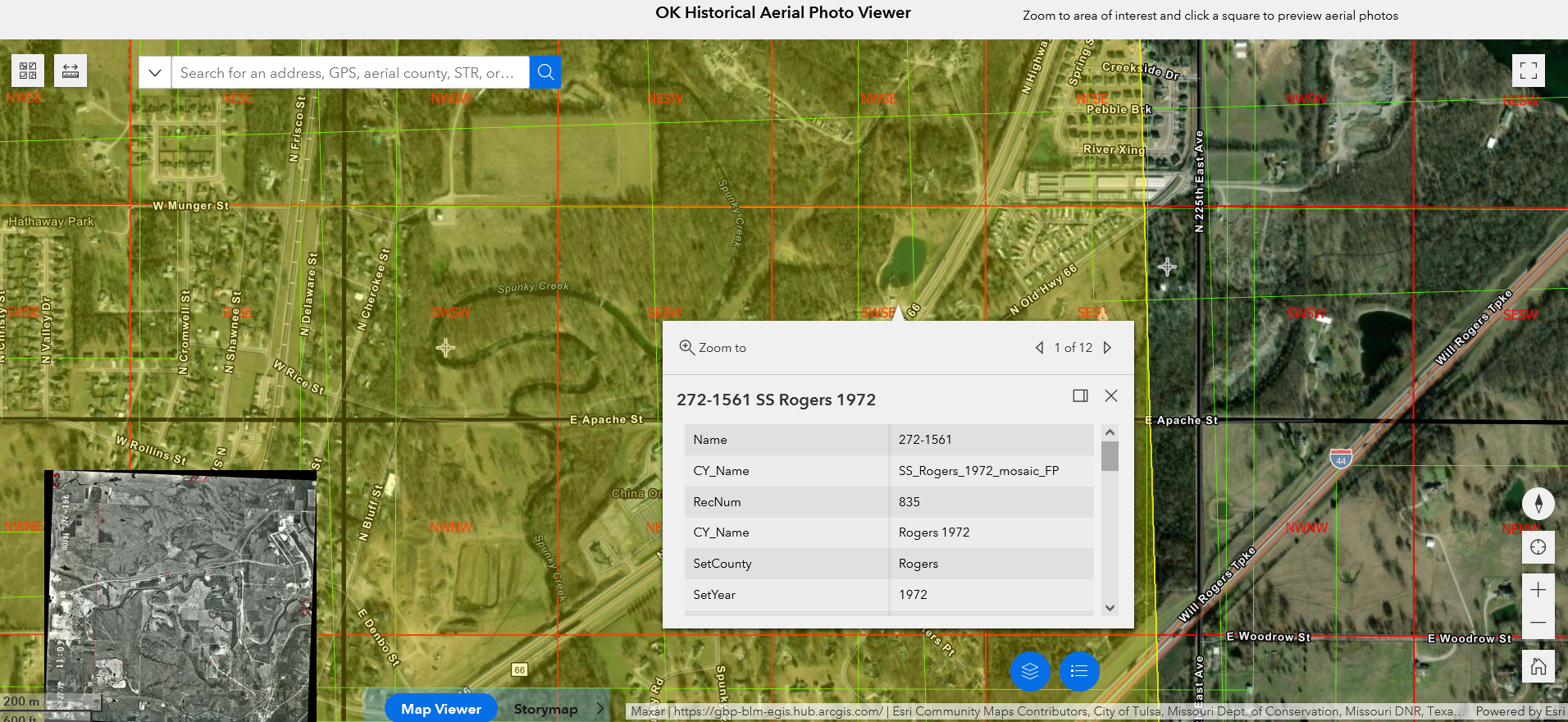
- Oklahoma Historical Aerial Digitization Project: Geotagged historical aerial photos going back to the 1930s
- Oklahoma Aerial Photo Inventory: A broader collection of imagery, including some not yet geotagged
- EarthExplorer: US Geological Survey aerial imagery: Higher resoution aerial photos from the 1950s through the 1970s, plus satellite and other imagery
- topoView: US Geological Survey historical topographical maps: Maps for Oklahoma from 1901
- US Bureau of Land Management Land Records: Township survey plats of Indian Territory from the 1890s, with field notes from the surveyors
- Oklahoma State University McCasland Maps Collection: Includes historical county highway maps as early as 1937, plus USGS topo quads not in the topoView collection
- WPA 1936 land ownership and valuation maps: Interactive statewide browser
- Tulsa Sanborn Fire Insurance Maps at Library of Congress: Building-by-building detail from Tulsa's earliest days through 1915, 1939, and 1962
- Tulsa Census Enumeration District and Census Tract Maps: Base street maps and boundaries of statistical neighborhoods
- Tulsa County Clerk Subdivision Plats and Deed Indexes
- Tulsa County Assessor Static Section Maps
- Miscellaneous Maps of Tulsa
I have finally gotten around to reading Killers of the Flower Moon by David Grann, in anticipation of the Martin Scorsese film to be released in October. I'm about halfway through, and I was skimming ahead. (It's OK. I already knew who the bad guys were.) I was surprised to read this:
One summer day in 2012, after traveling from New York, where I live and work as a reporter, I visited Pawhuska for the first time, hoping to find information on the Osage murder cases, which, by then, were nearly a century old. Like most Americans, when I was in school, I never read about the murders in any books; it was as it these crimes had been excised from history.
The idea, even if meant in a broad sweeping way, that the Osage oil murders were excised from history struck me as strange, because I learned about the Osage murder cases 50 years ago this month, from a program that aired on KTUL-TV channel 8, on Monday, July 30, 1973, at 7:00 pm.
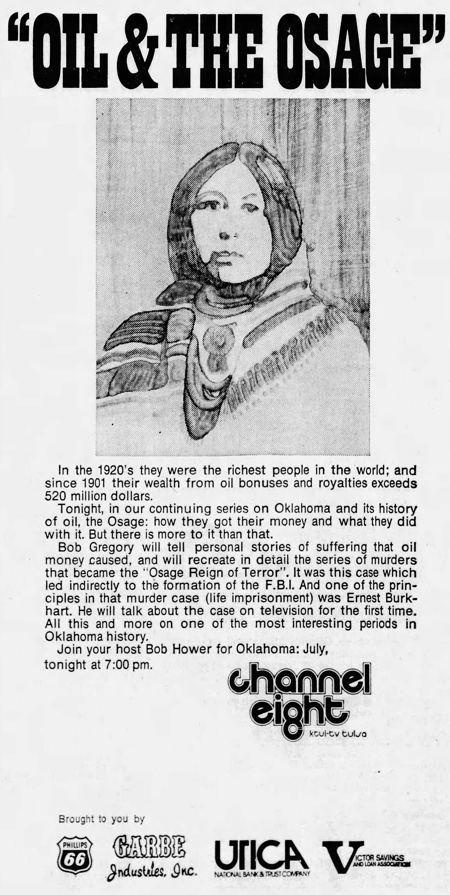
In the 1920's they were the richest people in the world; and since 1901 their wealth from oil bonuses and royalties exceeds 520 million dollars.Tonight, in our continuing series on Oklahoma and its history of oil, the Osage: how they got their money and what they did with it. But there is more to it than that.
Bob Gregory will tell personal stories of suffering that oil money caused, and will recreate in detail the series of murders that became the "Osage Reign of Terror". It was this case which led indirectly to the formation of the F.B.I. And one of the principles in that murder case (life imprisonment) was Ernest Burkhart. He will talk about the case on television for the first time. All this and more on one of the most interesting periods in Oklahoma history.
Join your host for Oklahoma: July, tonight at 7:00 pm.
As I mentioned in my tribute to Bob Gregory after his death in 2019:
The book Killers of the Flower Moon has brought the Osage oil murders back to public attention, but viewers of Oil in Oklahoma learned from Bob Gregory a half century ago about the Osage Nation, their sudden oil wealth, and the murders of Osage citizens for their headrights. Two images from that episode stuck in my mind: (1) The photo of an Osage family going around town in style, in a sitting room set up in the back of a glass-sided hearse. (2) A clip of a house exploding from the 1959 Jimmy Stewart movie The FBI Story, which includes a fictionalized retelling of the Osage murders among other important early FBI cases.
The movie The FBI Story was based on the 1956 book of the same name by Don Whitehead. Chapter 13, "Murder by Proxy," discusses the Osage murders, albeit in 6 brief pages.
What I had not remembered about this "Oil and the Osage" episode was that Bob Gregory had interviewed Ernest Burkhart, who had been sentenced to life in prison for his involvement in the murders of his wife's family.
This program was an episode in a locally produced monthly series, usually airing toward the end of each month. The title was simply Oklahoma, followed by a colon and the name of the month, a collection of long-form feature stories and interviews. The series launched with Oklahoma: March at 9 pm on Friday, March 27, 1970, and the inaugural lineup had stories on Sam Houston, husband-and-wife jazz duo Susan and Sonny Gray, airline luggage, lifers at the Oklahoma State Penitentiary, school busing and racial integration in Tulsa Public Schools, and Sports Director Hal O'Halloran interviewing Johnny Bench at the Cincinnati Reds spring training camp. Bob Gregory, producer of the show and writer and host of many of the episodes, was Vice President of News and Special Projects for Leake Television, a four-station chain that included KTUL. Gregory had returned to Tulsa and KTUL in 1969 after two years with CBS News in Washington.
Topical and typically Oklahoma... a new monthly news special exploring our state, its people and problems. Hosted by Bob Gregory
An item in a special 1972 fall TV preview supplement highlights the extent of KTUL's local programming including Country Music Time weekday mornings at 7, the John Chick Show weekdays at noon, Betty Boyd Show at 1, weekly coaches' shows with Arkansas head coach Frank Broyles and Oklahoma head coach Chuck Fairbanks, and the Oklahoma series.
The Oklahoma Series was originated in March 1970 as a monthly focus on area places, personalities and potpourri. In a state so comparatively new, history may be thought hard to come by but the Oklahoma Series has found this a fertile field with segments concerning "89er Day," "Memories of Sam Houston by his grandson from Woodward," "Grapes of Wrath Remembered," "Isaac Parker: Memories of the Famous Oklahoma Hanging Judge."The famous and infamous have been highlighted with stories of "Oral Roberts: Evangelism the New Image," "Bud Wilkinson in Washington," "Anita Bryant," "J. Paschal Twyman Second Youngest University President In the US," "Whatever Happened to Tim Holt," "Pretty Boy Floyd," "Three Strikes Yer Out -- Johnny Bench and Bobby Murcer," "Life Sentence -- A Conversation With a 50-year Resident of the State Penitentiary."
Utilizing the talents of cinematographers and the effectiveness of imaginative editing' pictorial essays have become an integral part of each month's OKLAHOMA program. The scope of these essays ranges from "Stained Glass Windows" to "Flowers and Raindrops" to "Snow and Icycles[sic]."
The most compelling segments in this series were reported by Bob Gregory and focused on oil's influence on Oklahoma history, beginning in March 1973.
I couldn't say for sure what first sparked my fascination with Oklahoma history -- perhaps walking past Bartlesville's Nellie Johnstone oil well replica on the way to the Johnstone Park swings, perhaps an early family visit to Fort Gibson, perhaps the Oklahoma history unit in 3rd grade, culminating in a Land Run re-enactment. But Bob Gregory's Oil in Oklahoma series fanned the spark into a flame.
The decision to move from a potpourri of stories to a full hour on a topic from Oklahoma's oil history may have been connected with the 75th anniversary of Tulsa's incorporation. Another likely prompt was the world premiere of Oklahoma Crude at Tulsa's Southroads Mall Cinema on June 14, 1973. The movie, set in the oil fields of Osage County but filmed in California's Central Valley, was directed by Stanley Kramer, starred George C. Scott and Faye Dunaway. The film's brassy theme by Henry Mancini was used in later airings of Oil in Oklahoma.
"Oklahoma: March" introduces the Oklahoma oil history focus, with a segment on E. W. Marland, the oil man who made and lost a fortune and served as governor and congressman; the episode also featured Binger, Oklahoma, native Johnny Bench at spring training for the Cincinnati Reds.
Marland is just one of the fascinating figures in Oklahoma's great history of oil. In the months to come you'll meet Skelly, Phillips, Sinclair; you'll learn why Tulsa became oil capital of the world and what oil has done for Oklahoma; and you'll get to know a group of men unlike any other---the wildcatters. All this is coming. But tonight, as this monthly series begins, the Marland story. Bob Gregory will be your host. And you're invited to accompany him to the Burbank and Tonkawa oil fields, to Ponca City (the town Marland made), and to his two mansions (one had 55 rooms).
Here are the other episodes that aired in 1973 and 1974:
- Monday, April 30, 1973, at 7:00 pm: Oklahoma: April: Tulsa as oil capital of the world
- Wednesday, May 30, 1973, at 9:00 pm: Oklahoma: May: Frank Phillips and Waite Phillips
- Friday, June 29, 1973, at 9:00 pm: Oklahoma: June: W. G. Skelly
- Monday, July 30, 1973, at 7:00 pm: Oklahoma: July: Oil and the Osage
- Friday, August 31, 1973, at 8:30 pm: Oklahoma: August: Thomas Gilcrease (90 min special)
- Tuesday, October 30, 1973, at 6:30 pm: Oklahoma: October: Alfred Aaronson at 80
- Wednesday, December 26, 1973, at 9:00 pm: Oklahoma: December: Oklahoma City & Seminole
- Thursday, February 28, 1974, at 7:00 pm: Oklahoma Oil Philanthropies: Marland, Wentz, Phillips, Noble, Goddard, Chapman, Merrick, Mabee, Warren, LaFortune
That's the last of the episodes I found in the 1973-1974 time frame. There aren't any episodes in the TV logs for February, September, or November 1973, or January 1974. Perhaps there were production delays. According to the book Oil in Oklahoma, James C. Leake and Bob Gregory interviewed J. Paul Getty at his Sutton Place estate in Surrey, England, in the fall of 1973 and again in October and November 1974; it may be that a Getty episode was planned for the original 1973 series, but was delayed as the interviews continued. (1973 was also the year that Getty's grandson and namesake was kidnapped.)
![]()
TV logs in subsequent years show replays of the Oklahoma history segments, now repackaged under the title Oil in Oklahoma. The first such occurrence I could find was a Saturday afternoon rebroadcast of the episode on W. G. Skelly, on March 27, 1975. The entire series was rebroadcast over the course of 1975, with an episode roughly once a month. From August 7-13, 1977, KTUL ran an "encore presentation" of Oil in Oklahoma, with an episode airing every day of that week:
Jo Ann Wilburn is writing a novel, Tumbleweed, fictionalizing her family's 1948 journey from Oklahoma to California on Route 66. Her mother recorded her memories of the trip in a diary. Jo Ann has expanded on those memories with a great deal of research. But her publisher thinks she's got too much of a good thing:
Because of my need to cut the word count of my book down significantly from nearly 130,000 words, many cuts are those that added to historical value rather than story. It makes me sad because I like those historical references. I hope that by presenting some of those here, I can share an authentic 1948 trip down Route 66 and add a little extra as I go.My parents made a real 1948 trip to California and my mother kept a diary, which I faithfully used in planning this fictional trip.
You can read these historical gems on her website starting here. There are now six installments, taking the family to Oklahoma City so far.
Although I've been driving Route 66 in Oklahoma for decades, through Jo Ann Wilburn's excerpts, I'm learning about people and places I had never heard of and discovering new details about familiar sites. A few examples: Seaba Station's little rock outhouse with the automatically flushing toilets; Washington Irving's camp site, Ulysses Grant Threatt and his filling station east of Luther.
Wilburn also has some blog entries discussing the process of writing her novel and the pain of making those cuts.
I hope you'll take time to visit her blog, catch up with the story so far, and drop Jo Ann a note to encourage her to continue to share these deep cuts (in the album sense as well as the novel sense) from her work. You can sign up to get email notifications of new entries as they're published.
If you knew how quickly people would forget you after your death, you would not seek in your life to please anyone but God.-- John Chrysostom
I shared that memeified quote on FB recently, and it spawned a few other thoughts.
In central Europe, at least, you only rent your grave. John Banner, beloved as Sgt. Schultz in "Hogan's Heroes," died on a visit to his hometown of Vienna in 1973 and was buried there, but by 1988, the grave was no longer his. His grave marker was removed because the lease had expired and was not renewed by family. (He and his wife had no children.) Someone else was buried there and a new marker erected in 1988. (We enjoy watching at least one of the two nightly episodes, every weeknight at 9 on MeTV, channel 23.2.) A fan had tracked down the grave and placed a placard honoring Banner next to the headstone of the latest occupant.
When visiting Glarus, Switzerland, the hometown of my wife's great-grandfather, in 1990, we had expected to find graves with her family name in the churchyard. We were accustomed to graveyards in New England and the British Isles with very old memorials, and earlier in the same trip had seen the Old Jewish cemetery in Prague where tombstones are stacked on each other -- 12,000 representing 100,000 burials in a tiny plot of land. We were stunned to see that all the burials in this Swiss cemetery were quite recent.
In America, the likelier fate of old graves can be seen in the work of Orange Rex, who found a book of Muskogee County death certificates from 1910 to 1916 in an Oklahoma City thrift shop, has been tracking down graves and stories of the deceased, matching entries in the register against news stories and obituaries. That link leads to the Facebook group, An American History Mystery: A Tale of Death in Muskogee Co, OK 1910-1916, where he has been documenting his research, crowdsourcing additional information, and connecting with the distant relatives of the people whose lives are documented in these ledgers. Many of the people listed are buried in long-neglected cemeteries, reconquered by nature. A few names and stories have elicited reaction descendants, and one name -- Bass Reeves -- remains well known, but most are utterly forgotten. Orange Rex has located the Harding Cemetery north of Muskogee, overgrown even though the most recent burials are as recent as the 1990s.
Orange Rex recently posted on his research into the Lieber Cemetery. It was platted in 1905 by John L. Lieber, who was the first city attorney of Muskogee, owned five theaters in the city, and was been head of the commission on land disputes for the Dawes Commission. His wife Dora was the great granddaughter of an Indian Chief. It was set aside only for burials of blacks, up to 2000 graves. He figures that as many as 1000 were buried there. Yet 117 years later, only one local historian ("former 2 time Genealogy club president and 15 year museum curator") knew about the cemetery but didn't know its name.
Orange Rex, the finder of these records, is a professional firebreather. He writes:
Only God has the right sense of humor to put a fire breather in charge of the lost paper records which might be the only records of their lives besides their bones.I'll breathe the fire of life back into this history. Yesterday I saw a headstone for the first time of a laundry woman that died during childbirth in 1912. Sarah E Clark.
From my research.
I KNEW HER MIDDLE NAME, OCCUPATION AND HOW SHE DIED.
It was a weird sense of pride weighted with the gravity of being the keeper of that knowledge.
Tempus fugit. Memento mori.
The last surviving Howard Johnson's restaurant, located in Lake George, New York, was recently found to have closed, evidently for good. An enthusiast, Alyssa Kelly, reported on Facebook over Memorial Day weekend that there were cobwebs on the door, a for-lease sign out front, and all the furnishings and memorabilia gone. This followed years of inconsistent schedules and poor management. One commenter on Kelly's post stated that the Lake George location didn't deserve the title of last HoJo's; but that honor belonged to the stores in Lake Placid, NY, Waterbury, CT, and Bangor, ME. Atlas Obscura profiled the Lake George HoJo's in 2019, noting that it had opened in 1953.
HoJo was once the largest restaurant chain in America, famous for fried clam rolls and 28 ice cream flavors (33 if you counted their five flavors of sherbet). The Bangor, Maine, HoJo's, which closed in 2016, was the last survivor in New England, where the chain got its start. This Yankee magazine feature story from 2015 outlines the history that began when Howard Johnson opened an ice cream parlor in the Wollaston neighborhood of Quincy, Mass., and describes the diner's mid-century atmosphere: "The deep red vinyl booths, wood paneling, patterned carpet, and the unmistakable whiff of restaurant/lounge mixed with fried food is a powerful combination."
Some HoJo fans mark as the beginning of the end the 2005 closure of the Times Square restaurant, with its spectacular neon depiction of the Simple Simon and the Pie Man logo.
The news got me thinking about the days when HoJo was dominant on Oklahoma's turnpikes. HighwayHost.org documents long-lost or much-changed chains that served the motoring public, thriving in the 1960s and 1970s, including Howard Johnson's, Horne's, Stuckey's, Holiday Inn, Alamo Plaza, Wigwam, Nickerson Farms. This page documents Howard Johnson's in Oklahoma, including motels in Tulsa, Oklahoma City, and Norman, standalone restaurants, and the many locations on Oklahoma turnpikes.
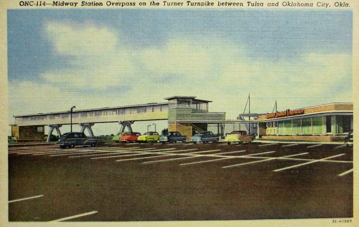
In 1953, Howard Johnson's won the restaurant concession for the newly opened Turner Turnpike, with the big restaurant on the eastbound side near Stroud (linked with the other direction of travel by a pedestrian overpass), counter-service cafes linked with Phillips 66 gas stations at Heyburn (first-stop westbound) and Chandler (first stop east-bound). Howard Johnson himself traveled to Oklahoma for the dedication. The Highway Host website says that HoJo also had a sit-down restaurant at Wellston and counter service at Bristow, but I never knew those sites as anything other than Stuckey's. The service areas were built by Phillips, who then sublet the restaurant spaces to HoJo.
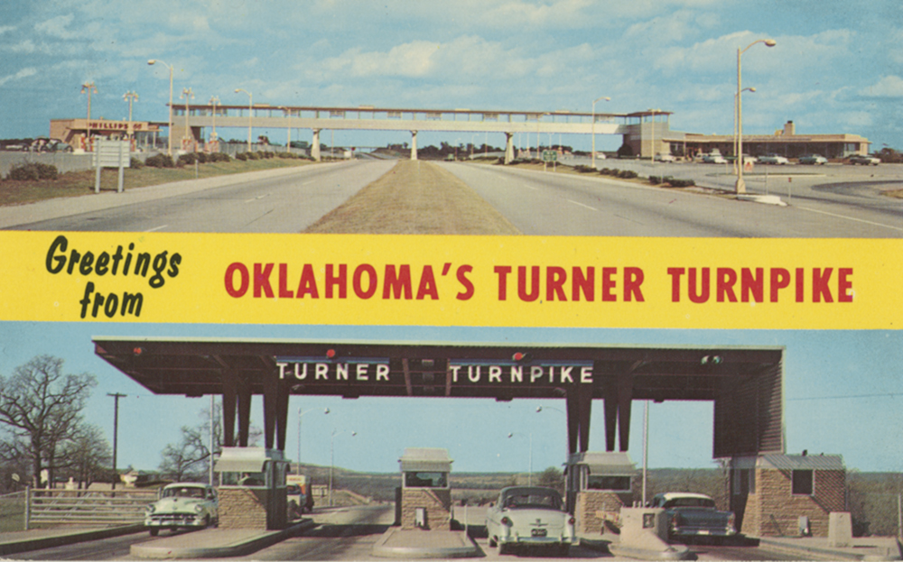 Postcard of the Turner Turnpike midway and toll gate.Courtesy of Metropolitan Library System of Oklahoma County
Before Eisenhower's Interstate Highway System, before state highway officials collaborated to create a national highway numbering system in 1926, motorists traveling cross-country followed turn-by-turn directions contained in the Official Automobile Blue Book. These books are a time capsule of transportation history, not only mentioning routes, but road conditions, locations of hotels, garages, train stations, and trolley tracks.
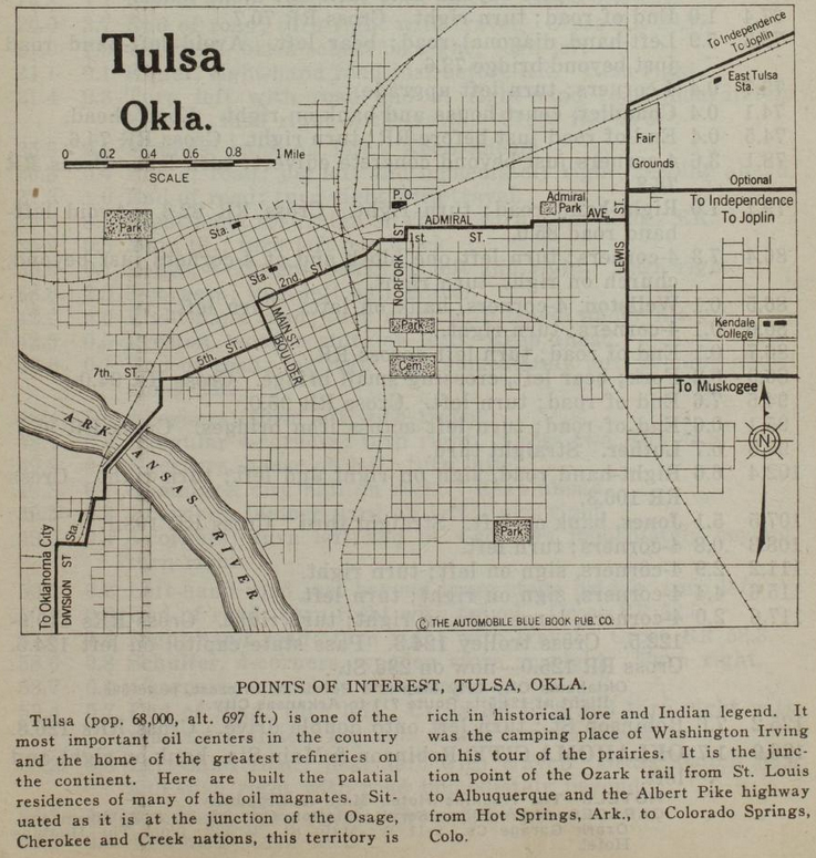
Above is a map of Tulsa from the Official Automobile Blue Book, 1920 edition, Volume 7, p. 779. That link will lead you to the page that begins the Route 901, 126.9 miles from 2nd & Main in Tulsa to Robinson & Main in Oklahoma City.
Only the streets that matter for inter-city motoring are labeled. The reset have to be inferred from old maps.
Heading east, the route goes down 2nd, but bends left at Kenosha onto 1st Place, and then joins 1st Street at Lansing Ave. Two blocks east at Norfolk (misspelled as Norfork) it jogs north to Admiral Blvd, which is today the north service road for I-244. Admiral Blvd jogs north at Utica, and the route reaches Whittier Square at Lewis, where it forks three ways.
- To Independence and Joplin: North on Lewis, east on Dawson Road.
- Optional to Independence and Joplin: North on Lewis, east on Archer Street
- To Muskogee: South on Lewis, east on 11th Street.
The route to Oklahoma City turns south at 2nd and Boulder, west at 5th Street, which merges into 7th west of Houston Avenue. The route turns south onto Maybelle Ave to 11th Street, then diagonally southwest across the Arkansas River bridge -- this part of the route was obliterated for the SW Inner Dispersal Loop interchange. On the west side of the river, the map shows the route heading south on Quanah to 17th, west to a road that follows the east side of the Frisco tracks to 19th, then west on 19th to Union Ave (labeled Division Street on this map). It looks to me like the mapmaker misidentified Union as Division; the 1920 census enumeration district map shows present-day Quanah Ave was West Tulsa's Division Street, before the annexed town's street names were normalized with Tulsa's, so in all likelihood, the route followed Quanah south, then Southwest Boulevard, then Old Sapulpa Road through Oakhurst and Bowden, into Sapulpa on Mission Street and Dewey Ave, then following the old Ozark Trail / Route 66 alignment that parallels and passes under the Frisco tracks.
The trolleys mentioned in the turn-by-turn route instructions are the Tulsa Street Railway (specifically the 5th Street track and the car barns at 5th/7th & Lawton) and the Sapulpa & Interurban, aka Oklahoma Union Traction, with an interurban line crossing the Arkansas River at West Tulsa and city streetcar lines in Sapulpa.
The Tulsa map shows SL&SF (Frisco -- SW to NE), AT&SF (Santa Fe -- SW to N), MKT (Katy - W to SE), and Midland Valley (N to S) railroads, but we can only infer electric interurban lines from mentions in the turn-by-turn text. These railroad stations are shown but Midland Valley is absent:
- MKT at Main between Cameron & Easton.
- SL&SF/ATS&F at Boston south of the Frisco tracks (to be replaced by Union Station)
- West Tulsa station south of what would be 18th & Santa Fe, west of the tracks
- East Tulsa Frisco station at about Delaware Ave, south of the Frisco tracks
Civic amenities shown include Oaklawn Cemetery, Owen Park, Central (Centennial) Park, and Swan Lake Park, but only Admiral Park is named. Kendall College (now University of Tulsa) is misspelled as Kendale, but shown as a couple of buildings east of College Ave between 5th and 7th. The Fair Grounds were between Archer St and the Frisco tracks, from Lewis to about Archer Place. The near northside is hidden beneath the title and scale on the upper left, but deep Greenwood Ave is not hidden. A Post Office is shown on the east side of Madison just north of the Frisco tracks, which seems strange, as that location is isolated from the center of town.
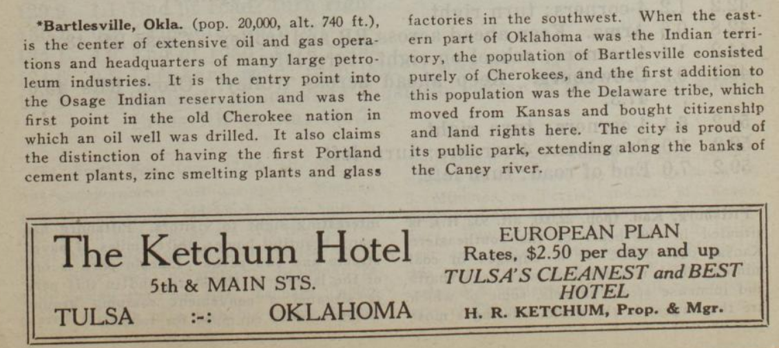
Route 902 is a longer route to Oklahoma City, 168.4 miles via Okmulgee and Henryetta, but it avoids Creek County oilfield traffic. Route 905 takes the Ozark Trail from Tulsa to Joplin, but you go through Owasso, where there was an Ozark Trail monument, to get to Claremore. Route 906 links Tulsa with Bartlesville and Independence, Kansas, paralleling present day US 75. Route 910 goes from Tulsa through Bixby to Muskogee. Each route has its reverse: Route 931 heads back from Independence to Tulsa, concluding with a description of Bartlesville and an ad for the Ketchum Hotel at 5th & Main in Tulsa.
MORE:
Hathi Trust partial collection of Automobile Blue Book volumes
1919 Official Automobile Blue Book, Volume 7, Tulsa map. In this edition, there is no route description for Tulsa to OKC via Stroud, but the road is depicted on the overview map.
"The Official Automobile Blue Book, 1901-1929: Precursor to the American Road Map," John T. Bauer (Department of Sociology, Geography, and Earth Science, University of Nebraska at Kearney), Cartographic Perspectives (Number 62, Winter 2009): Includes a list of all known editions with a breakdown by volume -- very helpful for finding the volume of interest in the Internet Archive and other online libraries.
RELATED:
Automobile Club of Southern California's beautiful strip maps of the National Old Trails Road from Los Angeles to Kansas City, with branches to Denver, Cheyenne, Big Springs, Nebraska, and the Grand Canyon. The stretch from Las Vegas, NM, to Los Angeles was the starting point for US 66 in 1926.
The National Old Trails Road: The great historic highway of America, a brief resume of the principal events connected with the rebuilding of the old Cumberland--now the National old trails road--from Washington and Baltimore to Los Angeles: A 1926 book with lots of interesting history about the evolution of named and numbered highway systems, beginning with the National Road from Cumberland, Maryland, to Vandalia, Illinois. Includes an unsuccessful 1913 congressional proposal detailing 18 numbered highways that would be improved with money from a new federal tobacco tax. Roads 11 and 13 would pass through Muskogee and Oklahoma City, but Tulsa doesn't get a mention. Also much discussion about the proper and constitutional role of the federal government in road building.
While searching for info on the state of Christianity in America circa 1923, when J. Gresham Machen wrote Christianity and Liberalism, I found the US Census Bureau's 1916 two-volume survey:
Religious bodies : 1916 : United States. Bureau of the Census : Internet Archive
This is Volume 1 of a two-volume set, listing Christian denominations and other religious bodies. Includes both statistics and historical information. From the introductory essay:
This report was prepared under the provisions of the permanent census act, approved March 6, 1902, as amended by the act of June 7, 1906. Its purpose is to present statistics of the number of organizations, members, etc., of the different religious denominations of the country and to give, in addition, a review of their historical origin and development, their doctrine, polity, and their missionary, educational, and philanthropic activities....Another body, known as the "Millenial Dawn," has a number of "meetings" in different parts of the country, as have also the "Russellites," or followers of Pastor Russell [Charles Taze Russell, founder of Jehovah's Witnesses], but in neither case was it feasible to obtain any definite statistics. Inquiries have been made of the bureau in regard to the "Holy Rollers," and an effort was made to identify them with specific organizations. It seems probable that the term applies to certain congregations whose members display physical manifestations in their services, similar to those exhibited by some religious bodies in the latter part of the eighteenth and early part of the nineteenth centuries, and which attract public notice for a time, but gradually subside into more normal ways of church life.
The page linked above has the summary table of adherents, attendance, congregations, and facilities. The list of changes since 1906 is interesting: New denominations include the Assemblies of God, Pentecostal Holiness Church, and Holiness Churches, reflecting the institutionalization of the Pentecostal movement, and the Albanian, Bulgarian, and Rumanian Orthodox Churches, the Jacobite Church (Assyrian), and the Lithuanian National Catholic Church, reflecting immigration from Eastern Europe and the Levant. Later in the book, there are church statistics by state (Oklahoma had 5,401 congregations with 424,492 members in 1916), adherents by denomination by state by county (Oklahoma is here) and large cities (Oklahoma City is here; Tulsa didn't make the cut of 25,000 inhabitants in the 1910 census). Oklahoma's largest denomination in 1916 was the Southern Baptist Convention (also the most congregations at 1,112), followed by the Methodist Episcopal Church, South, with the Roman Catholics in 3rd place.
Volume 2, which has a narrative and detailed statistics about each denomination. is here. The link leads specifically to the narrative for the Assemblies of God, founded in 1914, "following upon the great revival in 1907."
Some other resources of interest:
- Brown, William Adams, The church in America : A study of the present condition and future prospects of American Protestantism, Macmillan, 1922
- Weber, Max, The Protestant ethic and the spirit of capitalism, Scribner, 1930
- Interchurch World Movement of North America, Preliminary Grand General Summary, All Budget Statements by Denominations, 1920: A four-page pamphlet printed for the 1920 convention in Atlantic City.
- Krull, Vigilius H., Christian denominations, or, A brief exposition of the history and the teachings of Christian denominations found in English-speaking countries, St. Joseph's Printing Office, Collegeville, Indiana, 1917: A description of Orthodox and Protestant denominations, explaining why they're wrong from a Roman Catholic perspective. Mormons and Dowieites are included with "Other Christian Denominations," but Unitarians, Universalists, Shakers, Swedenborgians, and Christian Scientists are categorized as "Pretending to Be Christians."
- Benson, Robert Hugh, Non Catholic denominations, Longmans, Green & Co., 1921: Another Catholic perspective on Protestants and other Christians in England.
I had the idea of teaching a one-quarter (13-week) adult Sunday School course based on Machen's book, which was written at the dawn of the Fundamentalist-Modernist controversy, which led to the creation of the Orthodox Presbyterian Church in 1935 and planted the seeds for the cultural and religious divisions that began to emerge in the 1960s. Machen's 7-chapter book would be introduced by an account of early 20th century Christianity in America and the influences of Darwin, Marx, Dewey, Freud, and higher criticism, and would be followed by a history of controversy and denominational division since Machen's time.
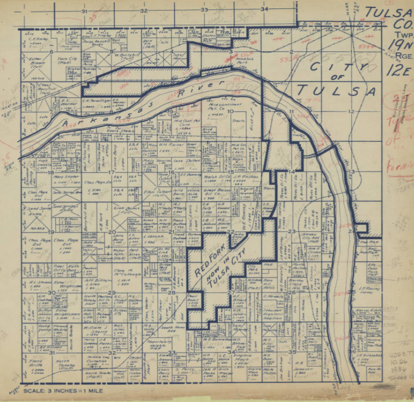
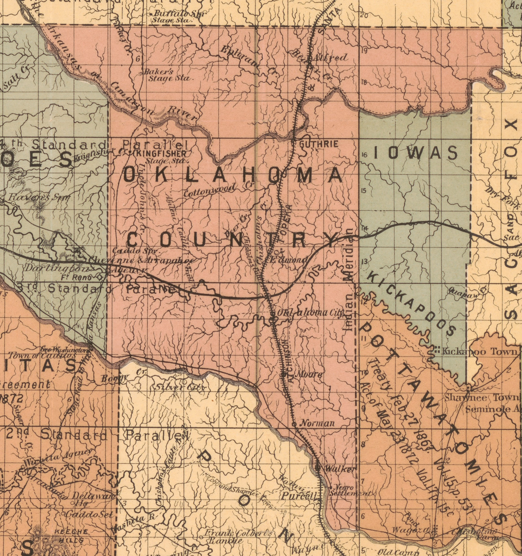
During the Great Depression, the Federal Works Progress Administration (WPA) and Oklahoma Tax Commission (OTC) commissioned a series of maps in 1936 to document land ownership and taxable value. An example of the maps are shown above. Each map covers a Public Land Survey System (PLSS) township (6 miles by 6 miles, divided into 36 square-mile sections). Approximately 2,300 maps cover the entire state.
Municipalities are marked with heavy shaded boundaries; note that Turley, Dawson, and Alsuma are all still independent, while Red Fork had been recently annexed by Tulsa. Tax-exempt properties are marked with a diagonal cross; if the listed owner is a person's name, it's likely a tribal allotment. If taxable, two numbers are listed: L (land value) and I (improvements value). Areas without valuation may be platted subdivisions -- I notice a bunch of them along US 66 in east Tulsa: Glenhaven, Plain View Heights, Radio Heights, Romoland, Lynn Lane Drive, Indian Hills. Interesting to see some prominent names -- Kennedy and Gilcrease in SE Osage County, L. S. Robson and C. S. Avery in what's now east Tulsa, Waite Phillips around Southern Hills, Charles Page and the Sand Springs Home around Sand Springs, Mullendore in Osage and Washington counties.
Some of the Tulsa County maps include part of Osage County. The township, range, and section grid for the Osage Reservation is offset from the rest of the state. It is shifted about 1/4 mile south and 1/2 mile east of the rest of the state.
On maps of T19N townships, there is a heavy-dashed east-west line about 1/8 mile south and parallel to the N edge of the boundary. This is the Creek/Cherokee boundary, which continues west as the Osage/Creek boundary and then the southern boundary of the Cherokee Outlet. East of Lewis Ave in Tulsa this line is Admiral Place, while Archer Ave is the section and township line. You may have noticed that it's farther from Pine to Admiral than from Admiral to 11th Street -- that's why.
Browsing through one of the Osage County maps, covering an area west of Hominy that included Boston Pool, I discovered the location of 200 acres of land that my great-grandfather had owned in 1936, which led me to do more research at the Osage County Clerk's office back in February 2017.
The Tulsa County General Highway Map, Sheet 2, from 1937, shows Tulsa, Sand Springs, Turley, Dawson, and Red Fork, T20N R12E, T19N R11E, T19N R12E, which will provide some context for the WPA maps.
OSU's Oklahoma Digital Map Collection has the entire collection of WPA land maps for Oklahoma online.
BREAKING: After typing up this entry, I just discovered that someone has created a interactive, georeferenced mosaic of all the Oklahoma WPA maps, which also allows you to download maps of interest. This will be useful for locating lost and drowned municipalities, like Keystone, Antwine, Lugert, Centralia, and Hochatown. You can adjust the transparency of the WPA maps, allowing you to overlay it on a present-day satellite view.
Here are the Tulsa County maps, starting at the north end of the county and working west to east in rows.
- T22N R12E (126th St N to 186th St N; 81st West Ave to Peoria, far north Tulsa County and part of Osage County around Skiatook)
- T22N R13E (126th St N to 186th St N; Peoria to Mingo, far north Tulsa County between Skiatook and Collinsville)
- T22N R14E (126th St N to 186th St N; Mingo to 193rd East Ave, far north Tulsa County around Collinsville)
- T21N R12E (66th St N to 126th St N; 81st St West to Peoria; Sperry and vicinity)
- T21N R13E (66th St N to 126th St N; Peoria to Mingo; between Sperry and Owasso)
- T21N R14E (66th St N to 126th St N; Mingo to 193rd East Ave; Owasso and vicinity)
- T20N R12E (Archer to 66th St N; 81st West Ave to Peoria; southeast Osage County, north Tulsa, Turley)
- T20N R13E (Archer to 66th St N; Peoria to Mingo; north Tulsa, Dawson, Mohawk Park, airport)
- T20N R14E (Archer to 66th St N; Mingo to 193rd East Ave; northeast Tulsa)
- T19N R10E (Edison to 61st St S; 273rd West Ave to 177th West Ave; far west Tulsa County)
- T19N R11E (Edison to 61st St S; 177th West Ave to 81st West Ave; Sand Springs, Prattville, and vicinity)
- T19N R12E (Edison to 61st St S; 81st West Ave to Peoria; west Tulsa, Red Fork, Sand Springs, Berryhill; heavy dashed line is the Cherokee/Creek & Osage/Creek boundary)
- T19N R13E (Archer to 61st St S; Peoria to Mingo; midtown Tulsa; heavy dashed line is the Cherokee/Creek boundary at Admiral Place)
- T19N R14E (Archer to 61st St S; Mingo to 193rd East Ave; east Tulsa; heavy dashed line is the Cherokee/Creek boundary at Admiral Place)
- T18N R12E (61st St S to 121 St S; 33rd West Ave to Peoria; southwest Tulsa in Jenks school district, west Jenks)
- T18N R13E (61st St S to 121 St S; Peoria to Mingo; Jenks, south Tulsa, north Bixby)
- T18N R14E (61st St S to 121 St S; Mingo to 193rd East Ave; Broken Arrow, Union and vicinity)
- T17N R12E (121st St S to 181 St S; 33rd West Ave to Peoria; Glenpool and vicinity)
- T17N R13E (121st St S to 181 St S; Peoria to Mingo; Bixby and vicinity)
- T17N R14E (121st St S to 181 St S; Mingo to 193rd East Ave; Wealaka (Leonard) and vicinity, south Broken Arrow)
- T16N R12E (181st St S to 241 St S; 81st West Ave to Peoria; south Tulsa County, north Okmulgee County)
- T16N R13E (181st St S to 241 St S; Peoria to Mingo; south Tulsa County, north Okmulgee County)
- T16N R14E (181st St S to 241 St S; Mingo to 193rd East Ave; south Tulsa County, north Okmulgee County)
House Bill 1775 (2021), signed into law earlier this week by Gov. Kevin Stitt, takes up a grand total of four sheets of paper. The substance of the bill occupies a mere page and a third, 282 words by my count. So it's frustrating, if not surprising, that the Tulsa Whirled and broadcast media outlets should mischaracterize the bill, when they could easily quote the entire text. (Here's all the info on HB 1775, including earlier versions, amendments, and legislative votes.)
Although HB 1775 targets the infiltration of Critical Race Theory (CRT) into our taxpayer-funded schools and universities, it does not use that phrase. Instead, it prohibits specific racist and sexist ideas from being taught. There are two subsections of what will become 70 O. S. 24-157. Subsection A deals with state universities, requiring the Oklahoma State Regents for Higher Education to promulgate rules, subject to legislative approval, to enforce the following law:
No enrolled student of an institution of higher education within The Oklahoma State System of Higher Education shall be required to engage in any form of mandatory gender or sexual diversity training or counseling; provided, voluntary counseling shall not be prohibited. Any orientation or requirement that presents any form of race or sex stereotyping or a bias on the basis of race or sex shall be prohibited.
Subsection B deals with K-12 schools, and the State Board of Education is assigned to enforce it:
The provisions of this subsection shall not prohibit the teaching of concepts that align to the Oklahoma Academic Standards.1. No teacher, administrator or other employee of a school district, charter school or virtual charter school shall require or make part of a course the following concepts:
- one race or sex is inherently superior to another race or sex,
- an individual, by virtue of his or her race or sex, is inherently racist, sexist or oppressive, whether consciously or unconsciously,
- an individual should be discriminated against or receive adverse treatment solely or partly because of his or her race or sex,
- members of one race or sex cannot and should not attempt to treat others without respect to race or sex,
- an individual's moral character is necessarily determined by his or her race or sex,
- an individual, by virtue of his or her race or sex, bears responsibility for actions committed in the past by other members of the same race or sex,
- any individual should feel discomfort, guilt, anguish or any other form of psychological distress on account of his or her race or sex, or
- meritocracy or traits such as a hard work ethic are racist or sexist or were created by members of a particular race to oppress members of another race.
Who would defend any of the ideas listed above? And yet these very ideas are being incorporated into school curricula (as well as corporate training) across America and throughout the Anglosphere. If we had a mainstream media worthy of our attention, they would be asking critics of HB 1775 to read the above list and indicate which of the ideas they endorse teaching to school children.
(Christopher Rufo has been tireless in documenting the spread of "woke" education and now is turning his attention to "woke" corporate indoctrination with an exposé of Disney's racist diversity and inclusion program. Rufo's coverage of CRT in the Federal Government led to President Trump's executive order banning racist dogma.)
Many critics of HB 1775 selectively quote subparagraph B.1.g. as prohibiting the teaching of any historical event that might make a student feel uncomfortable, for example, the Trail of Tears, the Tulsa Race Massacre, lynching, or Jim Crow laws. A change in wording ("ought to feel" or "is obliged to feel" instead of "should feel") might have avoided the easy distortion, but the language is clear enough to the careful reader. The bill bans teaching that "any individual should feel discomfort, guilt, anguish or any other form of psychological distress on account of his or her race or sex" (emphasis added). That last phrase has been utterly ignored by the mainstream media. A student ought to feel sad or angry when learning that a mob of white people descended on a black community, shot people and looted and burned their homes and businesses, but a person in academic authority over them, funded by Oklahoma taxpayers, should not tell the student that he should feel personally guilty because he has skin color in common with those responsible for these evil deeds.
Note the reference to Oklahoma Academic Standards, which I have hyperlinked above. The current Social Studies standards, last updated in 2019. HB 1775 explicitly allows the topics in these standards to be taught, notwithstanding anything else in the bill. All of the historical subjects that critics have claimed will be suppressed are in fact included, for example:
OKH.1.3 Compare the goals and significance of early Spanish, French, and American interactions with American Indians, including trade,the impact of disease, the arrival of the horse,and new technologies.OKH.1.4 Compare cultural perspectives of American Indians and European Americans regarding land ownership, structure of self-government, religion, and trading practices.
OKH.2.3 Analyze the motivations for removal of American Indians and the passage of the Indian Removal Act of 1830; trace the forced removal of American Indian nations, including the impact on the tribal nations removed to present-day Oklahoma and tribal resistance to the forced relocation
OKH.3.1 Summarize the impact of the Civil War and Reconstruction Treaties on American Indian peoples, territories, and tribal sovereignty including:
- required enrollment of the Freedmen
- Second Indian Removal
- significance of the Massacre at the Washita
- reasons for the reservation system and the controversy regarding the reservation system as opposed to tribal lands.
- establishment of the western military posts including the role of the Buffalo Soldiers
- construction of railroads through Indian Territory
OKH.3.4 Compare multiple points of view to evaluate the impact of the Dawes Act (General Allotment Act) which resulted in the loss of tribal communal lands through a transfer to individual property and the redistribution of lands, including the Unassigned Lands and the Cherokee Outlet, by various means.
OKH.3.5 Explain how American Indian nations lost control over tribal identity and citizenship through congressional action, including the Indian Reorganization Act.
OKH.5.1 Examine the policies of the United States and their effects on American Indian identity, culture, economy, tribal government and sovereignty including:
- passage of the Indian Citizenship Act of 1924
- effects of the federal policy of assimilation including Indian boarding schools (1880s-1940s)
- authority to select tribal leaders as opposed to appointment by the federal government
- exploitation of American Indian resources, lands, trust accounts, head rights, and guardianship as required by the Bureau of Indian Affairs.
OKH.5.2 Examine multiple points of view regarding the evolution of race relations in Oklahoma, including:
- growth of all-black towns (1865-1920)
- passage of Senate Bill 1 establishing Jim Crow Laws
- rise of the Ku Klux Klan
- emergence of "Black Wall Street" in the Greenwood District
- causes of the Tulsa Race Riot and its continued social and economic impact
- the role labels play in understanding historic events, for example "riot" versus "massacre"
Those are just the Oklahoma History standards. The standards for U. S. History demand more depth and nationwide scope on slavery, Reconstruction, Jim Crow, Indian removal, and other topics that don't paint the United States in a positive light. (In fact, the U. S. History standards as a whole seem unbalanced to the negative; the State Board of Education ought to undertake a review.)
The hair-on-fire reactions to HB 1775 from educrats and leftist politicians fail to engage the substance of the bill, setting up strawmen that are easily demolished.
Now Phil Armstrong, the Project Director for the 1921 Tulsa Race Massacre Centennial Commission, has sent a letter to Governor Kevin Stitt claiming that his signing of HB 1775 amounts to submitting his resignation from the commission. (Gov. Mary Fallin was given an ex officio seat when the commission was created, as was Lt. Gov. Todd Lamb; these were handed down to the present incumbents when Fallin and Lamb left office in January 2019.) Despite the official sounding name, I can't find any statute or ordinance creating the commission, which appears, from the cast of characters, to be a cog in what Michael Mason has dubbed "the Kaiser System" -- the network of organizations and initiatives tied to billionaire philanthropist George Kaiser.
The Governor's office responded:
Governor Stitt and the First Lady both strongly support reconciliation, healing and the rebirth of Tulsa's Greenwood District, and have worked with the 1921 Race Massacre Centennial Commission on multiple productive events.While it has become clear that Mr. Armstrong does not speak for the entire Centennial Commission, it is disappointing that some commission members feel that a common-sense law preventing students from being taught that one race or sex is superior to another is contrary to the mission of reconciliation and restoration.
Governor Stitt issued Executive Order 2021-12 as a signing statement to expressly direct that the Tulsa Race Massacre, and all historical events included in the Oklahoma Academic Standards, must still be taught in our schools. The governor believes that any other interpretation of this legislation is misguided and fundamentally inaccurate, and that position was expressed to the Centennial Commission before the bill was signed into law.
America has made great progress over the last century toward an America in which a person's race and sex are no impediment to the full enjoyment of life, liberty, property, and the pursuit of happiness. Whatever racism or sexism may lurk in stony human hearts, laws and regulations enforcing racism and sexism have been swept away. And yet the Left continues to seek access to our children to sow mutual suspicion and division. Despite massive Republican supermajorities in the legislature, Leftists claim the right to run our taxpayer-funded schools and universities. HB 1775 is a welcome first step in ordinary Oklahomans reasserting democratic control of state institutions of cultural formation.
MORE: Don't miss BatesLine's collection of stories, maps, and images on the history of Tulsa's Greenwood District, Black Wall Street, after the 1921 Tulsa Race Massacre.
This past April 22, 2020, was the 131st anniversary of the land run that opened the central part of today's State of Oklahoma to homesteading by non-Indian settlers. These were lands owned by the U. S. Government and not assigned to any organized territory nor to any Indian nation or reservation. It was the first time and one of a handful of times that land was allocated based on who could get there the quickest. Tent cities with populations in the thousands sprung up in a matter of hours after the guns were fired to start the run. The land runs, particularly the first land run in 1889, constitute an aspect of Oklahoma's history unmatched by any other state, and, as far as I'm aware, any other region of the world.
For many years, April 22 was marked at elementary schools across Oklahoma by land run reenactments. Kids would come to school dressed in cowboy hats and denim overalls or bonnets and gingham dresses, would line up at the edge of the football field, some pulling Radio Flyers made up as covered wagons. At noon, they would rush across the sideline to drive a stake in the ground, claim a homestead, and eat a picnic lunch.
But this fun, child-friendly introduction to Oklahoma's unique history is threatened by a handful of busybody killjoys who distort the real story of how the 1889 Land Run territory came to be available for settlement and by the school officials who cave into their demands. I've done some digging into the treaties and agreements leading up to the 1889 run, and what strikes me is that the U. S. Government bent over backwards to give the tribes that previously held the land a fair deal.
When I was a third-grader, our land-run reenactment was the culmination of a few weeks of focus on Oklahoma history. We learned to square dance. We studied the map of tribal lands before statehood. We learned about the Trail of Tears. On land-run day, teachers led a re-enactment of the one-room school house, complete with dunce cap. One of the covered wagons, belonging to a young Chip McElroy, was motorized, thanks to the assistance of his dad, Art McElroy, then head of McElroy Manufacturing. KOTV covered the re-enactment that year, and the closing credits of that night's newscast crawled over footage of one of my classmates relieving himself, pioneer style, against a tree.
All of my own children have participated in land-run re-enactments -- at "The Barn" at 109th & Louisville, on Augustine Christian Academy's grailball field, and at Harn Homestead in Oklahoma City, where Lt. Gov. Todd Lamb signed the homestead claims. It's a fun event that provides a memorable hook on which to hang a beginning understanding of our state's unusual origins.
Unfortunately, Leftist activists have been persuading schools to drop the land-run reenactments by claiming that Land Run reenactments are celebrations of genocide and land theft. In 2014, the Oklahoma City school board banned reenactments. A Leftist activist named Sarah Adams-Cornell had already persuaded all but one classroom in the district to drop the activity -- this in a city that owes its very origin to the 1889 Land Run -- making unsubstantiated claims that 10,000 Indians were made homeless by the Land Run and that "in many cases land grabbers walked right into a house and took over."
As far as I have been able to find, Adams-Cornell offered no evidence for her claims. The first instinct of a typically risk-averse school bureaucrat, when confronted with a claim of oppression by someone who ticks several intersectional boxes, would be to capitulate immediately, without asking for evidence. To resist in even the mildest terms would bring protests and bad publicity, but immediate compliance would bring praise for virtue-signaling.
There is no question that American Indian nations suffered great oppression and hardship at the hands of the U. S. Government, particularly in the passage and enforcement of the Indian Removal Act of 1830. But the guilt that attaches to the actions of Andrew Jackson or, say, gold-hungry north Georgia settlers, doesn't necessarily attach to the '89ers who staked claims on the Unassigned Lands. We need to look at the documentation and understand exactly how these lands came to be unassigned.
The Unassigned Lands were part of the lands purchased from the Creek and Seminole Nations under the 1866 treaties following the Civil War. The two nations had signed treaties with the Confederacy at the start of the war, in violation of their treaties with the U. S. government. Despite official Creek and Seminole support for the rebellion, the Federal government didn't simply claim their lands as spoils of war. Instead, the U. S. paid the two nations for their western, unoccupied lands, ($975,168 to the Creek Nation, $15,673,385.66 in 2019 dollars; $325,362 to the Seminole Nation, $5,229,283.55 in 2019 dollars, less $100,000 to the Creek Nation for a new reservation), and then settled several Plains tribes on the land, including Pottawatomie, Iowa, Kickapoo, Sac and Fox, Cheyenne, and Arapaho. Some of the funds were earmarked for paying reparations to Creek and Seminole citizens who remained loyal to the Union during the war and suffered losses as a result.
When the U. S. wanted to open the Unassigned Lands -- lands that had not been reallocated to other Native peoples -- for non-Native settlement, they had to get permission from the Creek and Seminole Nations, because the 1866 treaty only allowed for other Native tribes and freedmen to be assigned reservations within the ceded land. In 1885, Congress authorized new negotiations to remove the deed restriction on the land:
Most of the enthusiastic home seekers did not then know of that clause in the treaty of 1866--whereby the surplus lands of both the Creeks and Seminoles were ceded back to they United States for the purpose of "locating other friendly tribes of Indians and freedmen." While no other Indians or freed Negroes were to be located on the land, yet the government claimed that while the cloud was on the title, no white citizen would be permitted to make settlement. By an Act of March 3, 1885 [48th Congress, Session 2, Chapter 341, Section 8], a commission was appointed to negotiate a new deal with these two tribes whereby the clause as to the "friendly Indians and Freedmen" would be stricken from the treaty of 1866 and the unassigned lands would be, without question, public domain and opened to homestead settlement. The negotiations were concluded and the price agreed upon before the country was opened. ("Colonel Crocker and the Boomer Movement, Chronicles of Oklahoma, Volume 13, No. 3 (September 1935), p. 275 [21], hyperlink added)
The 1889 agreements required the U. S. Government to pay a further $2.2 million to the Creek nation [50th Congress, Session 2, Chapter 317] and $1.9 million to the Seminole nation [50th Congress, Session 2, Chapter 412, Section 12] -- that's in 1889 dollars. The only people authorized to live in the Unassigned Lands between the sale of the land in 1866 and April 22, 1889, were railroad workers and Federal marshals.
(And who had the land before the Creeks and Seminoles? Nearly all of present-day Oklahoma was part of the land ceded by the 1825 treaty with the Great Osage and Little Osage Nations. The Osage tribes, with a population of about 4,000 in 1807, had villages in western Missouri and a colony along the Grand River that was founded circa 1796 under the leadership of Chief Clermont (namesake of Claremore) and with the encouragement of fur trader Pierre Chouteau. With the 1825 treaty, they ceded all their claims for a 50-by-150 mile reservation in southern Kansas. A small number of mixed-blood Osage were granted homesteads along the Grand River. The specific territory that became the Unassigned Lands might have been used as hunting grounds -- Washington Irving's party came across Pawnee and Osage hunters and warriors in the region -- but don't appear to have been settled by any tribe.)
At noon on April 22, 1889, guns were fired and settlers began streaming across the border into a region known as the Unassigned Lands, trying to stake a claim on one of the best quarter-sections for homesteading or a good lot in the new townsites along the Santa Fe railroad, like Guthrie, Edmond, Oklahoma City, Moore, and Norman. They were beaten to some of the best land by "Sooners," who were in the territory illegally, having stolen across the border ahead of the gun, and by federal officials and railroad workers, who were in the territory legally but were legally barred from competing for lots and homesteads. Collectively, these settlers became known as the Eighty-Niners -- the original settlers who were renowned for their grit and determination to survive the harsh conditions on the prairie. A first-hand account by William Willard Howard, published a month after the Land Run in Harper's Weekly, paints a vivid picture of the chaos and hardship of those early days. (A note to the reader: Howard uses the name Oklahoma to refer specifically to the Unassigned Lands opened by the '89 run, not the larger Oklahoma Territory or present-day State of Oklahoma.)
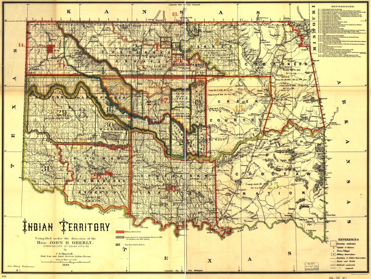
 From Rand McNally, 1889, "Map of the Indian Territory showing Oklahoma country "
A year later, in 1890, Congress and President Benjamin Harrison would approve the Organic Act for Oklahoma Territory, establishing Oklahoma Territory as a non-contiguous collection of the Unassigned Lands, the Public Land Strip (better known as No Man's Land and the Panhandle), and the tribal lands that had been assigned after the end of the Civil War (e.g. Pawnee, Tonkawa, Sac and Fox, Pottawatomie). This excluded the portion of the Cherokee Outlet that had yet to be assigned to another tribe or opened for settlement, and the area that the act would, for the first time, officially designate as Indian Territory: the lands of the Five Civilized Tribes, and the tribal lands overseen by the Quapaw Agency near present-day Miami. The Cherokee Outlet lands would be added to Oklahoma Territory at a later date. The territorial capitol would be at Guthrie, and the territorial government would be elected by the residents of the former Unassigned Lands and No Man's Land. Greer County, the land between the north and south forks of the Red River, was also excluded from Oklahoma Territory until the boundary dispute between the State of Texas and the Federal Government could be settled by the courts.
The Organic Act makes references to agreements made with the Muscogee (or Creek) Nation, ratified by Congress on March 1, 1889, and with the Seminole Nation, ratified by Congress on March 16, 1889. The western lands that the two nations had ceded to the United States in the post-Civil War treaties of 1866 could only be occupied by peaceful Indian tribes. In order to open the lands to non-Indian settlement, the government had to negotiate an additional treaty with the Creeks and the Seminoles, which included a significant amount of money.
Pursuant to the 1889 agreement, the US made an immediate payment to the Muscogee Creek Nation $280,857.10, and held an additional $2,000,000 in a trust account at 5% annual interest, to be paid to the tribe semi-annually -- $50,000 every six months, in addition to the government's existing financial obligations under earlier treaties. That's an immediate payment of $7,760,264.84 in 2019 dollars, and a semi-annual payment of $1,381,532.61. An 1890 tribal census counted 14,800 Creeks. These interest rates were set at 5% at a time when the economy was deflating -- prices declined by 3.16% in 1889. In the 18 years between 1889 and statehood in 1907, prices rose only by 2.17%
The Seminoles received $412,942.20 immediately, and an additional $1,500,000 in a trust account at 5% annual interest -- $37,500 every six months. In 2019 dollars, that's $11,409,862.30 immediately and $1,036,149.46 every six months. The 1890 census counted 2,427 Seminoles.
Critics may argue with the amount of money that was paid, or the way in which it was paid. It's fair to say that the Creeks and Seminoles were not in a strong negotiating position after the Civil War or in 1889, but, nevertheless, the U. S. Government didn't simply say, like Darth Vader, "I am altering the deal; pray I don't alter it any further." If the U. S. Government had simply forced its will without compensation -- claiming the land as spoils of war and later modifying its deed restrictions -- who would have stopped it? Instead, whether from moral convictions or from concern for its reputation for treaty fidelity in the wider world, the U. S. Government negotiated and paid for the changes it sought.
The result was an unoccupied region of two million acres to which the U. S. Government had clear legal and moral title, ready for settlement by Americans who were desperate for land to farm.
NOTE: I started writing this in April of 2019, hoping to finish in time for that year's anniversary of the 1889 Land run, but it has been sitting in draft since that time. I had in mind to delve deeper into some details, but at this point, I simply want to publish what I have, as I find I keep referring to the information in online discussions.
Hello from Tulsa, M.C.N. We're not in Oklahoma any more.
This morning, in a 5-4 decision, America's permanent super-legislature voted, in the case of McGirt v. Oklahoma, to liberate convicted child molester Jimcy McGirt by ruling that all the lands within the 1866 boundaries of the Muscogee Creek Nation continue to constitute an Indian reservation for the purposes of the Major Crimes Act. Under the court's ukase, If a member of an Indian tribe -- any Indian tribe -- were to murder me in my own home, he would be prosecuted and tried in Federal court, not the courts of the State of Oklahoma.
The ruling establishes a definition for Indian Country far different than that which has been applied in Oklahoma for the last 113 years and establishes a precedent that brings into doubt questions of jurisdiction, governance, and ownership that were previously thought to be settled. Neil Gorsuch, the latest disappointment to take a seat as a permanent super-legislator, was joined in his opinion by the four knee-jerk Leftists, who probably were just gleeful at the thought of causing headaches for hundreds of thousands of Trump voters. As in the Bostock decision, Gorsuch blithely dismissed concerns about the implications of the decision beyond the major crimes act.
Beyond the former Creek boundaries, the case has implications for all of eastern and south-central Oklahoma, the land officially designated Indian Territory from 1890 to 1907.
This case was a companion to Sharp v. Murphy, which was argued in the 2018-2019 term, but was scheduled for reargument, because it had reportedly deadlocked at 4-4 with Gorsuch not participating in the decision..
Jimcy McGirt, the petitioner in this case, is an enrolled member of the Seminole Nation. Here is the State of Oklahoma's summary of Mr. McGirt's crimes in its brief in opposition:
In 1996, Petitioner and his wife were taking care of Petitioner's wife's grand-daughter, four-year-old B.B., while B.B.'s mother was on vacation. While Petitioner's wife was at work, Petitioner penetrated B.B.'s vagina with his finger and his tongue, and forced B.B. to touch his "private." Petitioner was convicted of first degree rape, lewd molestation, and forcible sodomy. The jury recommended sentences of five hundred years each for first degree rape and lewd molestation, and life imprisonment without the possibility of parole for forcible sodomy. On direct appeal, the Oklahoma Court of Criminal Appeals (OCCA) affirmed Petitioner's convictions and sentences, recognizing that Petitioner had two prior convictions for forcible sodomy. See McGirt v. State, No. F-1997-967 (Okla. Crim. App. Aug. 26, 1998).
This is the guy that Neil Gorsuch overturned a hundred years of settled law to set free.
Gorsuch speaks movingly of promises made by the US to the MCN in 1832, but glosses over or ignores the subsequent history of the relationship, including the MCN's alliance with the Confederate States of America against the USA, the 1866 Reconstruction Treaty, and the numerous acts and agreements involving the allotment of tribal lands to tribal members and the subsequent extinction of the tribal government.
Chief Justice John Roberts's dissent (in the same document with the majority decision) is a master class in the evolution of Indian Territory toward incorporation in the State of Oklahoma. He walks through the process of the dissolution of communally held lands and tribal governments toward full American citizenship and property ownership for tribal members. He mentions treaties, agreements, statutes, federal reports, congressional debates, and the contemporary writings of Muscogee Creek principal chief Pleasant Porter. Roberts notes the determination in the last decade of the 19th century, that continued communal ownership of tribal land benefited the politically connected to the detriment of most of the tribal members. When I have more time, I intend to walk through the documents Roberts cites and provide links where I can find them.
Many individuals and entities filed amicus curiae briefs in support of one side or the other of the case. One brief stood out to me as a worrisome sign of tribal government influence in the State of Oklahoma's government: Filed in support of molester McGirt's appeal by the Chickasaw Nation, the Choctaw Nation, Congressman Tom Cole, former Governor Brad Henry, former Senate President Pro Tempore and Secretary of State Glenn Coffee, former Attorney General Mike Turpen, former Secretary of Transportation Neal McCaleb, former House Majority Leader Danny Hilliard, former House Speaker Kris Steele, former Congressman Dan Boren, former House Speaker T. W. Shannon, and former State Rep. Lisa Billy. Cole, McCaleb, Shannon, and Billy are all members of the Chickasaw Nation. McCaleb, Hilliard, Boren, and Shannon either have been or currently are on the payroll of the Chickasaw Nation or its subsidiaries, and Billy serves in the Chickasaw legislature, according to the footnotes of the brief.
The Cherokee Nation and Muscogee Creek Nation also filed briefs in support of molester McGirt's appeal. It's important to note that these two tribes, and the other tribes and individuals I mention above, were not supporting claims of good character or innocence by McGirt, but were supporting the legal doctrine that would void his conviction in Oklahoma's state court system, a doctrine with the potential of providing the tribes with new leverage over the citizens of the State of Oklahoma.
Amici in support of the State of Oklahoma's case included the US Government, the states of Kansas, Louisiana, Montana, Nebraska, and Texas, International Municipal Lawyers Association and National Sheriffs Association, and seventeen of Oklahoma's 27 District Attorneys, along with the Oklahoma District Attorneys Association, including Tulsa County's Steve Kunzweiler and Jack Thorp, who serves Wagoner, Cherokee, Sequoyah, and Adair Counties.
The City of Tulsa's amicus brief in support of the State of Oklahoma explained what is at stake for Tulsa citizens if molester McGirt were to win his case.
The overwhelming majority of Tulsa's landmass and population lies within the former territory of the Creek and Cherokee Nations. But for over a century, the entirety of the City--with the exception of a few scattered land plots--has not been "Indian country." Shortly before Oklahoma statehood, the Creek and Cherokee tribes agreed to disclaim and convey "all right, title, and interest" in their land to individual landowners, including the residents of the platted townsite of Tulsa. Since then, municipal and state laws have been applied throughout the City to Indian and non-Indian Tulsans alike. Only a handful of plots in Tulsa are treated as "Indian country," because they either are still owned by the tribes themselves or remain subject to unique title restrictions.Petitioner's arguments, if adopted, would upend Tulsa's system of government and force the City into years of litigation over the most basic exercises of regulatory authority. Tulsa's Police Department would be stripped of jurisdiction to investigate crimes against or involving Indian Tulsans. Numerous lots in residential neighborhoods could suddenly be exempt from zoning. The City's taxing and regulatory authority could be subject to numerous challenges and endless litigation.
Tulsa's prosperity has been built on a system of government and regulation that applies equally to all Tulsa residents, regardless of their tribal membership. Petitioner's argument threatens that system, and would negatively impact the lives of thousands of Tulsans.
Here are some bookmarks of interest:
- McGirt v. Oklahoma SCOTUS docket page, with links to McGirt's petition, the Oklahoma Court of Criminal Appeal's denial, and the State of Oklahoma's brief in opposition.
- SCOTUS McGirt v. Oklahoma opinion, with dissents by Roberts and Thomas
- Oral argument transcript and audio.
- Joint statement from Oklahoma Attorney General Mike Hunter and the Five Civilized Tribes: "The Nations and the State are committed to ensuring that Jimcy McGirt, Patrick Murphy, and all other offenders face justice for the crimes for which they are accused. We have a shared commitment to maintaining public safety and long-term economic prosperity for the Nations and Oklahoma."
Rita Thurman Barnes, a Bartlesville local historian and newspaper columnist, recounts a Tulsa conversation that rubbed her the wrong way.
We made a very early trip to Tulsa this morning to get a belt for hubby's lawn mower. We left before breakfast so we could get there when the dealership opened and home to mow before the rain.On the way back about 9:30 we stopped at a bakery and got a couple of donuts. We were making small talk while the clerk made change and I mentioned we were hungry and heading back to Bartlesville. She was an older lady, about my age, and she looked at me and said, "I've been up there a couple of times. It's such a 'cute little town'."
I don't know what rattled my cage but her comment didn't set right. I could be getting old and touchy but I want the town I'm spending the rest of my life in to be thought of as more than just "a cute little town".
I reminded her that Phillips 66 had its beginnings in Bartlesville as did what is now known as Citgo. I had to stop myself from preaching a sermonette about all the good things that go on here in town and how the lives of people around the state and even around the world have been impacted because of the research and development that continues to take place in Bartlesville in spite of some relocation to Houston.
We may be a small city tucked in the NE corner of Oklahoma but we matter and we contribute and for the most part we reach out to our neighbors and friends less fortunate and give from deep down in our pockets and from our hearts.
There's no doubt that Bartlesville punches above its weight, culturally and economically.
My earliest memories, mostly happy, are of Bartlesville -- walking to Johnstone Park playground past the Nellie Johnstone replica and the tank cannon and the steam engine, swimming at Sani-Pool, walking to the library, church, and the stores; the Play Tower and the amphitheater at Sooner Park; and of course the Kiddie Park. As an adult, I brought my family back annually for Kiddie Park visits (until the youngest got too tall) and OK Mozart concerts, often with supper at Mr. Limey's or Murphy's or Dink's, and always with a drive around town to point out where things used to be when I was a kid.
When I was five, my dad's employer, Cities Service, moved his job to Tulsa, and we were sad to leave Bartlesville. I've been told that Cities Service didn't feel welcome to expand its presence in Bartlesville, that efforts to build a world headquarters in the city were blocked. I have no way of knowing if that was true, but it certainly seemed like Bartlesville was a Phillips town, even though Cities Service's antecedent companies were there first. There was a frequently used jibe, "Cities Service makes me nervous. Phillips gives you better service." I'm sure Tulsa worked hard to woo the company as well.
 How did Phillips get such a hold on the civic imagination of Bartlesville? I'm sure the moguls who led Cities did their share of philanthropy, but it seems like Frank Phillips was more generous, or at least more visibly generous, and flamboyant on top of it, enough so that the main east-west road through the city was renamed in his honor, and that he came to be known simply as Uncle Frank. (To my shame, I still haven't read Michael Wallis's biography of Phillips.)
In hindsight, I can't but wonder if Cities Service's move was an inflection point in Bartlesville's destiny. Had Cities Service felt that it was welcome to consolidate and grow in Bartlesville, other businesses would have sprung up as well, and perhaps it would be a city of 100,000 now, instead of bumping along in the mid-30s where it has been since 1980.
Comparing the population history of Bartlesville and Tulsa it looks like something happened in the early decades of the two cities to set them on different courses. Both grew dramatically in the first 20 years of the 20th century, but Tulsa grew twice as fast and kept growing into the 1920s as Bartlesville stagnated. Was Bartlesville limited by geography -- wedged between a flood-prone Caney River and the Osage boundary? Or was the Phillips dominance already enough to convey to energetic entrepreneurs that they'd have to go elsewhere to shine? Even Frank's brother, Waite Phillips, seems to have felt the need to move to Tulsa to make a name for himself, out from under Frank's shadow.
I confess this is speculation on my part, but it seems to me that if a city is dominated by a single businessman and philanthropist and by the company he founded, if the city's leading citizens all climbed the ladder with his help, people with dreams of making it big on their own might take their entrepreneurial energies elsewhere. The junior executives and non-profit leaders and city officials who advanced to influence and wealth through the good graces of the city Big Shot might feel threatened (more so than the Big Shot himself) by the rise of independently wealthy and powerful innovators, and they might use their influence over local government, real estate, and finance to frustrate potential rivals and encourage them to move elsewhere.
In the short run, a dominant businessman/philanthropist would give a city a certain stability and identity; in the long run, that dominance would deprive the city of dynamism, particularly after the founding Big Shot has left the scene, and the system he left behind becomes more about self-preservation than innovation and progress.
Michael Mason's excellent and exhaustive study, "The Kaiser System," has stirred some of these musings, and I hope to comment more in the near future.
Tulsa was once a city where W. G. Skelly, Josh Cosden, Harry Sinclair, Thomas Gilcrease, W. K. Warren, Waite Phillips, and many others made names for themselves in business and society in parallel with one another, in a dynamic environment where success and fame didn't require ingratiating oneself to the in-group. When that dynamism is lost, the city is poorer for it.
NOTE 2020/09/25: The brief excerpt above from an article by Rita Thurman Barnes is presented here under the Fair Use limitation on exclusive rights under Section 107 of the U. S. Copyright Law for the purpose of comment. No license or prior permission from the copyright owner is required to quote an excerpt within the boundaries of Fair Use. In all cases where I present a short quote from another publication for comment, I make no claim to ownership of the copyright of the material I am quoting. The copyright notice at the bottom of this page applies to my work here presented on BatesLine, not to quotations from other sources presented under the Fair Use exemption. Although these facts are generally known by people familiar with copyright law, I am stating it explicitly here to allay concerns in this particular instance.
MORE: Bartlesville historian Granger Meador has posted a scan of the program for the citywide celebration honoring Frank Phillips on his 66th birthday, November 28, 1939. Special trains carrying employees and special guests came from Kansas City, Oklahoma City, and Phillips, Texas, where they were greeted by members of the Jane Phillips Sorority serving breakfast. The morning was filled with tours and open houses at Woolaroc Ranch and Museum, company headquarters, research lab, US Bureau of Mines building, the Phillips company airport, Jane Phillips Sorority, and Phillips Men's Club. A birthday parade through downtown included a historical pageant depicting key episodes in Uncle Frank's life, all 21 departments of the company, Osage Indians, marching bands from high schools around the region, including Nowata, Dewey, Collinsville, and Coffeyville, and a drill team from the Tulsa sales division. Phillips was presented with a birthday cake at the Municipal Stadium, with a speech by Gov. Leon Phillips, and the festivities broadcast over KTUL in Tulsa, KOMA in Oklahoma City, KWFP in Wichita Falls, and KGNC in Amarillo. The evening festivities included a "continuous variety show" at the Civic Center, a basketball game at the new high school gym (built with financial support from Uncle Frank), a fireworks show at the stadium, and free dances at four different venues, plus (weather permitting) a street dance.
The earliest reference to Spanish flu or influenza in the Oklahoma Historical Society's Digital Newspapers Collection is from page 4 of the August 31, 1918, edition of the Daily Ardmoreite. The flu is still a far-off thing, but near enough to be worthy of some advice:
INFLUENZA AND OSCULATION
If your friend or your relative or your best beloved has a runny cold, don't kiss him or don't kiss her and don't kiss them. They may have the "Spanish Flu."
Bacteriological investigation of the cases which have gotten into this country, indicate that there is nothing new or mysterious about this malady. Some of the cases are of what we would call grippe, some of common colds. The only serious thing about it, according to the New York Commissioner of Health is its tendency to a resultant complication of pneumonia.
Most of these communicable diseases are limited to a five-foot zone. The victims cough or sneeze -- or kiss someone -- and anybody within a radius of five feet of them comes in for a share of the dangerous germs. If people will learn to keep a distance of five feet or more from any person with a cough or the sniffles, or a sore throat, they will be quite reasonably safe.
This is not always possible on trains or street cars. It is the duty of the person with the cold to keep out of such conveyances when possible. When travel is absolutely necessary, the cought [sic] should be covered, and the nose-blowing conducted with as much decency as possible. Kissing should be foregone during the period of the illness. Affection can be expressed without it, and the kisses will be none the less desirable when the danger is over.
This early mention still minimizes the threat to little more than a cold or common flu, with a possibility of pneumonia, and the only precautions are to cover your cough, blow your nose decently, avoid kissing, and avoid public transport.
(The same page of the Ardmorite humorously suggests that the cubist school of art is perfect for producing military camouflage and notes that British subjects living in Oklahoma would be classified for the draft along with Americans.)
The term "grippe" is the French term for the flu, which had caught on in America, often preceded with the feminine article, viz. la grippe. Catarrh, colds, and grippe, an 1899 book by John H. Clarke, M.D., a London homeopath, describes colds as of great interest on both sides of the Atlantic, in his preface to the American edition:
An extensive esperience among American residents and visitors in London convinces me that among the bonds of community between the two great divisions of Anglo-Saxonia, one of no little importance is a common interest in the subject of nasal catarrh. I must, therefore, abandon the claim I made in the first editions of this work, that "cold in the head" is a British interest par excellence; and in offering this little work to American readers I trust that my insular standpoint will prove no bar to its wider usefulness.
In the preface to the Fourth English Edition, Clarke writes that he is adding a section "on that most unwelcome visitor of recent years -- EPIDEMIC INFLUENZA." He mentions that it is, in 1899, "in the seventh year of its visitation. ... For centuries the epidemic disease has prevailed in Western Europe at uncertain intervals, and for want of a more definite description the Italians named it 'Influenza,' or 'The Influence.'" He says that severe colds had come to be named commonly as "Influenza Colds," and then merely as "Influenza." In the new section of the book on "Grippe or Influenza," Clarke says that to distinguish it from Influenza Colds, "the malady is sometimes called 'Siberian' or 'Russian' Influenza, since the epidemics have always begun in the northern part of the Russian Empire." Symptoms are defined as including body aches, chills, high fever, fatigue, and nasal drainage, but "It may attack the chest, the heart, the bowels, or the brain." "Constitutional weakness" is said to be a predisposing factor.
(I hasten to state that I find Clarke's book interesting for its definition and description of influenza as it was understood at the turn of the 20th century, and NOT for its recommended remedies, which involve arsenic, mercury, and belladonna in homeopathic quantities.)
After I posted my tribute in memory of Bob Gregory, I received an email from his son, Jason Pitcock, who included a copy of the eulogy he wrote for his dad and delivered at his service. What an amazing life he led! Like Bob Gregory's work, Jason's tribute to his father leaves me delighted by a story well told, better informed, and yet wanting to know more about the subject. With Jason's kind permission, I'm republishing it here.
I'm tickled to read that The Sports Buff was a regular haunt of his. It was a sports memorabilia store that was located in the shopping center that stood on the north side of 51st east of Harvard (demolished during I-44 widening). The Sports Buff was where you went to get authentic Major League Baseball caps and other sports fan apparel, as well as books and cards, when there wasn't another store like it in Tulsa. (I've got a Cardinals jacket and hat from The Sports Buff, and I liked to pick up the annual NCAA Football preview. Somewhere I've got the OU media guide with Billy Sims on the cover for his senior year, wishing for a second Heisman Trophy.)
Remembering Dad
by Jason Pitcock
"Dry your pretty eyes / And let me have a smile / Think how it's gonna be / When we're together again..." Lyrics from the musical "Applause." Dad loved Broadway.
Robert Bruce Pitcock, later Bob Gregory, was born in Fort Smith, Arkansas in 1931. He was Bobby to his six siblings, his mother, Leona, his father, Reves, and his stepfather, J.B. The Great Depression hit hard in the early years. But dad and his beloved little sister, Betsy, often reflected, "It was tough on everyone and we always had family. We had each other."
In the early 1940s, dad and older brother, Billy, would take the bus out to Camp Chaffee, a nearby army base, to shine soldiers' boots. One pair got you ten cents. Everything back then was measured in nickels and dimes - hamburgers, cokes, movie tickets. And dad never adjusted for inflation. World War II, an event that imbued his life, was in full swing. A lifelong passion for newspapers was born.
After the war, at the age of seventeen, he enlisted in the U.S. Army. He served between World War II and the Korean War. And his father, Reves, barely averted combat in World War I. He was on a train in 1918 headed to fight in Europe when the Allies and Germany signed the armistice. Dad knew full well that life, as John Cheever wrote, is a "collision of contingencies."
He felt duty-bound to serve. He also knew that joining offered a chance to make his own way in the world. But it wasn't easy. Basic training in the freezing cold. Family thousands of miles away and no trips homes for the holidays. Letters and Western Union telegrams sustained him. He credited army buddies, many from the east coast, with broadening his horizons. Jocko McDermott, Augie Carlino, Russ Sarami, George McReynolds - his band of brothers. Stationed in Alaska, they were purportedly training for ski patrol. But dad, half-joking, would say, "we couldn't have taken Aspen." Always witty and ready with a quip.
In the service, he took an interest in jazz, tried Pabst Blue Ribbon, shot dice, and played cards. After a hot streak one night, he wired most of the winnings to family in Arkansas.
Dad kept a pocket edition of Shakespeare in his army fatigues and studied as duties allowed. He was self-taught. His trademark elocution and diction were the result of diligence, insatiable curiosity, love of language, and a burning desire to excel. A gifted pitcher, he was a star on the baseball team. And in order to rest his arm before starts, the commanding officer exempted him from "KP" duty. A professional baseball scout later expressed interest only to rebuffed, "I'm going to be an actor."
One evening in the barracks, inspired by a radio disk jockey spinning Stan Kenton records, he resolved, "that's what I'm going to do." And man, did he do it. His persistence won over doubters. Told repeatedly by a station manager back in Fort Smith that no positions were available, dad sought permission simply to observe, without pay. The manager relented and for the next six months, aged nineteen, he showed up every day, watched, waited. Finally, he got the job he dreamed of. The deep voice, the cadence, the delivery; dad was a natural.
Several years later, as television was in its infancy, he transitioned to that medium. Telegenic, articulate, hungry, he cut his teeth in Arkansas and Tulsa. His buddies in those days were Gary Chew and Hal Balch. In 1967, one year after he married the love of his life - our beautiful, kind, sweet, selfless mother - his biggest professional break came. It was a pivotal moment. Bill Small, CBS Washington Bureau Chief, called Tulsa. Come on up to the network. Without hesitation, off to the nation's capital they went, baby Kendall, just months old, in tow.
Walter Cronkite anchored the evening news at the time, a tumultuous period in American history. Eric Sevareid, one of Edward R. Murrow's "Boys," was a mentor. Dad worshipped him. Dan Rather, Roger Mudd, and Bruce Morton were among his colleagues.
When Robert F. Kennedy was assassinated, dad received word from headquarters, 2020 M Street in Georgetown. He took an early morning taxi out to Hickory Hill, the Kennedy family compound in McLean, Virginia, to cover the story. Positioned on the lawn, dad was moved that Ethel Kennedy - grieving, distraught widow - brought out coffee and pastries for the press. Crooner Andy Williams was on hand to comfort the clan and donned monogramed slippers.
Dad saw Martin Luther King preach at the National Cathedral two weeks before his assassination. And after King was shot, he was at the White House and delivered the news to President Johnson's aide. Days later, as riots broke out on 14th Street in the Northwest DC, his cameraman was hit in the head by a protestor's bottle and the two fled to safety on a motorcycle. Soon after that he was with LBJ in the Texas hill country. Johnson wielded a pocketknife and tossed freshly sliced peaches to the assembled reporters, alternately fielding questions and telling folksy tales with that heavy drawl.
Dad, an ardent New Deal Democrat, interviewed President Nixon on numerous occasions and maintained that, politics aside, he was among the most charming, engaging men he'd ever met. He would say the same of Ronald Reagan, governor of California when they first crossed paths. There are hundreds more of these stories. Dad relished telling them. He never paused or failed to recall the slightest detail. The man spoke in complete paragraphs of lapidary prose.
Mom, dad, and Kendall left DC in 1970. He remembered the Cherry Blossom trees in full bloom along the Tidal Basin as they headed for Tulsa. They settled in. Scotty was born that year and dad began a 14-year run at KTUL, Channel 8, under James C. Leake. At the time, Leake also owned KATV in Little Rock, where little brother, Jimmy, would become a star. Dad wore it as a badge of honor. "Jimmy built that station," he would boast. It was the same with his older brother, Billy, who anchored at KOTV, Channel 6, in Tulsa. "Everyone loved your uncle. Mr. 10 o'clock."
Bob Gregory's documentaries and special features at KTUL won dozens of awards. The "Oil in Oklahoma" series, and companion book, were a sensation. For that program, he traveled to England to interview J. Paul Getty at his Wormsley Park estate. "I know people say he was a bastard but I found him fascinating," he'd say.
Dad's encounters were legion and legendary. Dinner with Menachem Begin at the King David Hotel in Jerusalem after the Six-Day War; a chat with Washington Post editor Ben Bradlee at the Mark Hopkins Hotel in San Francisco; a few minutes with Steve McQueen in Texas on the set of The Getaway, the Sam Peckinpah film co-starring Ali MacGraw (he'd gone down to interview cowboy actor and Pawhuska native, Ben Johnson); and over the course of just one weekend out in early Las Vegas with Balch, they hit a trifecta: catching a glimpse of Arnold Palmer on the golf course, receiving a warm "hello, boys!" from a tuxedoed Frank Sinatra in the lobby of the Sands Hotel, and watching Dean Martin lay thousands at the blackjack table.
In the 1970s in Tulsa, dad found his way into a loosely assembled quartet of creative camaraderie: Gailard Sartain, the actor and painter; Jay Cronley, the sportswriter and novelist; and Darcy O'Brien, the professor and author, who'd gone to Princeton only because F. Scott Fitzgerald had, and whose parents were Hollywood royalty in 1930s. Is it any wonder, then? They convened over drinks at Cognito Inn, Little Joe's, and the Tulsa Press Club. Lots of laughs, sure, but it wasn't all light banter. They loved books and movies and the art of the conversation. Dad treasured those times and reminisced often.
So many large personalities and famous names. So many momentous occasions and interviews in faraway places. But this was only the more public side of the man.
What we'll cherish most, what we'll miss most, is the lesser-known side. Birmingham Avenue has been home for almost 50 years. He loved it. Growing up, kids in the neighborhood enjoyed dad's many kindnesses. The Saturday runs were a particular treat. Cliff, Jonathan, Stemmons, Bandy, Jay Reed, cousin Marc. We'd load into the burgundy Cadillac and make the rounds: QuikTrip, B. Dalton books, the Sports Buff, Coney Islander. Dad savored every minute.
His bedroom was part-library, part-newsroom, part-shrine; signed photos adorned the walls. Stacks of newspapers and magazines. The seemingly scattered books were in fact organized, his way. At one point, he had three televisions on his desk. One for news, one for sports, and one for Turner Classic Movies. When the sports world was quiet, two were for news. For big occasions, the Oscars or Oklahoma Sooners football, he would join us in the den. There was the favorite lounge chair on the back patio. "I need some color," he'd say on sunny days. New York Times in hand and music playing, always.
I never once heard him say the words, "I'm bored." He found abundant joy in the simple things. He loved rain. "Listen, Jay. Isn't it great?" he'd gush, as the drops began to fall. The colors of the trees. The roaring fireplace in the living room. Homegrown tomatoes from his small garden in the backyard. Taking a photo of a red cardinal perched on a branch at the perfect moment.
In the old days, when he hauled us to Colorado Springs and Santa Fe for summer vacations, he took pictures of us - and of the West - with a Pentax. But after sister Betsy one year sent as a gift a digital camera, he photographed everything in sight. Flash drives replaced rolls of film. Thousands of moments - frozen in time. Family meals usually meant dozens of candid, mid-bite shots, our mouths full of food. He got a real kick out of it. And even as he slowed down, energy flagging, we still took him on drives so he could observe and capture nature.
Trivia contests were a mainstay of family dinners. Featured topics: The Golden Age of Hollywood, literature, history. Subjects he'd long ago mastered. He read avidly and his mind was a vault. Politics, war, biography. He was encyclopedic. A dear friend offered this astute and comforting appraisal: "Your dad, no doubt, lived an incredibly thoughtful and examined life. People are the richer for it."
He was kind. He was gentle. He was funny.
Music was another passion. The Great American Songbook: the Gershwins, Cole Porter, Rodgers and Hart, Lerner and Loewe. He knew songs, lyricists, composers, dates. And, oh how he loved those melodies, especially when interpreted by Sinatra, Tony Bennett, and Nat Cole. And so many movies: film noir, Westerns. Clark Gable, Cary Grant, Gregory Peck.
As the grandkids came along, the difficulty level of his trivia contests decreased. Dad wanted them involved in the fun, so he crafted questions by researching things he cared very little about. And he closely monitored the kids' progress, delighting in their successes.
Dad was effusive in his praise. He was a fierce advocate, an unwavering supporter. His love was unconditional. He was proud of every single thing we did. And he never played favorites.
All was vicarious when it came to family - the pleasure and the pain. The day Scotty's Columbia University acceptance packet arrived, dad was euphoric. His boy was headed to the Ivy League. Kendall's artistic abilities and gifts as a teacher were an immense source of pride. And I think he enjoyed my time working as a lawyer for the US congress in Washington more than I did. We were in touch constantly. Discussing who was testifying on Capitol Hill or sharing thoughts on the news of the day. He liked to know where I was. The Monocle, The Occidental, The Willard Hotel. His old haunts now were mine.
One afternoon when I lived there, I called home, anxious and upset. He could hear it in my voice. "Get on a plane," he said. "You can be home tonight. I am here for you. You're a great kid."
On the morning of the 9-11 attacks, he was on the phone immediately, as Scotty and Kendall were then living in New York. Kendall alleges that dad broke the story before NBC. The preschool staff where my sister taught, in lower Manhattan, hadn't heard the news but assured him that Kendall was safe.
Six years ago, I visited Antietam, a seminal Civil War battlefield. Standing by Burnside Bridge, I called dad. I listened raptly as he recounted troop movements and tactical blunders. He lamented missed Union opportunities. History was alive. It was September 1862 once again.
Dad was fond of quoting, as he did that day, Lincoln's rejoinder to the feckless, tentative George B. McClellan, "If the General doesn't want to use the army, would he mind if I borrowed it for awhile."
Ever the art enthusiast, dad awaited summaries when we visited museums: The Frick Collection, The Met, The National Gallery. He conveyed his tastes and judgments and in so doing cultivated ours.
For my 26th Birthday, he bought us tickets to see Bobby Short, the virtuoso cabaret singer, perform at The Carlyle Hotel on the Upper East Side of Manhattan. Scotty, Kendall, mom, and me. "Come on, dad. Come up and join us." "No," he said, "I've had my day, but call me right after and tell me everything. I mean, everything."
A few days before he died, a hospice nurse paid us the dreaded visit. Dad insisted on shaving, put on a Brooks Brothers button down and his New Yorker baseball cap. After a brief exchange, he said to the nurse, "Thank you, madame, you've been a great help, and we appreciate it very much." Dignified, brave, and courteous to the end.
The Roman poet Horace wrote, "I shall not wholly die, and a great of part of me will escape the grave." I know this is true of dad. He was too big of a presence, too brilliant a mind, too loud a laugher, too adoring of his family, too much a lover of life, to ever really die. He lives on in the photographs, the documentaries, the grandkids he treasured, the memories, and all those beautiful words he wrote, private and published.
We remain very proud of his critically acclaimed biography of Cardinals pitcher Dizzy Dean. The Washington Post's Thomas Boswell said of it, "Put 'Diz' on the short list of baseball's best biographies." Fitting, then, to conclude with that book's final paragraph.
Bob Gregory, our mentor, our hero, my best friend, wrote:
"The funeral was held...and a thousand people came. His favorites were there - the hillbilly singers, football coaches, politicians, and businessmen - and from baseball came Ken Smith...Hank Aaron; and Dean's old Gas House teammate...Joe Medwick. Most of the talk was about Dizzy's accomplishments and all the fun he'd had and the laughs he'd brought to others. Nobody, they said, ever loved baseball more. He was buried near a magnolia tree on a slight mound in the center of the...cemetery, and Medwick said, 'Well, that's the ballgame...'"
Legendary Tulsa television broadcaster Bob Gregory died earlier this month, November 6, 2019, at the age of 88.
As Vice President for News and Special Projects at KTUL, Gregory wrote, directed, and hosted the popular series of "Oil in Oklahoma" television programs, which aired throughout the 1970s and into the 1980s, received much acclaim, and appeared in book form. He created many other award-winning documentary films and television shows focused on Oklahoma history, politics, and culture. Along the way, he trained or mentored a host of Tulsa-area TV journalists.Longtime Tulsans might recall that Gregory's older brother, Bill Pitcock, was for more than a decade the evening news anchor at KOTV/Channel 6. His two other brothers, Jim Pitcock and Jerry Pitcock, worked in TV and radio in Little Rock. Gregory was the second of seven children.
An avid reader and gifted writer -- and a born storyteller and tireless researcher -- Gregory was largely self-taught as an interviewer, filmmaker, journalist, and author. Throughout his career, he contributed articles, profiles, and book reviews to Oklahoma Monthly, Tulsa Magazine, The Chicago Tribune, and other publications.
Bob Gregory's documentary series Oil in Oklahoma, which aired when I was a pre-teen, was one of several influences that sparked my lifelong interest in Oklahoma history.
The approach of Oil in Oklahoma was similar to that later used by Ken Burns in his historical miniseries: Photos, film, interviews, narration, and an atmospheric soundtrack with a focus on the larger-than-life characters who shaped Oklahoma's early growth, people like Harry Sinclair, E. W. Marland, W. G. Skelly, Thomas Gilcrease, Waite Phillips, Frank Phillips, and J. Paul Getty.
The book Killers of the Flower Moon has brought the Osage oil murders back to public attention, but viewers of Oil in Oklahoma learned from Bob Gregory a half century ago about the Osage Nation, their sudden oil wealth, and the murders of Osage citizens for their headrights. Two images from that episode stuck in my mind: (1) The photo of an Osage family going around town in style, in a sitting room set up in the back of a glass-sided hearse. (2) A clip of a house exploding from the 1959 Jimmy Stewart movie The FBI Story, which includes a fictionalized retelling of the Osage murders among other important early FBI cases.
Unfortunately, the series predated the home video boom by half a decade, so it was never offered for public purchase, nor are there home off-air VCR recordings circulating.
An episode dealing with the Oklahoma City and Seminole oil fields, edited down to a single commercial-free hour and repackaged for OETA, is available online courtesy of the Oklahoma Historical Society. KTUL news anchor Bob Hower, who referred to the program as "Oklahoma December," a monthly magazine program. My recollection is that Oklahoma City and Seminole were at the end of the series, as they were the last of the big oil discoveries in Oklahoma. This will give you a good sense of the style of the series, along with a strong dose of Bob Gregory's rich, warm baritone.
Part 1:
Part 2:
When people over the age of 50 say that local TV really was better in the 1970s, this is the sort of thing we're talking about. (Along with Mr. Zing and Tuffy, Uncle Zeb, Lee Woodward and Lionel, Don Woods and Gusty, and Mazeppa Pompazoidi's Uncanny Film Festival. See tulsatvmemories.com for all the details.) This is what ownership with deep local roots and a commitment to excellence can produce.
About 2 1/2 years ago, on a whim, I reached out to the Leake Auction Company, founded by James C. Leake, Sr., and the successor to the company that owned KTUL when Oil in Oklahoma was aired. I received a reply from Richard Sevenoaks, Mr. Leake's son-in-law and president of Leake Auction, who wrote, "We have the rights and copies of the programs. But we have been unsuccessful finding a broadcast partner to air the series." I wrote back, asking if he might consider releasing the series on DVD, but never got a reply. I provided his contact info to Bill Perry, VP for content production at OETA, with hopes that the two might talk. I haven't heard anything further from either gentleman.
Since those emails, Leake Auction was sold to Ritchie Bros. in 2018, but Richard and Nancy Sevenoaks continued to operate the business until retiring earlier this year. I would suspect that the family retained all the non-automotive assets of the company, like Oil in Oklahoma. Perhaps in retirement, the Sevenoakses could find a way to make Oil in Oklahoma available to a new generation of Oklahomans. It would not only be a wonderful teaching tool for Oklahoma history, but a fitting memorial tribute both to the vision of James C. Leake and to the storytelling gift of Bob Gregory.
MORE: Read Jason Pitcock's tribute to his dad, Bob Gregory, full of fascinating anecdotes about his life and career.
CORRECTION 2023/07/08: Thanks to newly available archives of Tulsa newspapers, I have learned that Oklahoma: December was the original title of an episode of KTUL's monthly "Oklahoma" series which began in 1970 as a monthly anthology of local feature stories. In 1973, it evolved to become hour-long specials about the men, events, and places in Oklahoma's oil history. Here's my tribute to Oil in Oklahoma on its 50th anniversary.
STILL MORE: The Oklahoma Historical Society has two boxes of Bob Gregory's papers, including scripts from Oil in Oklahoma and Oklahoma Diamond Jubilee episodes, research, and interview transcripts. The catalog entry indicates photographs and film/video as well, but these are not itemized.
A story published Monday by public radio station KGOU is another prime specimen of the cognitive dissonance that is the "Greenwood Gap Theory" -- the misconception that Tulsa's African-American neighborhood was never rebuilt after what is commonly known as the 1921 Race Riot (but more accurately described as a massacre).
"How Curious: Where Were Oklahoma's Green Book Listings" is the latest edition in KGOU's series of feature stories in response to listener questions. This year's winner of the Oscar best picture has called public attention to the annual series of guidebooks for African-American motorists, letting readers know where their business would be welcome in the days of Jim Crow segregation. According to the KGOU story, the Green Book was first published in 1936; the last edition was for 1966-67.
Oklahoma was first included in 1939. Remember that date. We'll come back to it.
The article paints a lively portrait of Oklahoma City's "Deep Deuce" district, where many of the businesses listed in the Green Book were located. N. E. 2nd Street was the commercial hub of the African-American community. There are a few pictures of businesses that are still standing today.
But what about Tulsa? Claire Donnelly writes:
In Oklahoma City and Tulsa, very few addresses listed in The Green Book are still standing.Many of Tulsa's listings were centered around the city's Greenwood District, which was looted and burned by white rioters in June 1921. According to the Tulsa Historical Society, 35 city blocks were destroyed and as many as 300 people may have died.
While those sentences are true, their juxtaposition suggests a causation that is impossible in the absence of time travel. The Green Book businesses, which were there in the 1930s, 1940s, 1950s, and 1960s, are gone, not because of the riot, but because of urban renewal and expressway construction in the late 1960s: The "Model Cities" program, part of LBJ's "War on Poverty," and the construction of the north leg of the Inner Dispersal Loop, which cut through the heart of the Deep Greenwood commercial district.
Here's an excerpt from the 1939 Sanborn Fire Insurance Map, showing Greenwood as it would have been the first year Oklahoma was mentioned in the Green Book.
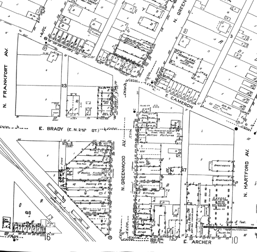
I can't get too upset with Ms. Donnelly: She links to the New York Public Library's online collection of Green Book editions and to a spreadsheet collating all of the Oklahoma Green Book listings, which (I surmise) she assembled herself -- a very handy resource.
Based on the spreadsheet, these are the Tulsa Green Book listings still standing. Keep in mind that street numbers may shift over time; I'm going by the numbering on the Sanborn map. The spreadsheet has the year of each individual book in which the business appeared; I've summarized with a range.
- Cotton Blossom Beauty Parlor, 106 N. Greenwood, 1939-1941.
- Art's Chili Parlor, 110 N. Greenwood, 1950-1961. (The Bryant Building.)
- Mrs. W. H. Smith Tourist Home, 124 1/2 N. Greenwood, 1939-1962. (Now the second story above Fat Guy's Burger Bar.)
- Maharry Drugs, 101 N. Greenwood, 1939-1955. (Northeast corner of Greenwood and Archer.)
- Vaughn Drugstore, 301 E. 2nd St., 1939. (Now Yokozuna.)
- Mince Service Station, 2nd & Elgin, 1939-1954. (NW corner, 325 E. 2nd. Red's Bar, formerly Dirty's Tavern and Woody's Corner Bar.)
- Lincoln Lodge, 1407 1/2 E. 15th St., 1941. (Aquarian Age Massage.)
The latter three are surprising, because they are outside the Greenwood District, in areas that might have been considered off-limits to African Americans. Association with the Green Book should add to the historic importance of these buildings.
Another location of note is the Avalon Motel at 2411 E. Apache St., on the northeast corner of Apache and Lewis, listed from 1954 to 1962. Before completion of the Gilcrease Expressway, this stretch of Apache was part of State Highway 11, which began at 51st and Memorial, headed north to Apache at the edge of the airport, then west to Peoria, and north to Turley, Sperry, and Skiatook. The motel, a simple one-story, park-at-your-door accommodation, was still there within my memory, but the site has been vacant for at least a decade. While many motels were built along US 66 around the same time, this appears to be the only motel catering to black tourists.
A concluding thought on the Greenwood Gap Theory: While it's easy to jump to the conclusion that Greenwood was never rebuilt after 1921 -- in the absence of city directories, aerial photography, Sanborn maps, and now the Green Book -- I suspect that the misconception has persisted in part because the civic leaders who were responsible for the second destruction of Greenwood in the 1960s and 1970s were still active in the community until not that many years ago and would have been quite happy to avoid any public blame for their decisions. Easier to remain quiet and let the folks sitting across the foundation boardroom table blame 1921 racists for the demolitions you promoted and approved.
MORE: You can find my omnibus overview of Greenwood's history, with links to further articles, images, and films, here.
UPDATED 2019/05/06, with a correction from Mike McUsic regarding Mince's Service Station. He provided a photo of a 1942 telephone directory listing Mince's at 325 E 2nd Street. McUsic will be leading walking tours of the Green Book locations in the Greenwood District on June 8th at 10:00 am and 3:00 pm, and on June 15th at 10:00 am. Tickets are $15, available via Eventbrite. McUsic has developed the Green Book Travelers HistoryPin site, locating 1,900 Green Book locations across the country, with names, descriptions, and historic and present-day photos. This link will take you to locations specific to Greenwood.
Another interesting map find. This Rand McNally Vest Pocket Map of Oklahoma from 1910 appears to be an earlier map, overprinted in red to show numbers indexed to railway names and parcel companies and to show electric railway lines.
The U. S. Post Office did not deliver parcels until January 1, 1913. Prior to that date, the parcel delivery business was handled by a cartel of companies. The index to this map lists four: Wells Fargo & Co.'s Express, American Express, Pacific Express, and United States Express. Each railroad was tied with a specific express company -- Santa Fe and Wells Fargo, Frisco and United States Express, Katy and American Express, etc. Presumably, you'd need to know which town was served by which express company in order to send a parcel. This U. S. Postal Service history commemorating 100 years of parcel post explains that the lack of competition that brought demands for the government to enter the market.
The map of electric rail lines shows interurban lines linking Tulsa, Sapulpa, and Kiefer (now the de-electrified Tulsa Sapulpa Union Railway); McAlester, Krebs, Haileyville, and Hartshorne (the Choctaw Railway and Lighting Co.); Shawnee and Tecumseh; Capitol Hill (south Oklahoma City), Oklahoma City, and Edmond, with a broken line indicating expansion plans to Guthrie.
Linking the Shawnee and Sapulpa interurbans is a broken double line indicating a proposed electric railway connection passing through Prague in Lincoln County, Paden in Okfuskee County, Newby and Tabor in Creek County. Lest that seem like too long a route for trains running on overhead wires, the Sacramento Northern Railroad, an electric interurban line, connected Chico, Sacramento, and Oakland, 183 miles from end to end.
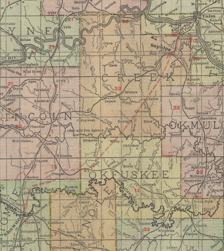
Sapulpa to Shawnee is one of many long-distance interurban proposals that never came to fruition. The December 16, 1910, edition of the Canadian Valley News, published in the town of Jones in Oklahoma County, reported that work had begun on the Tulsa to Sapulpa interurban line. "This is the line that will build on west to Oklahoma City, passing through Jones." The November 10, 1911, edition of the same paper reports an expected consolidation of the Tulsa-Okmulgee and Sapulpa interurban lines. I had never heard that Okmulgee had any sort of electric railway, much less a connection to Tulsa.
Another surprise on the map is an electric railway line beginning at Clinton, then extending west and north about 20 miles, into an area that lacks other railways.
This may be all that was completed of a proposal reported in the July 28, 1906, Trade Bulletin:
A WESTERN OKLAHOMA INTERURBAN.The Clinton, Cheyenne & Canadian Interurban Railway Co. is the name of a new company, recently organized at Cheyenne and incorporated with a capital stock of $1,000,000. The officers and directors are C. G. Gilkerson, president; L. L. Collins, vice president; R. V. Converse, secretary-treasurer; L. W. Pate and W. T. Bowers, all of Cheyenne. The proposed road will be built from Clinton, Custer county, to Cheyenne, Roger Mills county, and then to Canadian. texas. A branch line will be constructed from Cheyenne to Mangum. The projected road will open up entirely new country not now reached by any steam or electric line and should it be successfully pushed to completion, will be of great value to the farmers and merchants of this section and also a profitable investment for the stockholders.
The same page mentions plans from an electric interurban line from Ardmore to Lawton, one from Newkirk to Oklahoma City via Peckham, Blackwell, Tonkawa, Billings, Perry, Guthrie, and Edmond; and Muskogee as the "center of a great interurban electric system."
Subsequent maps don't show proposed routes, except that the 1911 Rand McNally map of Oklahoma and 1912 Rand McNally map of Oklahoma have a dotted line from Sapulpa to Tulsa.
The 1913 Rand McNally map deletes the Clinton electric line and shows instead a steam railway on that route, the Clinton, Oklahoma, and Western, from Clinton to Strong City in Roger Mills County, via Butler and Hammon. Later maps show it continuing on to Cheyenne and the state line. The Oklahoma City interurban connects north to Edmond, south to Moore, and west to El Reno. The Sapulpa system has a branch to Kiefer and another south-southwest of town. There is a Muskogee-Fort Gibson line, a Bartlesville-Dewey line, a line from Miami north to Hattenville (Geneva post office), and the aforementioned McAlester-Hartshorne and Shawnee-Tecumseh lines. The 1913 map also shows the transfer of a six-mile-wide band of southern Kiowa County to Tillman County and 45 square miles from Wagoner to Tulsa County.
The 1928 Rand McNally map of Oklahoma may show the peak of electric rail in the state. Sapulpa to Tulsa interurban is complete, and the Kiefer branch has been extended to Mounds. The Sand Springs Railway is listed as a steam and electric railroad. The Oklahoma City system now reaches Guthrie and Norman. Muskogee has a second branch to East Muskogee. There are new lines connecting Nowata and Coffeyville in the northeast and Lawton and Ft. Sill in the southeast. The McAlester to Hartshorne line still exists, but the Bartlesville and Shawnee interurbans are gone.
MORE: Oklahoma rail historian Cecil Cloud writes that the Shawnee-Sapulpa proposal "may have been part of a much more comprehensive scheme that was being floated at that time":
Those were the peak years of the interurban mania, and paper roads were being promoted across the state. One that was being boomed in Sapulpa would have connected almost every major town in Northeastern Oklahoma, but it was never completed.Tabor was just north of what would become Slick and northwest of Beggs.. Paden to Newby to Tabor to Sapulpa would have made a connection from the Fort Smith and Western at Paden to the Frisco at Sapulpa. It would also have to cross both the Deep Fork and Little Deep Fork, as well as some rugged terrain southwest of Sapulpa.
The Oklahoma and Southwestern Railway, as well as the town of Slick,did not come into being until after 1920, but the proposed line would have crossed the O&SW slightly north of the Slick depot.
During the interurban era, the O&SW was advanced, along with the Midland Valley, as a potential merger partner for the Sapulpa and Interurban. Local and regional sources indicate that the Sapulpa and Interurban line south of Kiefer was taken up to build the line to Tulsa. Some grading may have been completed southwest of Mounds, in the direction of the proposed junction with the O&SW at Tolon. According to an old Frisco timetable, Tolon was between Edna and Nuyaka. There is a 1920s vintage OCC map in the town museum at Davis which shows a proposed extension of the Sapulpa and Interurban south from Mounds and almost to Okmulgee--but this was never built. The same map shows the Midland Valley branch from Jenks, through Perryman and Watkins, though Glenpool and on to a junction with the Sapulpa and Interurban at Kiefer.
I have a digital copy of the 1908 Rand Oklahoma Map, and this line does not show on it, nor does it show on the OCC 1909 Railroads of Oklahoma map. My 1908 map was also overstamped with the names of express companies and their associated railroads, as this was before the merger which created the Railway Express Agency.
The 1910s mania for interurbans, with new plans announced before any attempt to assess the geographical or financial feasibility of the proposals, brings to mind the airline mania of the 1990s, when airline boosters convinced city and state governments to subsidize new airlines with the promise of non-stop flights to the coast, which never materialized.
On the back wall of the Meers Store, overlooking a dining table laminated with a poster of Lucille Ball singing the praises of Royal Crown Cola, is a framed map of Oklahoma, a page from an old Geo. F. Cram atlas, circa 1910.
The 1910 map shows several differences with the final form of Oklahoma's county map. Tulsa County looks even more like a collection of unwanted scraps, missing chunks at its southeastern and northeastern corners -- Collinsville, and everything northeast of 126th Street North and Mingo, are in Rogers County; everything southeast of 121st Street and Mingo are in Wagoner County. One of the post-statehood counties is there -- Harmon County (born June 2, 1909) has been carved out Greer County -- but Comanche County's southern boundary is the Red River; Cotton County would not be created until 1912. The map reflects the June 11, 1910, election that moved the state capitol from Guthrie to Oklahoma City.
And yet this map shows 77 counties. In southwestern Oklahoma, between Comanche, Tillman, Kiowa, and Jackson Counties, there is Swanson County, with its seat at Mountain Park. Swanson County included the towns of Snyder, Roosevelt, Cooperton, formerly in Kiowa County, and Indianola, formerly in Comanche County.
You can view a badly-registered four-color version of the Cram 1910 map of Oklahoma in Oklahoma State University's online map collection; the version at the Meers is yellow and black only. Swanson County also appears in Rand McNally's 1911 map of Oklahoma.
Swanson County's existence was brief, tumultuous, and ultimately found to be illegal. A referendum to carve the county out of southern Kiowa County and the westernmost 8-mile-wide band of Comanche County passed on May 2, 1910, with over 60% of the vote (1990 for to 1220 against), but failed to meet that threshold in the section of Comanche County to be included in the new jurisdiction. The portion of Kiowa County voted 1910 to 907 in favor of the new county, while the Comanche County portion voted against by 80 to 223. Gov. Charles Haskell proclaimed the new county's existence on August 13 and designated Mountain Park as the county seat, but the citizens of Snyder, at an important rail crossroads, objected. According to the Encyclopedia of Oklahoma History and Culture:
Competition arose between Snyder and Mountain Park for the seat. Snyder citizens claimed that their town was better suited because Mountain Park lacked a water system, fire protection, and office space for county officials. After dark on September 5, 1910, Snyder citizens removed the records from Mountain Park when a rainstorm soaked the documents housed there. In retaliation, Mountain Park men invaded county officials' homes and arrested the officials at gunpoint. Wyatt L. Staples, who worked for one of the county commissioners, was killed.
The Swanson County Democrat published letters to the county commissioners, one from County Judge Frank P. Cease and one signed by the treasurer, surveyor, registrar of deeds, court clerk, county clerk, district clerk, and superintendent. Judge Cease stated of the county courthouse:
At the present time the building is not in a habitable condition for the safe preserving of the records and the property of the county. It is impossible to remove the filing and record cases to any safe place where they would not be exposed to fire or being carried away, and the roof of the building is in bad condition, and some of the property has already been damaged by reason of the bad condition of the building.
The other county officials complained that Mountain Park "is without sufficient hotel and eating house accomodations to meet the demands of your petitioners [the county officials] or the public at large and that there are no suitable residence or sleeping accomodations for the use of your petitioners and their familes." A news story on the same page reported that officials were forced to stay in Snyder and commute every day to Mountain Park, a distance of four miles each way. The only official that didn't move his office to Snyder was the county sheriff.
A headline in the September 15, 1910, Swanson County Democrat trumpeted:
Snyder Remains County Seat
GOV. HASKELL REFUSES TO ACT
County Officers Remain at Snyder--County Court Held Monday and Tuesday--All Legal Business Transacted Here--No Riots--No Trouble--Just a Lot of Guano Eltoro in the Oklahoman Furnished by L. E. Cahill and E. J. Giddings Attorneys for Mt. Park
Comanche County sued to have the creation of Swanson County nullified. The Supreme Court upheld the district court's decision, citing the language of Article 17, Section 4, of the Oklahoma Constitution: "Provided, that when the territory is to be transferred from an existing county to either a new or an existing county, there must be sixty per centum of the vote cast in such particular territory in favor of the transfer."
Swanson County might have succeeded had it not attempted to include that unwilling chunk of Comanche County. It would have met the requirement for 400 square miles of land, but perhaps it would have fallen short of the required 15,000 population or $2.5 million land valuation.
With the Oklahoma Supreme Court ruling, Swanson County ceased to exist, and the count of Oklahoma counties reverted to 76. Nevertheless, the territory once claimed by Swanson County would continue to elect a representative to the State House for the remainder of the decade, as it existed during the 1911 legislative apportionment, and the Kiowa County representative would elected only by those voters in the remaining part of Kiowa County, according to an Attorney General's opinion reported in the April 11, 1912, edition of the Kiowa County News.
It's easy to understand why residents of southern Kiowa County would want a county seat closer to home. Manitou was, at that time, on the border between Kiowa County and Tillman County. Someone living on the Kiowa County side of Manitou would be 36 miles as the crow flies from the county seat of Hobart, but the Tillman County side was only about 7 miles from the county courthouse in Frederick.
An item in the September 1, 1910, Swanson County Democrat describes "the new county craze which has seized southwestern Oklahoma," mentioning a new effort to form a county out of southern Caddo and northern Comanche County centered on the town of Apache.
On January 30, 1909, a proposal to create Park County, with the same boundaries that would be proposed a year later for Swanson County had fallen short of the 60% threshold by 18 votes, just a month after the southernmost township of Kiowa County had voted to join Tillman County, a decision that still needed to be ratified by the voters of Tillman County.
Not long after the end of Swanson County, a smaller swath of southern Kiowa County succeeded in getting itself transferred to Tillman County, and in 1912, the southern section of Comanche County seceded to form Cotton County, bringing the roll of counties back to 77. There would be a few more boundary adjustments over the coming years, but the end of county creation had come to a close.
Amongst the discussion about education funding in Oklahoma is the claim that the large proportion of teachers with emergency or alternative certification is a danger sign -- we can't staff our schools with teachers that have the proper credentials. Getting the proper credentials involves taking certain courses in educational philosophy and method and some amount of student teaching.
Thinking back to my teachers at Holland Hall in the 1970s, very few of them had degrees in education. They had at least a bachelor's degree, typically in the field they were teaching, but they also had enthusiasm and a gift for communicating with students. The same is true of the teachers that my children have had in their private school experience.
In light of that, I thought it would be interesting to look back at the early days of teacher training. Oklahoma has six regional colleges that began life as normal schools, institutions for training teachers: University of Central Oklahoma, Northwestern Oklahoma State University, Southwestern Oklahoma State University in old Oklahoma Territory, and Northeastern State University, East Central University, and Southeastern Oklahoma State University in old Indian Territory. Langston University served a dual role: Its name at birth was the Oklahoma Colored Agricultural and Normal University, serving as the "separate-but-equal" Morrill Act counterpart to Oklahoma A&M and as a teachers' school for the African-American population.
A large number of other state universities began life as normal schools, including Illinois State University (in Normal, Illinois), Indiana State University, UCLA, and several branches of the SUNY system. What made a normal school normal was that students would be taught a particular set of norms for common education. This would include not only theoretical instruction but classroom experience, often by means of teaching children attending a training school attached to the normal school.
The oldest of Oklahoma's erstwhile normal schools is UCO, which began life in 1891 as Territorial Normal School. After the territorial legislature established Southwestern and Northwestern, it was renamed Central State Normal School. The Central State Normal School prospectus for 1913-1914, a 32-page brochure aimed at prospective students, is available on the Internet Archive, and it's fascinating reading. It tells us a lot about attitudes and expectations for public education a century ago.
What Central State Normal offered prospective teachers were certificates which would free them from having to take certification tests -- "grinding examinations" -- on a regular basis in order to get a job teaching. If you already had at least three years of high school, you could study for three terms at Central and get a certificate good for two years "in any county of Oklahoma." If you had a high school diploma, six terms at CSN would earn you a State Life Diploma -- a permanent certification to teach. The terms could be non-consecutive -- studying summers while teaching. The summer session of 1913 attracted 1,286 students. Teachers in districts that begin in late fall -- perhaps delayed because of the cotton harvest -- could take the opportunity to attend CSN for the fall term as well. For those students who could not come to Edmond, CSN offered correspondence courses, but you could only take one per year, and you still needed a year on campus for a diploma.
Students with only an eighth-grade education could come to CSN for a four-year preparatory course (high school) followed by the two year sequence of college-level teaching courses. Students could major in science, foreign languages (German, French, or Latin), or elementary teaching; the differences between majors were seen mainly in the high school years.
WILL YOU HEED THE CALL?There is a call constantly going out--give us a trained teacher for primary grades, principals and superintendents.
Students completing three years of high school work and doing satisfactory work for one year will be entitled to the Two-Year State Certificate. Students completing the Four-Year Normal Preparatory Course or a course equivalent to a standard four-year course in high school will receive a Two-Year State Certificate. This entitles the holder to teach in any county of Oklahoma for two years immediately following issuance.
Students completing a four-year high school course may take thirty-six weeks' work here and receive the Elementary State Certificate and at the same time have advanced to within one year of the State Life Diploma. To secure a State Two-Year Certificate, to become independent of grinding examinations for two years, to possess a license to teach and acquire funds to enter school again, to have the profit and pleasure of a year in a great state institution of learning and to get within one year of the State Life Diploma good in this and twenty more states of America, is the largest privilege ever granted to a high school graduate. Would it not pay you to begin right now to get this training? The school year consists of three regular twelve week terms -- fall, winter, spring -- and one summer term equivalent in every way to a regular term....
We extend to all friends of education a cordial invitation to visit Central State Normal over the hourly trolley from Oklahoma City, or Santa Fe.
The college-level requirements included two terms of psychology, two terms of pedagogy, two terms of advanced composition, three terms of observation and teaching, two terms of history of education, a term of philosophy of education, three terms of either manual training or domestic science, two terms of a teachers course, and a term of something called "Ind. Geog." Students following the elementary teacher's preparatory course took some of those classes during their high school years, leaving room in the two college years for courses like genetic psychology, child study, sociology, and advanced pedagogy.
The prospectus put a great deal of emphasis on Central's progressive and modern outlook, with modern technologies like a motion picture machine, Kodaks, and a phonograph available, and put forward the teacher as an agent of progress in Oklahoma communities, using school facilities for much more than teaching grade-school children. That's worth further exploration in another entry, but the crusading tone reminds me very much of Carol Kennicott, the central character of Sinclair Lewis's Main Street.
CNS boasted that it was easily accessible from anywhere, as there was an hourly trolley to Edmond from Oklahoma City from 6 a.m. to midnight, as well as service from Oklahoma City via steam train on the Santa Fe railroad.
TO THE OKLAHOMA CITY, EL RENO, AND YUKON HIGH SCHOOL GRADUATES RESIDING NEAR TROLLEY LINE.Over fifty Oklahoma City high school graduates came to Central State Normal this summer. There was a reason. Here it is: Central State Normal is on the hourly trolley line with Oklahoma City. This puts the oldest and largest State Normal School at the front gate of every pupil along the trolley line. To the high school graduate of Oklahoma City, and all towns along the trolley system, Central State Normal says: "Attend school here three terms taking proper credits and you will be awarded a Two Year State Certificate, recognized in any county, town, etc., of Oklahoma." It matters not whether these three terms be taken consecutively or not. Three summer terms will make a complete year. Add to these three terms another year's work in this school and you have a Life Diploma, freeing you from all examinations, and introducing you to the best position in education in this state and to all throughout the land. Besides this, you have done two years of college work and will be given equivalent credits in any College or University for such advancement.
So the Oklahoma City, the El Reno and other high school graduates in towns along the trolley line have a Two Year State Certificate within their grasp by three terms' work -- a Life Diploma, by six terms' work.
What wonder then that the high school graduates of these places are buying reduced rates over the trolley line to Central State Normal and thereby working out one of life's greatest opportunities?
Of the 30 faculty members, only 4 had master's degrees and an additional 10 had bachelor's degrees. No degree is listed for the remaining 16. It would be another five years before the school would be authorized to offer a four-year degree. At that point in time, a high school diploma was considered sufficient to teach students through eighth grade, but modern schools would have wanted teachers to have the additional training afforded by a normal school.
The Vital Records Department of the Oklahoma State Department of Health has made its database of birth and death certificates searchable online. While the certificates themselves can't be viewed, the limited information (county and date) may provide helpful leads to family historians. The database includes limited information on births that occurred more than 20 years ago and deaths that occurred more than 5 years ago.
Certified copies of birth and death certificates may be ordered from the Department of Health, but those that are not yet considered public record require some justification -- proof of relationship to the subject of the record, or a court order.
Birth certificates older than 125 years and death certificates older than 50 years are considered public record and require only an application and payment of fees to receive a certified copy. I'm hoping that eventually researchers who don't require a certified copy will simply be able to view public record certificates online.
This development is thanks to a bill sponsored last session by State Sen. David Holt and State Rep. Elise Hall, which mandated the creation of the index and that it be available free and online. The bill also reduced the public record waiting period for death certificates from 75 to 50 years, bringing it more inline (but not entirely) with surrounding states. Chris Powell, whose genealogical research provided some impetus for these changes, wrote last June about the bill's passage and then, last week, hailed the advent of the online database, almost six months earlier than the legislation's deadline of July 1.
Dale Ingram posted the cover of this piece of sheet music from 1920 on the "Oklahoma History -- People, Places, Things" Facebook group. He was kind enough to send me the two inside pages, too.
"The Oklahoma Oilfield Blues" was written by Jack Randolph (lyrics) and John F. Carroll (music). It was published in 1920 by the H. M. Keifer Music Pub. Co. of Pawhuska, Oklahoma. The cover, printed in blue, gold, and black, depicts a dapper man in a boater and cuffed pants sitting on a park bench and reading the "Oil and Gas News." In the background is the Minnehoma Gusher, "the 15,000 Barrel Well, PAWHUSKA, OKLAHOMA." The Minnehoma Oil Company was founded by George F. Getty, the father of J. Paul Getty.
The gusher, which came in on January 4, 1920, made national news:
OIL MEN RUSH TO NEW FIELD(published in the El Paso Herald, January 14, 1920)
Pawhuska, Okla., Jan. 14. -- Since the Minnehoma Oil company's gusher on the Jackson-Worten lease, in the northeast corner of section 14-26-8 [5 miles W and 5 miles N of Pawhuska], came in 10 days ago, more than 100 new locations have been made and already 15 derricks have been started. Trains of trucks carrying materials to the various sites line the road from Pawhuska to the new well.
This well, the largest gusher ever brought in in Oklahoma, encountered production at 2313 feet with the drill 28 feet in the Mississippi lime. The monster flow came as a complete surprise to the owner of the well. It is the No. 3 on this quarter section. The No. 1 was abandoned as dry and the No. 2 made 25 barrels a day. Naturally when the great flow came there was not sufficient storage facilities arranged. Oil covered the ground for more than half a mile. Some 5000 gallons of oil was burned. Along the creek between the wel and the large reservoir, temporary dams were constructed and more than a dozen pumps were put in operation. In this way at least 40,000 barrels of oil valued at $100,000 was saved.
The Gulf Refining company and the Prairie Pipe line concern are rushing two lines to the well from their respective trunk lines.
Operators say that Pawhuska is surrounded by the greatest oil pool yet discovered. Within a radius of eight miles during the past two months four wells have been brought, proving the existence of as many separate fields. The last of these wells was brought in by the J. D. Wrightman company, of Tulsa, only a few days ago in section 30-[2]6-10, four miles northeast of town. This well is making a 100 barrels from the Bartlesville sand.
Still another new field was discovered when Gardner and Spencer completed their 500 barrel well on the southwest quarter of section 19-25-9 [three miles west and three miles south of Pawhuska], one mile from production.
Pawhuska is the mecca toward which Oklahoma producers are now turning and great things will happen in this field within the next few months.
A special advertising spread in the February 1, 1920, Tulsa Sunday World, celebrated Pawhuska's growth (quadrupling between 1910 and 1920) and reported that four oil fields had been found around the city in the previous 60 days and the Minnehoma Gusher had been tamed and was producing 1,000 barrels per day.
There's not much on the web about this song. In March 2007, Eric Marchese performed the song at the Orange County Ragtime Society.
Eric closed his set with a nod to the state of Oklahoma's centennial this year by playing his own, souped-up arrangement of John F. Carroll's music to "The Oklahoma Oil Field Blues," one of the few ragtime pieces to come out of the Sooner State (published in 1920 by H.M. Keifer Music Publishing Company in Pawhuska, Okla.). Again, Eric refrained from singing the piece's lyrics (by Jack Randolph) but described them (the singer longs to be back home in the oilfields where he will, presumably, one day strike it "rich as old John D."). The cover of the sheet music depicts "the Minnehoma Gusher, the 15,000-barrel well" in Pawhuska, as a young gent in a suit sits on a park bench reading a newspaper, the "Oil and Gas News."
The song also is listed in the 1920 Catalogue of Copyright Entries
The lyrics:
I love Oklahoma and the climate too.
When I leave that state I'm always feeling blue.
I want to go back there just to play the oil game,
To make some money and to win some fame.There are men down there who just worked in the ditch,
Took a little chance and now they're more than rich.
I read all about them in the Oil and Gas News,
So that's just why I've got the oil field blues.CHORUS:
I've got the blues,
I've got the oilfield blues,
I never felt this way.
I'm going back to a box car shack
If I have to work both night and day.
I'll save up all my money and invest you see,
And if I'm lucky I'll be rich as old John D.
Oh, boy, I've got the Oklahoma oil field blues.
According to the Long Lost Blues website, Jack Randolph and John F. Carroll also wrote the Jamaica-Ginger Blues.
(Click on each photo to see the full-sized image.)
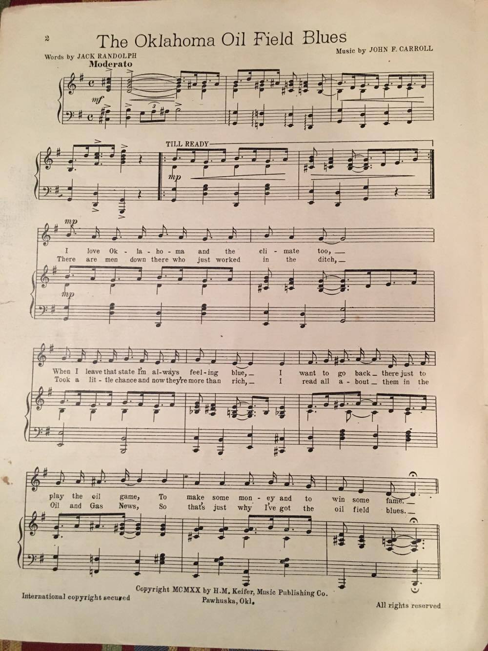
A bit of good news to break up the election stuff:
Wayne McCombs, local baseball historian and executive director of the J.M. Davis Arms & Historical Museum in Claremore, is the subject of a profile in GTR Newspapers.
The profile by Terrel Lester begins with the story of McCombs's first encounter with the Davis collection, when he was a nine-year-old boy and the collection was still housed in the lobby of the Mason Hotel in downtown Claremore:
On a summer afternoon, air-conditioning and guns would be an inviting and double-barreled treat for rambunctious boys still shy of their teenage years.They entered the lobby, cautiously, stealthily, if not so quietly. Looked around for the boss man.
Considering themselves alone, the boys encircled one of the most enticing pieces of Davis' collection of guns: The Gatling gun, rapid-fire linchpin of 19th-century army brigades and star of so many western movies.
As ringleader of the youngsters, Wayne McCombs remembered that he and his pals began imitating cavalry troops, rattling off sounds they thought mimicked the actions of the Gatling gun, whooping, jumping. One of his confederates even fell to the floor as if shot and wounded.
That was enough to rouse the heretofore silent and unseen James Monroe Davis.
"He stood up from behind his desk," McCombs said. "He saw us come in. He let us play for a little bit, but then it was time to get out.
The profile goes on to describe McCombs's career in radio at KWPR and KVOO, his work as University of Tulsa athletics promotion director during the exciting early '80s, his books on baseball history, his efforts as a Claremore civic leader, and his work, for the last seven years, to promote the J. M. Davis Museum.
McCombs routinely calls upon his marketing background for events to put, and keep, the museum in the public eye.Along with the monthly appearance of western re-enactors, McCombs has installed such short-term exhibits as a collection of John Wayne movie posters and a tribute to the radio career of Billy Parker. In October, McCombs hosted a book-signing for former New York Yankees pitcher and Chelsea native Ralph Terry. Once or twice a year, McCombs plays host to a BB-gun shooting contest for youngsters.
"I was tired of hearing people say, 'I've been to the museum, but it's been a while. I haven't been back in years.'
"Well, I am trying to get people to come back to the museum," McCombs said.
When they do return, or even make their first trip, to the museum, patrons will find what McCombs and others often refer to as "an Oklahoma gem."
I've known Wayne going back to his time at TU, through Hal O'Halloran's Sports Night show on KXXO. It's always heartening to see someone find a role that is such a good fit for his skills and passions.
BatesLine is proud to welcome a new advertiser: Durant-based artist G. N. Taylor, whose website offers paintings of scenes from Oklahoma history and the American West.
 Neal Taylor is an accomplished sculptor and painter. A bronze sculpture by Taylor, "The Spirit of '89," was presented to President Ronald Reagan and is on display at the Reagan Presidential Library, with a casting on display at Will Rogers World Airport in Oklahoma City. The Franklin Mint selected his design for the Oklahoma Bicentennial Medallion, and recently, he was associated with the U. S. Mint as one of nine master designers. His paintings have won numerous blue ribbons at juried shows and are on display in museums, galleries, banks, and institutions around Oklahoma, Texas, and New Mexico.
Taylor's work is rooted in his love of Oklahoma and its history and reflects his own first-hand-experience working with horses and cattle. Paintings depict land runs, cattle drives, buffalo hunts, oil discovery, and the hardships and joys of frontier life. Taylor has done a series of portraits of the principal chiefs of the Choctaw Nation, of which he is a member.
Faithful readers may recall an earlier BatesLine article which featured Taylor's depiction of the only naval battle to take place within Oklahoma's boundaries, when Confederate troops under Stand Watie's command attacked a Union supply steamboat on the Arkansas River at Pheasant Bluff. Taylor's eye for detail brings this uniquely-Oklahoma historic event to life.

Christmas is not that far off, and it's not too early to think about unique gifts for a loved one. Instead of buying something that will wind up in the bottom of a drawer, why not choose a gift that will be on display, providing daily enjoyment and a reminder of Oklahoma's rich history?
Through Taylor's website, you can purchase the oil-on-canvas originals or giclée prints on canvas or archival paper of Taylor's paintings. Print prices are quite affordable. Please take a few minutes to click through the ad and browse through the wide selection of paintings. You may find the perfect painting for your den, lobby, or classroom or the perfect gift for someone who loves the American West.
On Friday, September 6, 1935, Al Stricklin arrived in Tulsa with his wife to take a job as piano player for Bob Wills and His Texas Playboys. After joining Bob and the band for the noon broadcast at the Barrel Food Palace and then rehearsing that afternoon at the home of Bob's parents, Al went along on his first dance gig at a little place called Glenoak, Oklahoma. This account of that dance is excerpted from Chapter 4 of Stricklin's memoir, My Years with Bob Wills, Austin: Eakin Press, 1980. It's a highly entertaining book, with lots of vivid detail. You really get a sense of the times, the people, and most of all, the larger-than-life, magnetic personality of Bob Wills.
It didn't take long for me to learn about the musical magic of Bob Wills. I learned that first night after that first rehearsal. It was at a place called Glen Oak, a frame building dance hall about fifteen miles east of Bartlesville, Oklahoma....
It was Bob Wills who was leading us in the bus that day as I made my first trip with the band to Glen Oak. It was the beginning of seven years of experiences that many men with money would have given a powerful part of their personal coffers to share....
The guys told me that the women in Oklahoma were wild over the band. So wild that they would gang up on you and take you out and attack you.
They weren't that bad. But I will say that there did seem to be plenty of them who were most agreeable to being most friendly if a man was interested.
"something else you have to watch for, Al. The men in these dance halls like the one we are going to do some powerful drinking. They get crazy drunk, and their eyes get red and watery like an old dog that's been chasing his tail in the sun all day long. And they get to wanting to beat up on us musicians because their women will smile at us and those crazy drunks don't take to that very nice at all," said one of the men.
"So what do I do?" I asked.
"Just keep yourself in the bus if you are afraid to fight. Just sit in here and listen to us," said one of them.
That brought another wild round of laughter.
Our old bus finally clanged into Glen Oak. When I said Glen Oak was out in the coutry, I mean it was out in the country. There were maybe two families living there. One of them owned the dance hall.
The sun was just dipping down into a hall of black when we arrived. There wasn't a car in sight. I thought: "How in the world is this guy Bob Wills going to pay guys like me $30 a week without any customers?"
Then I began worrying that maybe I wasn't going to get paid, just like it used to always happen. I remembered a time when a bunch of us in Waco rented a hall about ten miles out in the sticks. We paid $10 for it. We started playing about 9:00 p.m. There wasn't anybody there. By 10:00, still nobody had shown up. Then we saw the lights of a car turn in and the sax man said, "Let's hit 'Dinah,' men. A car just drove up."
That's how I was feeling. Until about 9:00 p.m. That's when they began coming to the dance at Glen Oak. Cars were pilling up outside. Some people were coming on foot. Some were riding horses. By 9:00, they were having to turn them away.
We started playing. Bob hadn't arrived yet. And nobody paid us much mind. About thirty minutes later, while we were playing, I heard the wildest racket I had ever heard. There was applause, yelling, and whistling. People were just going wild. Bob Wills had finally arrived.
He got up there wil us and drug his fiddle out of its case. The crowd had gotten as close as they could to the bandstand. They were packed like three dozen eggs put into a one-dozen egg container. When Bob started, the applause drowned out the music.
Bob was grinning and playing, and every so often he would point that fiddle bow of his at one of the boys and tell him to get with it. We would. And again would come that wave of applause. Maddening. Deafening. I had never heard or seen anything like it. It wasn't a dance. It was a show. A "happening."
The boys had impressed on me during the trip up there that one of the most important things was to watch Bob at all times. You never knew when he would call on you to take it. And if he called on you and you weren't looking at him, that was the unpardonable sin.
They had also told me to smile like crazy when Bob gave me the cue and then to smile again when I had finished my break. And there wasn't any taking a break. By that, I mean you didn't shut down the music any time. That began to hurt me. We had drunk a bunch of coffee right before the dance had started and about 11:00 p.m. I was crossing my legs so many times that if somebody out in the audience was watching me, the probably would have thought that I was doing the Charleston.
Finally, I leaned over to Sleepy and asked, "Sleepy, when are we going to have an intermission?"
"We don't take intermissions. If you've got to go to the bathroom, just forget it," he said.
He was right in a way. We didn't take intermissions. But, every once in awhile, one of us could get down and go back and get some relief. When that time finally came for me, I know I overstayed my allotted time in front of the trough. But man, it sure did feel good. As I was leaving, the first man in the long line behind stopped me and said, "Fellow, I want to shake your hand. You skin them keys on that piano like you were peeling a stalkful of bananas." He laughed and then added, "What I am trying to say is that you are a piano player. One of the best I've ever heard!"
I don't know how I got through that night. But I did. After it was all over, the people crowded around and kept yelling for more, and when they realized there wasn't going to be any more, they started asking for autographs. It was a long ways for a country boy from Grandview to come. I thought later as we were sopping up some chicken fried steak and cream gravy in a cafe before we headed back for Tulsa, "Man, I came awfully close to not coming up here. If every night is like this one, then I think I'll go kick myself for ever even thinking slightly that way."
I went to sleep happy that night. That old moon was outside our bedroom window, still pretty high in the sky considering how late it was. It looked like it was winking happiness at me.
Old county maps pinpoint Glenoak on US 60, just east of the Washington-Nowata County line, with a cluster of homes and a commercial building (probably the dance hall) on the southside of the road.
MORE: Jerry Stevens writes with a story of Glenoak, where his grandfather had been a bouncer for Bob Wills.
My Grandpa used to say that there would be model "T"'s parked all the way around the east curve along the highway. There was also chicken wire across the front of the stage to protect the band from thrown bottles. It was a wild place alright. My Grandma told of a time that she drove down to the dance (my dad and Uncle were with her) to pick up my Grandpa after the dance and when he came out the front 5 men jumped him and beat him up for kicking them out of the dance. They knocked him out and went over and were standing there talking in the parking lot. He woke up and went over to them and knocked out the one that hit him last and they beat him up again. Grand Dad had a permanent knot on his head from a whiskey bottle he was hit with in the fight. Dad said he (Grand Pa) later caught up with each one of them and paid them back. I guess a lot of people from all around used to go there.
The east curve is over two miles east of where Glenoak is marked on the map. Imagine having to walk for over half-an-hour to get to the dance and half-an-hour back to your car when it was all over.
I've been watching politics for a very long time, going back to my childhood, so it's funny to observe the media's new-found concern about gerrymandering -- the practice of manipulating election district boundaries to benefit one party over another. The media's concern seems to have emerged with the growing dominance of the Republican Party in state legislatures and governor's mansions. (If that chart went further back, into the '70s and '80s, Democrat-dominated state governments would show up in greater numbers.) Suddenly, there are calls to take redistricting away from the politicians and put it in the hands of judges or computers or appointed commissions, or some combination of the three.
But a recently released, comprehensive archive of historical congressional district boundaries reveals that Democrats had no scruples against partisan gerrymanders when they had control of the process. Scholars at the University of California at Los Angeles have developed digital shapefiles of congressional districts going all the way back to 1789 and the 1st Congress. A Github site has the files organized by state and Congress; click on a link and you'll see an interactive map overlaying OpenStreetMap. You can zoom in and see how the old boundaries overlay towns and streets. More readily accessible, but without the interactive capabilities, is a Wikipedia page showing Oklahoma congressional district maps going back to 1972.
I had unsuccessfully been looking for old district maps for ages. I can't tell you how excited I was to find these.
As I said, I've been watching this process for a very long time. I remember 1982, when the Democrats in the Legislature, with Governor Nigh's approval, cut heavily Republican south Tulsa out of the 1st Congressional District, in order to improve incumbent Democrat Congressman Jim Jones's chances of survival, and shifted those voters into the heavily Democrat 2nd District, where their votes would be a tiny GOP drop in a big Democrat ocean. In that same redistricting, the Democrats at the State Capitol had the African-American neighborhoods of northeastern Oklahoma City share a congressman with the Panhandle and the wheat fields and cotton fields of western Oklahoma -- all to protect the Democrat incumbent in that district.
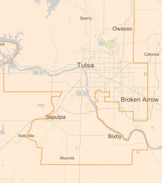
District 5, once compactly encompassing part of Oklahoma County, was stretched for hundreds of miles to take in Republican concentrations around Guthrie and Bartlesville. The Wall Street Journal mocked the District's twisted boundaries as "Mickey's Enchanted Kingdom" in honor of incumbent Republican Mickey Edwards. The new boundaries gave Edwards a very safe seat, while making it harder for Republicans to get elected in other districts.
The resulting map contained the impact of growing Republican sentiment in the state, inspired by Ronald Reagan and the leftward shift of the national Democrat party, limiting the GOP to a single seat out of six.
I also remember walking blocks in 1988 for Jerry Riley, who was running for the open Senate 37 seat. That district consisted mainly of the rural and blue collar areas of western Tulsa County, but the boundaries crossed the river to take in a sliver of land between 21st and 56th Streets west of Peoria, including the luxury apartment building at 2300 Riverside. The story I heard was that the Democrat incumbent at the time of redistricting wanted to continue to represent the common people but preferred not to live among them.
These events inspired me to submit an op-ed to the Tulsa Tribune, published on May 31, 1991, opposing the practice of protecting incumbents in redistricting and urging an approach that focused on communities of interest and natural boundaries. I suggested an independent redistricting commission that would include unsuccessful candidates, the use of nested districts to make it harder to draw boundaries favoring an incumbent, and ratification by statewide referendum.
Although Republicans swept control of Oklahoma's congressional delegation in the 1990s, legislative redistricting protected rural Democrat incumbents by adding to each district just enough population from the growing suburbs to keep them viable. That tactic delayed the GOP takeover of the State House until 2004 and the State Senate until 2008. Term limits and the continued shift of the national Democrat Party to the Left ultimately overcame the Democrat advantage built into the maps.
Here's a map showing the State House districts drawn after the 2000 census, but colored to show party status after the 2010 election. Here's the State Senate district map following the 2000 census.
When they had control of the process, Democrats dismissed calls for redistricting reform as so much partisan whining by the GOP. They only seem to have warmed to the idea now that the shoe is on the other foot.
MORE:
Here are direct links to interactive versions of each Oklahoma congressional map since statehood. The dates refer to the election years affected; add 1 year to get the start of the corresponding congressional term. I've added notes after some of the links:
- Oklahoma congressional districts, 1907, 1908, 1910 elections (60th-62nd Congresses): Oklahoma was assigned 5 congressional seats at statehood.
- Oklahoma congressional districts, 1912 election (63rd Congress): Oklahoma was apportioned three additional seats, but these were elected at-large for one term.
- Oklahoma congressional districts, 1914 - 1930 elections (64th-72nd Congresses): The legislature got around to redrawing the district lines in time for the 1914 election. Congress failed to approve reapportionment after the 1920 census, so Oklahoma's lines were not redrawn.
- Oklahoma congressional districts, 1932 - 1940 elections (73rd-77th Congresses): Oklahoma's 1920s oil boom earned the state a 9th seat, but this was elected at-large; district boundaries did not change.
- Oklahoma congressional districts, 1942 - 1950 elections (78th-82nd Congresses): Dust Bowl emigration cost Oklahoma that at-large seat; boundaries of the 8 remaining districts were not changed.
- Oklahoma congressional districts, 1952 - 1966 elections (83rd-90th Congresses): Further outmigration cost Oklahoma two more seats. District lines had to be redrawn for the first time since 1914. Since the number of congressmen did not change in 1960, the legislature left the map alone.
- Oklahoma congressional districts, 1968 - 1970 elections (91st-92nd Congresses): This map reflects judicially-controlled redistricting to equal-population districts, pursuant to the Voting Rights Act
- Oklahoma congressional districts, 1972 - 1980 elections (93rd-97th Congresses): At time of redistricting, Republicans held districts 1 and 6 only. Long-time District 1 Republican incumbent Page Belcher had won the 1970 election by a narrow margin over Democrat Jim Jones, then opted to retire. The new boundaries added Democrats to and removed Republicans from the district; and Jones won the open District 1 seat in 1972, beating former Tulsa mayor Jim Hewgley by 11 percentage points.
- Oklahoma congressional districts, 1982 - 1990 elections (98th-102nd Congresses): At time of redistricting, Mickey Edwards of CD 5 was the only Republican in the Oklahoma delegation, but growing enthusiasm for Ronald Reagan and the Republican Party in Oklahoma forced boundary adjustments to protect vulnerable Democrat incumbents, like Jim Jones in CD 1 and Glenn English in CD 6.
- Oklahoma congressional districts, 1992 - 2000 elections (103rd-107th Congresses): At time of redistricting, Republican Mickey Edwards still held CD 5, and Republican Jim Inhofe had picked up CD 1 in 1986, when Jim Jones chose to challenge Sen. Don Nickles, so lines were drawn to pack as many Republicans as possible into those two districts.
- Oklahoma congressional districts, 2002 - 2010 elections (108th-112nd Congresses): After being on the bubble in the previous census, Oklahoma finally lost its 6th seat. At time of redistricting, five of six seats were held by Republicans; Democrat Brad Carson held the CD 2. 3rd District incumbent Wes Watkins retired prior to redistricting, avoiding the need to assign two incumbents to the same district.
STILL MORE:
thirty-thousand.org makes the case for a larger Congress, closer to the constitutional ideal of 30,000 people per seat. The site recounts the 1929 law that froze the number of House members at 435 and the negative effects of that decision.
"Men, you know me. You remember me when I led you out to war. I went first, and what I told you was true. Now I have been away to the East, and I have learned about another captain, the Lord Jesus Christ, and he is my leader. He goes first, and all he tells me is true. I come back to my people to tell you to go with me now in this new road, a war that makes all for peace and where we never have only victory..."(From Okuhhatuh's first sermon to the Cheyenne people, June 19, 1881. As posted by Wade Burleson, A Captivating Story of God's Saving Grace: From Cheyenne Warrior to Christian Missionary.)
The diaries of the Rev. David Pendleton Oakerhater, a warrior of the Cheyenne Nation who became an Episcopalian missionary to his own people, have been donated by his family to the Oklahoma History Center. Oakerhater is the first American Indian added to the Episcopal Church's calendar of saints; September 1 is the Feast of St. Oakerhater.
In his journals, which date to 1895, Oakerhater wrote of his everyday life and ministry as an Oklahoma Episcopal missionary, with several notable exceptions, including his mention of meeting the ill-fated George Armstrong Custer at one time and his participation as a warrior who fought against the U.S. cavalry at the Battle of Adobe Walls in the Texas Panhandle.Oakerhater, known as O-kuh-ha-tu or Making Medicine before he adopted Christianity, was a Cheyenne warrior who fought European encroachment on his homeland until he was imprisoned by the U.S. Army at Fort Marion in Florida in 1875, along with many other American Indian warriors.
He eventually converted to Christianity in 1878 in New York and returned to the Cheyenne and Arapaho people in Oklahoma working to influence many American Indians to receive Christ, make peace and learn the value of education.
Oakerhater, known as "God's warrior" among the Cheyenne people, was ordained an Episcopal deacon in 1881 at age 34....
[Michelin Butler] Lopez, 39, said she prayed for months before deciding to donate the diaries belonging to "Old Grandpa," as her family members fondly call their ancestor.
In the end, it was not so much his journal entries about who he met or what he did, but rather the person who changed his life forever -- Jesus -- that finally convinced her that the journals deserved to be preserved at the history center.
They would, she said, help promote his powerful spiritual legacy.
"Through my grandfather's faith, he didn't turn his back on his people," Lopez said. "He fell in love with Jesus, and he stayed true to his faith so that we would all come to know Christ."
Be sure to read Wade Burleson's article on the life and faith of David Pendleton Oakerhater.
MORE: Oakerhater made it to the "Saintly 16" round of "Lent Madness" this year, losing to King Kamehameha of Hawaii.
Some interesting observations about the people of Oklahoma City and the memorial they created and maintain, from NYU media, culture, and communication professor Marita Sturken in her 2007 Duke University Press book Tourists of History: Memory, Kitsch, and Consumerism from Oklahoma City to Ground Zero.
One of the primary ways that individuals are encouraged to interact at the memorial is through the fence that is now placed on an outside wall at its entrance. This was the same fence where people initially left objects. The designers had envisioned three small sections of fence in the children's area that would encourage a similar activity, arguing that the fence itself was not as important as "what the fence allows to happen." Yet several family members were concerned that this fence, which had been so important to them in those first years, would be lost, even though a few felt it was an "immature" form of memorial. When the memorial was completed, the fence was transported by volunteers to an outside wall, where it is both separate from and part of an entry into the memorial. The material on the fence is only a fraction of the massive inventory of objects that the memorial has acquired and which are part of its archive.In its incorporation into the memorial design, the fence remains a primary site where people come to leave objects and messages. There are much-considered rules concerning this activity and these objects, which reflect the overall thoughtfulness and intensity of the memorial's intended rituals. Objects that are left on the fence are allowed to stay for a maximum of thirty days. The memorial staff then removes them if they are not related to a particular victim or agency and according to issues of space and durability. The memorial staff will not place something at the fence if someone sends it in; it must be placed there in person. Rules are different for the chairs, where items are left for seventy-two hours after an anniversary ceremony and otherwise removed and discarded after twenty-four hours (though the staff will, on request, move an object then to the fence). This policy was the result of an extended debate among families, survivors, and rescue workers because many survivors and rescuers thought that it would look tacky to have objects left on the chairs.
The Memorial Center, which opened In February 2001, now houses a massive and growing collection of materials in its archive. According to the archivist Jane Thomas, once people realized that their collection was "more than 3,000 teddy bears," they began to send in other materials: photographs, documents, artwork, and personal material from families; trial materials; and documents, such as surveys, from the process of writing the mission statement of the memorial. The archive has six areas of collection: the history of the site; the incident itself, including rescue and recovery; responses to the event, including media coverage; the investigation and trial; spinoffs, such as new regulations and laws that resulted; and memorialization. It now houses over eight hundred thousand pieces, including documents related to the McVeigh and Nichols trials, seventy thousand photographs, newspaper articles, and over one hundred thousand objects, such as cards, letters, quilts, art objects, uniforms, memorial designs, the personal effects of some victims, reporters' notes, shattered glass from the building, and items from the building such as the playhouse from the day care center's play yard....
The memorial design thus encourages many different kinds of responses, encompassing as it does a broad range of spaces, each with particular intent. Visitors are encouraged to be active in responding to the memorial, by leaving objects on the fence or drawing things in the children's area. People often depart from the proscribed codes in interacting with the memorial, for instance, dipping their hands into the water in order to leave handprints on the bronze gates. The memorial is open all the time and is a place that people often wander through at night. It is staffed constantly by volunteers, many of whom are survivors. Many family members and survivors work as docents for the Memorial Center and are frequent visitors to it. It has what is often referred to as a fervent volunteer culture, with seventy-five volunteers working every week.
The memorial is thus integrated into the community of Oklahoma City in complex ways that are about integrating a difficult past into the everyday. This intense community involvement is a factor in the relationship of the memorial to the National Park Service, which is in charge of the rangers and brochures at the site. According to the memorial's executive director, Kari Watkins, the Memorial Foundation restructured its relationship to the NPS in 2005. The NPS, says Watkins. expected the local community to recede as it has at other, similar sites, but the community in Oklahoma City is too invested to fully hand over the site. Thus, as in the design of the memorial, the local community has consistently made clear, both emotionally and financially, its ownership of this memorial site. This incorporation of the memorial into the city has been facilitated by the sense of community and local pride that is a part of the memorial, and its pedagogical mission, one that is fervently expressed and dedicatedly carried out, and that centers in many ways on an embrace of citizenship and civic life.
This coming weekend, September 6 and 7, 2014, is the opening weekend of the Helmerich Center for American Research, a unit of the City of Tulsa's Gilcrease Museum. The new facility is adjacent to the museum on Gilcrease Museum Road.
A weekend full of free events is planned, including Native American and Latin American dancers, the Cherokee National Youth Choir, red dirt/Americana band The 66. There will be lectures on art and history, art-making, kite-flying, and map-reading activities for children. Food trucks will be on hand and the museum restaurant will be open. It would be easy to spend the entire weekend out there.
Legendary guitarist, singer, picker and grinner Roy Clark, fiddler Jana Jae, and the Tulsa Playboys will perform together on Saturday at 2:30 p.m. on the main stage. The event is free and unticketed; seating is first come, first served.
The Red Dirt Rangers will close out the weekend Sunday evening at 4 p.m.
Because of limited parking at Gilcrease, visitors are encouraged to park in designated lots downtown and take a five-minute shuttle ride to the museum.
MORE: Here's an earlier -- much earlier -- performance of Orange Blossom Special with Roy Clark and Tulsa Playboys bandleader Shelby Eicher. Eicher shows up about 7:40 into the video.
AFTER-ACTION REVIEW:
Our family was among those huddled under a tent as the cold drizzle continued into mid-afternoon. We were delighted to listen to the Cherokee National Choir sing songs like "Take the Name of Jesus with You," "Battle Hymn of the Republic," and "I'll Fly Away" in the language of Sequoyah. Around 2:05, a few minutes after the choir left the stage, the Tulsa Playboys began to set up. They were in place, but there was some inexplicable delay. A sound check began after the show was scheduled to start, and it was quickly apparent that the sound man had no earthly idea what he was doing.
The Tulsa World had an item about what may be the only naval battle fought within the borders of Oklahoma, 150 years ago Sunday, on June 15, 1864. Confederate troops led by Col. Stand Watie (later promoted to Brigadier General) attacked a Union supply steamboat on the Arkansas River.
Painting of the Confederate attack on the J. R. Williams by Durant artist Neal Taylor, on display in the Oklahoma History Center.
After the war the U. S. Congress authorized the publication of the official war records of both armies in the "War of the Rebellion." Official dispatches from Col. Watie and his commanding officer regarding the Battle of the J. R. Williams were published in 1891 (Series I, Volume XXXIV, Part I (Reports), Chapter 46, Operations in Louisiana and the Trans-Mississippi States and Territories, Part 1, January 1 - June 30, 1864, pp. 1011-1013).
After one of Watie's lieutenants arrived with news, Gen. D. H. Cooper sent the following dispatch to Fort Towson:

Larry Harnisch, a local history blogger in Los Angeles, has reposted a 1948 Daily Oklahoman profile of Rich Owens, who built Oklahoma's first electric chair and ran it for 33 years at the Oklahoma State Penitentiary. Reporter Ray Parr had gone to visit Owens at his home in McAlester a few weeks before his death of liver cancer.
Owens talked about getting the job and about learning the science of electrocution, so as to get the job done quickly. He described his rehearsal procedure, in which the Death Row guards would walk him down to the chamber and strap him into the chair, to be sure the guards knew how to secure the prisoner. Owens was proud that each of his executions went without a hitch.
Owens, already a prison guard, got the job when the hired executioner was too drunk to pull the switch. He electrocuted 58 men in Oklahoma, three in New Mexico, and two each in Arkansas and Texas, and he carried out a hanging under the Federal law passed following the kidnapping of the Lindbergh baby.
"Nobody I ever electrocuted ever held it against me, at least not before hands. And I've executed some close friends of mine."
One of the men he executed, Choc Emery, had saved Owens's life during an earlier term in prison when six prisoners jumped him, but, once out, Emery raped a woman and killed her and her boyfriend.
"Well, on the night he was to go he sent for me and I stayed with him from 7:30 until he went. We talked about religion. He prayed some and then we got a preacher and all of us prayed. I'm kind of funny like that. I think when a man wants to pray you ought to let him pray."I says, Choc, if you want, I'll hire somebody else for this job. He says, no, I want you -- we're friends.
"I didn't have any sympathy for Choc. I said, Choc, I tried to learn you better and I know your mother did. You oughta go.
"He didn't seem to think anything wrong about being electrocuted either."
Incidental to his job as a prison guard, Owens killed a few escapees, including a pair of inmates who tried to "ride him out" -- use him as a hostage in their escape, steering him by the blade of a knife stuck in his back. With the help of sniper fire from a tower guard, Owens killed one with that very knife and the other with a long-handled shovel.
It's a fascinating story, and it reflects a different time, when even murderers knew that they deserved to die.
(Link via Ace of Spades HQ overnight thread. Picture of the electric chair at the Oklahoma State Penitentiary in McAlester from the Beryl Ford Collection, Accession A6013.)
The Oklahoma Historical Society has been scanning and posting documents from their archives, and there is a page full of links to architectural and historical surveys of Oklahoma cities and towns. The surveys were mainly conducted over the past 20 years, often by teams of students led by an architectural historian. The intent of a survey is to identify buildings and districts that may be worthy of placement on the National Register of Historic Places, a status that can convey tax benefits and grant eligibility for restoration. A survey usually includes extensive descriptions of the historical context -- when a town developed, what caused it to grow -- and descriptions of individual buildings of interest, with their historical and architectural significance. Maps and photographs are often included.
Tulsa surveys include a 1991 "Reconnaissance Level Survey" of a dozen near-north Tulsa neighborhoods, and intensive-level surveys of downtown, Reservoir Hill, Owen Park, Riverside, Swan Lake, Yorktown, and White City neighborhoods. Bartlesville, Bristow, Broken Arrow, Sand Springs, Nowata, Claremore, Cushing, Okmulgee, Muskogee, and Tahlequah are among the northeast Oklahoma cities that were surveyed.
Born Clara Ann Fowler in Claremore, Oklahoma, a graduate of Tulsa's Daniel Webster High School, she took her stage name from the Page Dairy in Tulsa, the sponsor of the radio show on which she was featured. In a 2010 interview with the Claremore Daily Progress, Patti Page explained how she came by the singing job and the name:
"We were living in west Tulsa," she recalled, "and about the time I completed the ninth grade, Mother called us girls together and told us we each needed to find jobs. The family needed the money. I decided I would go to Page Milk Company to get an application for what any job was available. They had a daily 15-minute program on Radio Station KTUL, but I wasn't even thinking about that."While I was waiting in the office the radio show's program director saw me. He had heard me sing at a school program and thought I was there for a tryout. After explaining I was only getting an application, he said to go ahead and fill out the application and wait until he returned. He was going to round up a couple of musicians and arrange a quick taping.
"The song I sang was 'Frankie and Johnnie'. A few days later the director called my mother and asked her if I could come to work as the singer on the radio show.
"You realize I wasn't the first 'Patti Page'. In fact, there were two before I arrived. The Page Company used the name for their program. The girl on the show at the time was getting ready to leave. That allowed me to step in. I did it the next three years while I attended high school at Daniel Webster and then one more year.
"When I left my sister Peggy replaced me and the name was changed to Peggy Page. The company officials said it was all right with them if I continued as Patti Page. Later in New York I went to court and made it my legal name."
Page's active singing career spanned seven decades. In April 2010, she performed a concert at the Robson Performing Arts Center in Claremore. A September 2012 message to fans mentioned the medical challenges that forced her to take a break from performing.
Throughout my life I never really gave much thought to my senior years. I was always able to hop on a plane, go out on stage and make music with the band. At this point I am no longer able to do that. My travels now are quite limited to North San Diego County, CA where I have called home for the past four decades. Although I feel I still have the voice God gave me, physical impairments are preventing me from using that voice as I had for so many years. It is only He who knows what the future holds.
Page died New Year's Day at the age of 85.
Here she is in 1950, singing one of her biggest hits, "The Tennessee Waltz."
Here's my favorite Patti Page tune, "Old Cape Cod." It brings back memories of a vacation in Yarmouth and leisurely drives along the gentle turns and hills of Old Highway 6. It was one of her favorites too:
"I believe 'Old Cape Cod' may be my most favorite," she replied, "The words are so beautiful and they describe the location perfectly. Of course 'Tennessee Waltz' is also at the top of the list. My father loved it and cried each time he heard me sing the song. Because of him it is my sentimental favorite. Then, I also like all the old standards."
This Land Press has a picturesque story by Sheilah Bright about Oklahoma's westernmost town, Kenton, in Oklahoma's westernmost county, Cimarron. Kenton is the only Oklahoma town that keeps Mountain Time and is closer to three other states than it is to its own county seat. There's no school, no store, no gas station, and the post office may be closed. Bright introduces us to long-time residents like 99-year-old Ina K. Labrier and former postmaster Bonnie Heppard, takes us to branding day on the ranch, and recalls tragedies ancient and modern. Be sure to read the comments, too, most of them from current and former residents.
![]() KRMG, TYpros, the League of Women Voters, and Leadership Tulsa are teaming up once again to bring candidates and voters together to meet and talk one-on-one about the issues in a relaxed environment. The Contenders is tonight, Monday, June 18, 2012, from 5:30 to 7:30.
KRMG, TYpros, the League of Women Voters, and Leadership Tulsa are teaming up once again to bring candidates and voters together to meet and talk one-on-one about the issues in a relaxed environment. The Contenders is tonight, Monday, June 18, 2012, from 5:30 to 7:30.
 This time it's at Tulsa's historic Cain's Ballroom, 423 N. Main St., a fitting locale in several respects. Dancers have two-stepped their way across the curly maple dance floor for over 80 years; a couple dozen politicians two-stepping their way around pointed questions should feel right at home. And Tulsans of the baby boom generation will remember a time in the early '80s when Cain's (under earlier ownership) hosted a weekly ladies' mud wrestling night. The mud slung tonight will be, we hope, metaphorical and kept to a minimum.
I hope to talk to a number of candidates tonight, but I know I won't have time to talk to very many of them, so please share any interesting exchanges you have with the candidates at Cain's event in the comments below.
 Tulsa author Michael Wallis, who helped rekindle America's love affair with Route 66 and who told us the true stories of Oklahoma legends like Frank Phillips, Pretty Boy Floyd, and Wilma Mankiller, has a new book out, and he'll be signing it this weekend in Tulsa and Oklahoma City.
The book is Oklahoma: A Sense of Place, and here are the places Wallis will be signing books:
Tulsa: Saturday, June 9, 2012, 1 pm to 3 pm, Steve's Sundry Books and Magazines, 2612 S. Harvard Ave.
Oklahoma City: Sunday, June 10, 2012, 3 pm to 5 pm, Full Circle Bookstore, 1900 NW Expressway.
Wallis invites you to write about your sense of place:
Everyone has a sense of place. Many have more than one. Your sense of place may be a state, city, or neighborhood. Perhaps it is a specific site -- a cathedral, a park, a river, a beer joint, a graveyard, or a house.I want to hear from you. I want you to tell me about your sense of place, or places. Send me your candidates and include pictures if possible. Some submissions will be posted and could be cast in a future Sense of Place video series.
I've already submitted one idea: The 1929 pony-truss bridge east of Headrick, on a historic aligment of US 62 in southwest Oklahoma.
MORE: Speaking of a sense of place, National Geographic travel blogger (and Tulsa native) Aric S. Queen thinks Tulsa (or maybe Oklahoma City) might just be the next Austin. And he asks whether Tulsa is "an architecture fanatic's dream". And he declares the grilled catfish at Wanda J's in Broken Arrow to be the best anywhere. (Hat tip to Holly Wall at This Land Press.)
"Official U.S. Navy Photograph, National Archives Collection. USS Maryland (BB-46) alongside the capsized USS Oklahoma (BB-37). USS West Virginia (BB-48) is burning in the background."
Here are links to historical audio and photos and personal stories worth reading about the Japanese Empire's attack on the U. S. Naval Station at Pearl Harbor, Hawaii, on December 7, 1941, and the war that followed:
The USS Oklahoma was hit by torpedos and capsized that day, and 429 of her crew lost their lives. The Naval Historical Center has photos of the USS Oklahoma through the years, on-board and close-up photos of the USS Oklahoma's earliest days, photos of the Oklahoma after the attack, and photos of the effort to salvage the Oklahoma.
Major Van Harl tells the story of the day the USS Oklahoma died and those who died on board helping others to survive.
There is a website for USS Oklahoma survivors and family members, which has a photo of the USS Oklahoma Memorial on Ford Island.
KOTV News on 6 spoke to three Pearl Harbor survivors members of Tulsa's Last Man Club about their experiences. (Video at the link.)
[Retired Captain Bob Norman] Norman was 21 years old and serving on the USS Nevada when the Japanese attacked Pearl Harbor. He was in his quarters when the bombs hit, nine in all exploded on the Nevada. He remembers being surprised but says his men were ready."No, no, no, no...the word chaotic we didn't even know about. Orderly? Yes. We went to general quarters and everybody went to the battle stations," Norman said.
Gene Meeker was 18 years old and also in the Navy. He and Joe Allsup were at an air station on the other side of the island, 16 of his fellow airman died during the attack.
Meeker worries that the stories of Pearl Harbor are fading away as time passes, he hopes today's generation takes time to learn of that infamous day.
"It's history, that's what I can say, it's really history," Meeker said.
Norman agrees and says the lesson from Pearl Harbor is to always be prepared.
"The big word is be alert at all times to what's going on," Norman said.
KTUL spoke to Arles Cole, a survivor from the USS West Virginia.
He says December 7, 1941 started out as just a normal Sunday morning, none of them saw what was coming...."I have to go back sometimes and pass by a lot of those memories," says Arles Cole.
He's visited Pearl Harbor many times but admits that to go back physically is a lot easier than going back emotionally.
"It's hard to go back in memory," says Cole. "I go back in nightmares, I go back in memories."
He still relives the scenes that are filled with loud noises, moments of death and shadows of his comrades.
"They are there, I see them, my friends," says Cole.
Earlier this year, StoryCorps recorded the memories of Waco, Texas, resident Frank Curre. He remembers that day vividly and wishes he could forget. He was cooking on board the USS Tennessee when the first blasts came. He was topside when the USS Arizona was hit and later that day was part of the effort to find the dead and wounded.
"That ship come 12 to 15 foot in the air, broke in two and settled back down," he says. "If you'd had a bag of popcorn and you'd went out here in the breeze and threw it up in the air -- that was bodies that went out all over that harbor."...I still have the nightmares, never got over the nightmares. And with God as my witness, I read my paper this morning -- and right now, I can't tell you what I read. I can't remember.
But what happened on that day is tattooed on your soul. There's no way I can forget that. I wish to God I could.
December 7, 1941, radio reports from Honolulu station KGU, NBC, and CBS. The second KGU report mentions the USS Oklahoma.
Photos of the damage on ships at Pearl Harbor
(Photo and audio links via Ace of Spades HQ.)
Neoneocon reflects on the resolve of the American people in response to the attack and doubts that we are capable of the same will to victory today. She lists some little known quotes from FDR's speech the following day; hard to imagine those words in the mouth of a modern American president.
Despite the loss of life and armament in the attack, it could be said that America got off easy. blogger Bookworm's mother was a 17-year-old living in Java in 1941. Her story is one example reminding that the attack on Pearl Harbor was part of a larger campaign by Japan to dominate the entire Pacific. Preston tells of the indignity, deprivation, torture, rape, and murder suffered by the people of those lands that Japan occupied during the war, reminding us of what we were fighting:
The women were not decapitated, but they were subjected to terrible tortures. After the men were taken away, the women and children were loaded in trucks and taken to various camps. The truck rides were torturous. The women and children were packed into the trucks, with no food, no water, no toilet, facilities, and no shade, and traveled for hours in the steamy equatorial heat.Once in camp, the women were given small shelves to sleep on (about 24 inches across), row after row, like sardines. They were periodically subjected to group punishments. The one that lives in my mother's memory more than sixty years after the fact was the requirement that they stand in the camp compound, in the sun, for 24 hours. No food, no water, no shade, no sitting down, no restroom breaks (and many of the women were liquid with dysentery and other intestinal diseases and parasitical problems). For 24 hours, they'd just stand there, in the humid, 90+ degree temperature, under the blazing tropical sun. The older women, the children and the sick died where they stood.
There were other indignities. One of the camp commandants believed himself to have "moon madness." Whenever there was a full moon, he gave himself license to seek out the prisoners and torture those who took his fancy. He liked to use knives. He was the only Japanese camp commandant in Java who was executed after the war for war crimes....
By war's end, my mother, who was then 5'2″, weighed 65 pounds. What frightened her at the beginning of August 1945 wasn't the hunger, but the fact that she no longer felt hungry. She knew that when a woman stopped wanting to eat, she had started to die. Had the atomic bomb not dropped when it did, my mother would have starved to death.
CORRECTION: I misidentified the author of the post about a mother living in Japanese-occupied Java. It was written by "Bookworm," a blogger for the Pajamas Media blog PJTatler; I saw the link when it was tweeted by Bryan Preston and mistakenly thought he had written the article.
THE REST OF THE STORY: Mitsuo Fuchida, the Japanese pilot who led the first wave of the attack on Pearl Harbor, became a follower of Christ in 1950 and a traveling evangelist, the result of reading a pamphlet by Jake DeShazer, one of the pilots in Doolittle's raid on Tokyo, who had become a Christian while in a Japanese prison camp and later returned to Japan as a missionary. DeShazer's pamphlet led Fuchida to read the Bible. Jesus's forgiveness of those who crucified him and DeShazer's forgiveness of his brutal captors led to Fuchida's conversion.
Though my country has the highest literacy rate in the world, education has not brought salvation. Peace and freedom -- both national and personal -- come only through an encounter with Jesus Christ.I would give anything to retract my actions of twenty-nine years ago at Pearl Harbor, but it is impossible. Instead, I now work at striking the death-blow to the basic hatred which infests the human heart and causes such tragedies. And that hatred cannot be uprooted without assistance from Jesus Christ.
He is the only One Who was powerful enough to change my life and inspire it with His thoughts. He was the only answer to Jake DeShazer's tormented life. He is the only answer for young people today.
More about Fuchida and DeShazer in this Christianity Today story. Click here to read Jake DeShazer's remarkable story and the pamphlet he wrote that touched Mitsuo Fuchida's heart.
Just four more days until the Niña and the Pinta, historical recreations of Christopher Columbus's two caravels, sail out of Muskogee's Three Forks Harbor and down the Arkansas River to their next destination. The ships serve as touring maritime museums, traveling around North America to teach about Columbus, seafaring, and the Age of Discovery. Sponsored by the Columbus Foundation, the ships were built in Valenca, Brazil, using the same sort of methods that would have been in use five hundred years earlier. Niña was built 20 years ago, Pinta 6 years ago.
Here's a link to schedule, hours, and ticket information for the Niña and the Pinta. December 7 is listed as the final day in Muskogee. Three Forks Harbor is part of the Port of Muskogee, on the east side of the Arkansas River just south of US 62.
 Earlier this week, in my entry about the passing of Twyla Mason Gray, I mentioned the fascinating collection of interviews from 2007 that makes up the OSU Women of the Oklahoma Legislature oral history project.
Cleta Deatherage Mitchell represented Norman in the State House of Representatives as a Democrat from 1976 to 1984, during which time she rose to the chairmanship of the appropriations and budget committee. Nowadays she's a Washington, D. C., attorney, a member of the National Rifle Association board, chairman of the American Conservative Union Foundation, and president of the National Republican Lawyers Association. She began working on national issues with her advocacy and legal defense of term limits. Her law practice focuses on election law and lobbying and ethics laws.
As you can see in the following quotes, Mitchell believes that politics should not be run by a professional class, but by ordinary citizens, taking time out to serve their fellow citizens.
In the interview, Mitchell also explains why smaller districts are a good thing, a timely reminder as some of our legislators are toying with the idea of fewer legislators and as Tulsa voters face a ballot initiative that would add three members elected at-large (citywide) to our City Council. (Emphasis added.)
I recommend everybody run for office. I really think everybody ought to serve. I really think it is a bad thing that we've come to this professionalization of politics because that isn't what this country was founded on. This idea--to have a really representative government, you have to have a system that allows people to take turns and go and spend a tour of duty in a legislative body or a city council or a planning commission or a school board. Those are the people who, in my view, really deserve the credit because those are generally volunteer positions. I decided I didn't want any part of people trying to get me to run for the Norman City Council. I said, "Do I want people calling me in the middle of the night because there's a dead dog in their street? No, I don't think so."Frankly my remedy for the cost of congressional campaigns is that one of the things we ought to do is to triple the size of the U.S. House of Representatives. It's not written in the Constitution that we have 435. They used to increase them. Cut the district sizes by two-thirds so people can get to know and do those grass roots door-to-door campaigns. I mean, that was such an important part of my learning process to become a legislator was the campaign. I would bring home zinnia seeds and watermelons and people would give me money--twenty bucks and, I mean--"Come back and get some of this squash from my garden," and I talked to people. My, campaign staff, my volunteers would say, "You are the slowest canvasser." Well, that's true because I really talked to people, and I really learned from them and listened to them. It's not easy for candidates to do that, running for Congress or the U.S. Senate now because it's all television. It's fundraising and television and they don't re-draw the state boundaries every ten years so Senators actually do have to maintain the boundaries. But for House members I really think that we've lost something in the retail politics that I think we could get back if we changed the system some.
I think everybody ought to do it, and I think people who think they're not qualified--women always say they're not qualified. That's the first thing they always say. They're not qualified. And I say, "Well, if you don't think you're qualified, then you just need to do what I did. Go sit in the gallery. Go listen. Turn on C-SPAN. You know, watch the local access channel. Watch your city council, and if you think you're not qualified, you are just not paying attention."...
Women always think, "Well, I need to go get another degree or I need to get another course." And I always say, "One more piece of paper is not what you need. You just need to know that you know what you know and you bring what you know to the table. And in a representative government, that's what we're supposed to have....
Listen more than you talk. Take care of the home folks. And work, work, work.
As you'll read in the transcript of the interview, Mitchell was instrumental in the Open Meetings Act, the restoration of the State Capitol building, an end to unrecorded votes in the legislature (the "Committee of the Whole"), the computerization of voter records, the redirection of state sales tax receipts from being earmarked for Lloyd Rader's welfare empire to the general fund under the legislature's control, and "displaced homemaker" training programs at the state's VoTech schools.
MORE:
Cleta Mitchell in the Daily Caller: Setting the record straight on voter ID laws
Back in February, RedState's Erick Erickson defended Mitchell for her devotion to the conservative cause, contrasted with her detractors' in GOProud and their support for left-wing groups and causes.
Route 66 News reports that the City of Catoosa is applying for a state grant to purchase the Blue Whale and surrounding property from the sole owner, a member of the Hugh Davis family.
I was pleased to see that there's talk of rebuilding the ARK -- Animal Reptile Kingdom -- which predates the Blue Whale. I remember a field trip from Catoosa Elementary School, c. 1970, to the ARK, which had small animals on exhibit inside. (I seem to recall a snake pit on the property too, and that the assistant principal, Mr. Hough, had some experience working with snakes and went into the pit.) I don't remember the ARK being open during the years that the Blue Whale pond was a public swimming hole. There is another building just to the south of the ARK -- a peaked roof with two wings, probably the original welcome center(and gift shop, no doubt) from Hugh Davis's roadside attraction.
My mom taught the Davises' grandchildren in kindergarten, and every year during her unit on Indians, Hugh would set up a teepee in her classroom.
For its May 22, 2009, issue, the Journal Record interviewed Blaine Davis, who tells the story of the Blue Whale that has its roots in his father's career at director of the Tulsa Zoo and the opportunity for roadside attractions created by the new four-lane alignment of Route 66 (c. 1957) through his property.
Straightening that stretch in the still-busy intercontinental road (the Turner and Will Rogers turnpikes were less than a decade old at that point) came as Hugh Davis contemplated retirement. For more than 30 years, the Tulsa Zoo curator struggled against tight budgets to build his facility, often journeying around the world to catch animals himself. So when highway planners dissected his 38- acre homestead with a safer U.S. Highway 66, thereby giving Hugh several new roadside lots, he left the zoo in 1966 to open a then- common tourist trap, the exotic animal park.Blaine Davis said his parents stocked Nature's Acres with alligators, poisonous snakes, monkeys and many other creatures, which were kept in a stable, pins or pits around a two-story wooden ark used for concessions and parties. Hugh Davis built the facilities by hand with whatever he could find - such as leftover World War II bomber turrets, which topped his grove of seven-foot- tall concrete mushrooms.
The story notes that the whale was completed in 1972, and the park was closed in 1988.
On the Blue Whale's Yelp entry, Hugh and Zelta Davis's granddaughter comments:
Im the great grand daughter of Hugh Davis, the creator of the Blue Whale, and I always find it comical to read reviews about our family's private property. Many people who don't take time to read the story of the Whale do not understand it. Hugh and Zelta Davis were avid animal lovers, and it's guaranteed if you ever stopped by their house you would have encountered animals such as bear cubs, monkeys, and even tiger cubs that needed a little extra care outside of the Zoo. Hugh Davis wanted to find a way to give citizens of Catoosa (and surrounding areas) the opportunity to enjoy animals and learn about them. First was Nature's Acre's and the ARK which had a snake corral and an alligator farm. This place stayed busy! Once Hugh retired about 10yrs later, he needed something to keep him busy. Within a few years the project was complete. Originally, the pond surrounding the massive Blue Whale was spring fed and intended only for family use. However, as many locals began to come to enjoy its waters, Davis brought in tons of sand, built picnic tables, hired life guards, and opened it to the public. The Blue Whale closed in 1988 because the owners were getting too old to manage the park. The Whale was created out of pure love for the love of his life, and they shared the gift with everyone. The thought that his whale would one day be a historic and fascinating attraction never crossed his mind, and so there was no need for copyright or trademark registration.
She notes that because the family doesn't hold any IP rights to the whale's image, T-shirts and souvenirs created and sold by others doesn't contribute to the upkeep of the whale.
MORE:
A vintage postcard of Hugh and Zelta Davis's Animal Reptile Kingdom, featuring Zelta with two alligators.
Zippy the Pinhead visited the Blue Whale in 2002.
A description of this stretch of Route 66 from the Twin Bridges to the Blue Whale.
Here's a Google Map I created showing the location of Animal Reptile Kingdom and Blue Whale and environs. Corrections and additions are welcome.
View Blue Whale and Animal Reptile Kingdom in a larger map
Oklahoma City has a new museum. Retro Metro OKC was launched recently, an online archive of Oklahoma City history, devoted to making artifacts and images of the city's past more readily accessible to the public via the Internet. Its mission statement:
Retro Metro OKC is dedicated to educating the community and its visitors about local history by collecting, preserving, displaying and interpreting materials reflecting the heritage of Oklahoma City.
RetroMetroOKC was started in September, 2009 by a group of history enthusiasts wishing to better promote and tell the history of the greater Oklahoma City metro and to support and work with like-minded organizations whenever possible. We are dedicated to making history fun and accessible to all. The founding group consists of historians, authors, urban planners, attorneys, real estate professionals, videographers and designers with ages ranging from 17 to 70.
I see some familiar names on the founders' roster: Oklahoman reporter and blogger Steve Lackmeyer (president of the organization), Jack Money (reporter and co-author with Lackmeyer of two books on Oklahoma City history, and co-founder of okchistory.com), Doug Loudenback (who has singlehandedly created a great web resource on Oklahoma City history), urban planner Blair Humphreys.
A Retro Metro OKC press release (via Dustbury) explains how the collection will be built:
Retro Metro OKC operates differently from other organizations in that we have no museum, we have no physical collections, and in most instances the materials we display remain in private ownership. In a typical situation our volunteer crews go to a home or business to scan an owner's collection and the owner participates in the project by sharing information about the photos and documents as they are being scanned. The materials never have to leave an owner's possession -- the owner is simply asked to sign a release that allows for the materials to be displayed online.The owner of such materials is given a disc of the digitized images and documents -- and copies also will be given to the Oklahoma Historical Society and the Metropolitan Library System to ensure they will be preserved for future generations.
This is exciting. It's a great way to collect and display historical information, and I look forward to seeing the collection grow. I'd love to be a part of such an effort here in Tulsa. So much material is already in the possession of the Tulsa Historical Society (photographs, ephemera, and artifacts, including the massive Beryl Ford Collect), the Tulsa Library system (vertical files, old government documents), INCOG (historical aerial photos and maps), the City of Tulsa (permits, ordinances, maps) -- but it needs to be digitized, categorized, and organized online in some form. The Retro Metro OKC folks were wise enough to realize that no one person, no one organization could tackle the job alone.
Nevertheless, I'm thankful for the all the local Tulsa history that is already available online. Tulsa Gal has been posting photos and ads from the Official Book of Tulsa in Pictures, a special publication for the 1927 International Petroleum Exposition and Tulsa State Fair. Her July archive contains all six parts of her Tulsa 1927 series.
Some of the most interesting aspects of these photos are the incidental details that are captured, details that would have been routine at the time, not noteworthy, but which are fascinating today. James Lileks calls this phenomenon "inadvertent documentary." For example: Go through the Tulsa 1927 posts and count how many times you see streetcar tracks, streetcar wires, or an actual streetcar.
Tulsa Gal also posts a regular photo trivia question on the Tulsa Historical Society Facebook page.
My apologies for the lapse since my last post. I've been writing, but it's all technical stuff for the gig that pays most of the bills.
While I was at the Coffee House on Cherry Street cranking away on that technical documentation, a customer at the next table, a gentleman named Cecil Cloud, said hello, identified himself as a BatesLine reader, and mentioned a post here about historic maps.
Cecil showed me an amazing collection of U. S. Geological Survey maps of Indian Territory and Oklahoma, online at the University of Texas Perry Castañeda Library Map Collection. Most of the maps predate statehood.
Take a look at this map showing Tulsa as part of the Claremore quadrangle, 1897. What's fascinating is that this is before the Dawes Commission, before land was allotted in quarter-sections to enrolled tribal members, and therefore before the familiar grid of section line roads was established. The townships, ranges, and sections were established, and are shown on the map as a reference grid, making it possible to pinpoint old locations with respect to the present day arterial grid. But the roads on these pre-1900 maps show a network of roads that follows the land, connecting settlements as directly as the terrain will allow.
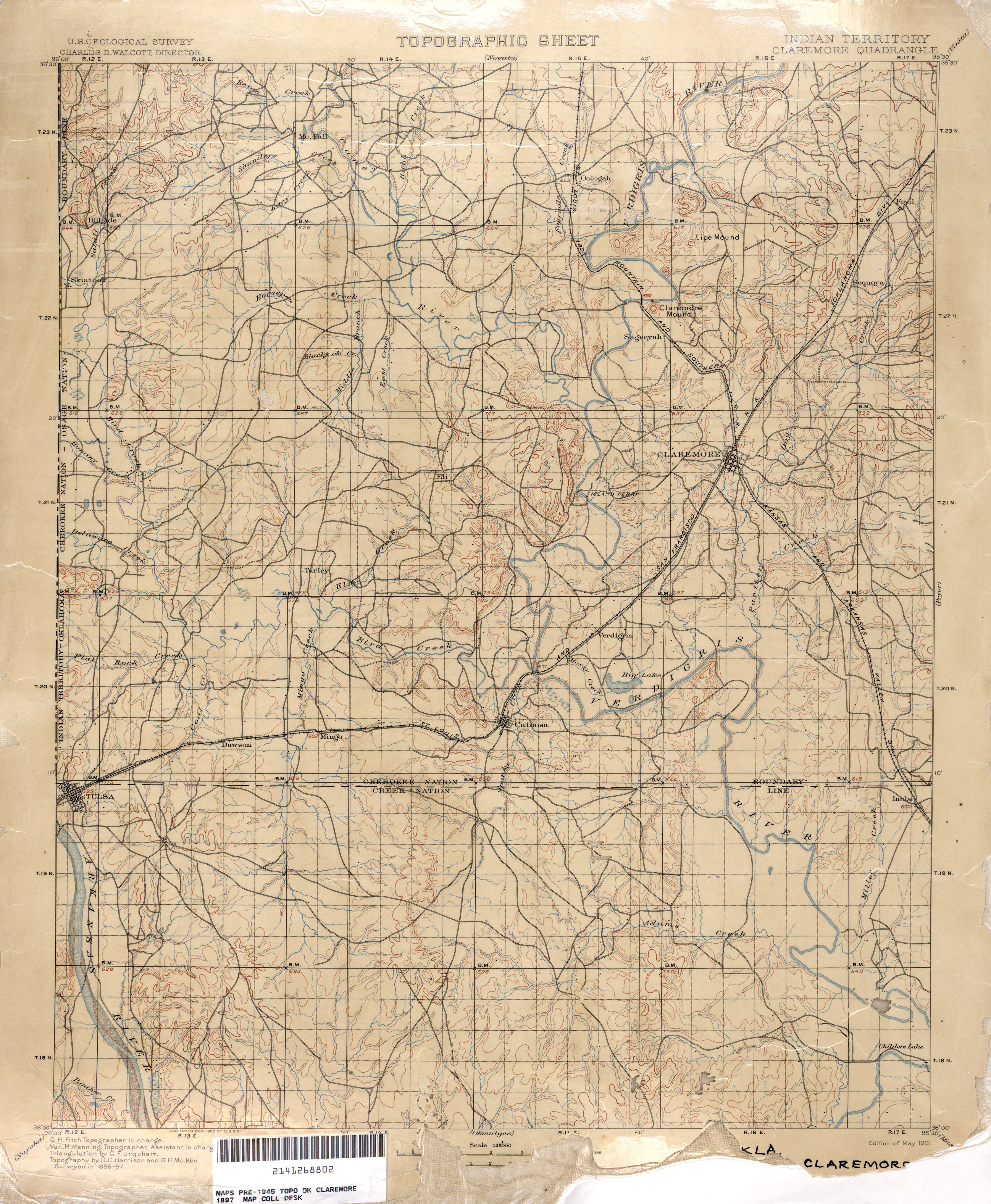
Here's the section of the map covering what is now midtown and downtown Tulsa.
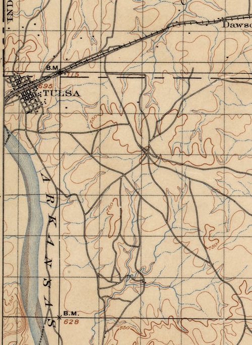
The grid of early day Tulsa is there, laid out parallel and perpendicular to the Frisco tracks which gave birth to the town. But the grid extends only from modern day Cameron St to 4th St, Cheyenne Ave to Cincinnati Ave. Beyond that, notice the hub of trails just east of present day 21st and Harvard, probably close to the high point that was more recently occupied by a water tower (just east of 21st and Louisville).
Notice too the creeks and streams, long before they were turned into underground storm sewers or rerouted into concrete channels. It's interesting, too, to see the locations of fords and ferries.
Here's an interesting contrast in the neighboring quad to the north, covering Washington, Nowata, and northern Rogers counties:
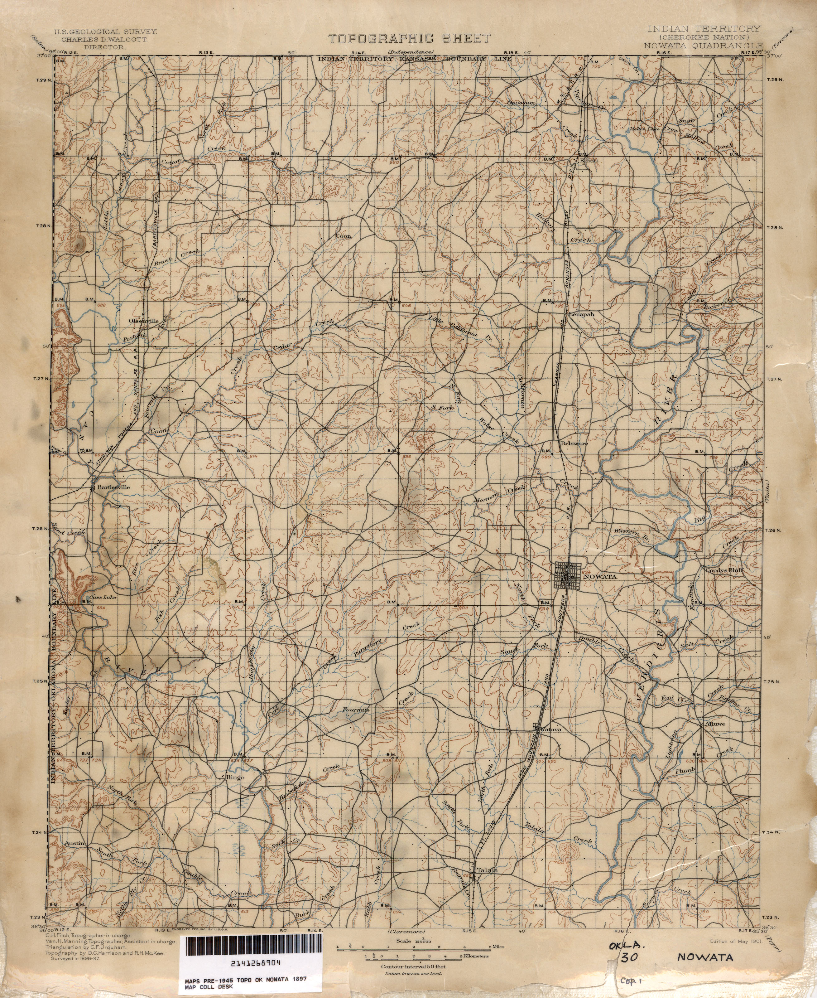
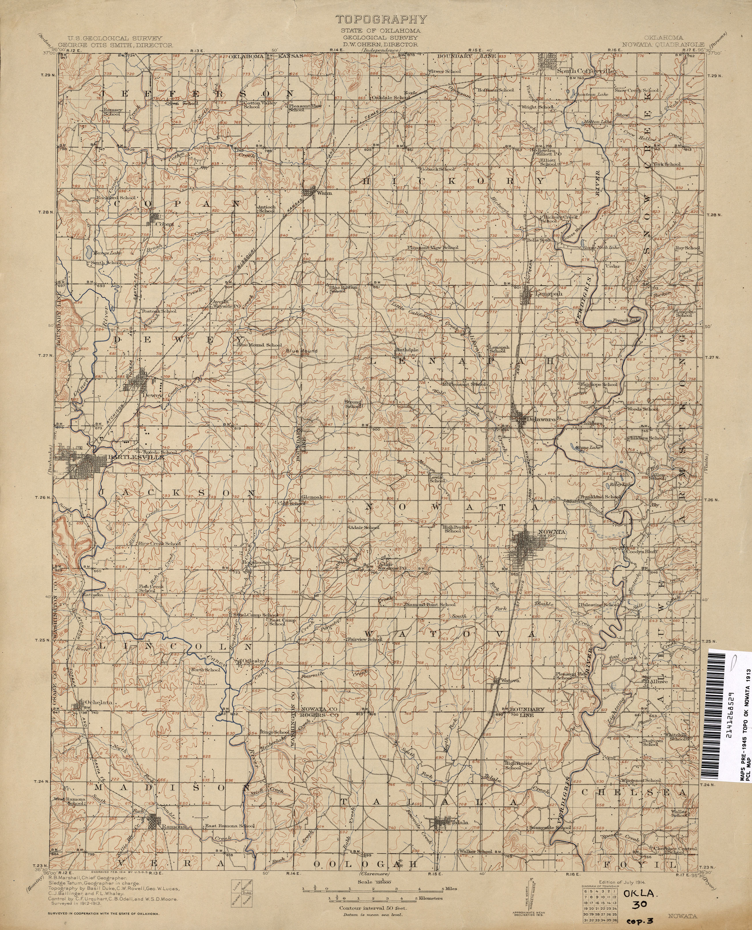
In just 16 years, the network of trails has been mostly replaced with a grid of section line roads, new towns have been established, and every few miles there's a school. Note the electric railway linking Bartlesville, Tuxedo, and Dewey.
More amazement at the PCL online archive:
1:250,000 USGS maps, including Tulsa maps from 1947 and 1967, covering all of Oklahoma northeast of Jenks. Note that the 1947 city map of Tulsa shows the Tulsa County Fairgrounds within the Tulsa city limits. The 1947 topo map shows the Union Electric Railway connecting Nowata and Coffeyville.
McGraw Electric Railway Manual Maps, 1913: Streetcar maps from nearly everywhere except Oklahoma, including Joplin, Little Rock, Dallas, Fort Worth, San Antonio, and Brooklyn.
Here's an odd little digression to take us into the weekend:
The mention of the town of Boley in the 1977 documentary on historic preservation in Oklahoma got me chasing a rabbit in the middle of writing the previous entry.
It brought to mind a time in the '70s when black celebrities adopted some of Oklahoma's historic black towns -- towns founded by Creek freedmen who, as tribal members, received Dawes Commission allotments in Indian Territory or by settlers in the newly opened lands of the Unassigned Lands and the Cherokee Outlet.
I remember newspaper articles and TV stories about well known entertainers like Redd Foxx and Flip Wilson visiting these little towns and offering to help finance civic improvements. "Sanford and Son" and the Flip Wilson Show were two of my favorite TV programs, so the announcements caught my attention.
Thanks to Google's online archive of publications, I have confirmation of my memories. Sometime in the summer of 1974, Taft, Oklahoma, mayor Lelia Foley appointed Redd Foxx police chief of the town. In the Sept. 26, 1974, issue of Jet, Foxx said that this would "not be a token job":
Foxx... said he plans to establish a museum to house the artifacts of outstanding Black leaders and personalities, plug for a new municipal swimming pool and promote a project to improve the appearance of residences and busnesses.
According to a story in the November 13, 1974, Toledo Blade, Foxx heard about the job opening and applied for it: "He was looking for an all-black community to help, so he took the job." He announced plans to finance a swimming pool and a museum for the town and to donate some of his memorabilia for display.
In October he visited and was sworn in. The December 19, 1974, issue of Jet featured Foxx on the cover, in cowboy hat and chief's badge, standing next to a police car.
A story in the December 3, 1974, Miami News, mentions Redd Foxx's adoption of Taft as a bright spot in his life:
The only time Foxx becomes lively is when talking about Taft, a town 104 miles from Oklahoma City. He's honorary sheriff, and wants to build a swimming pool and a black hall of fame there. He adds, "if people get off the highway to see a football hall of fame and snakes, why not get off the highway for a tribute to black accomplishment?"
October 26, 1974, Kentucky New Era quoted Foxx on his motivation for getting involved in Taft:
"It is my desire to put Taft on the map, to turn the town into a city," Foxx said. "Hopefully other entertainers will adopt towns and together we'll improve the plight of black people all over this country."
Other entertainers followed Foxx's example. A brief item in the March 6, 1975, issue of Jet reports that Sammy Davis Jr. had been named chief of police in Langston after comedian Flip Wilson had been honored with the same title in Boley. "Both Foxx and Wilson pledged to help their newly-adopted cities and Davis is expected to do the same for Langston.
But by April 1975, the relationship began to fall apart. Mayor Foley was impatient for some of the promised assistance to materialize, and she announced her intention to fire Foxx as chief.
From the April 17, 1975 edition of Jet:
She complained that the $10,000 check Foxx presented her in a public swearing-in ceremony in December was not to the town of Taft at all, but to the Redd Foxx Foundation. Since then, the $10,000 check has remained in a bank in nearby Muskogee, unused.She added that there has been no sign of any Redd Foxx provided police car and that she has not been able to get in touch with Foxx since the swearing in.
Foxx, the red hot star of Sanford and Son, said Mayor Foley, the first Black woman ever elected mayor in the U. S., just does not understand that the deals he promised take time to complete and that he is very busy. He also accused the mayor of "trying to get a whole lot of publicity."...
"As soon as we secure the property," Foxx assured, " we will start work on the swimming pool. I will buy the police car from Chicago, and they are supposed to give me a bus after I do a show to open up a new wing of the Cook County Jail." ...
"If she has the strength to fire me, I will find me another town," declared Foxx. "They can make me the librarian as long as I can help some Blacks."
But instead of firing Foxx, the other two members of the town council voted for one of them to replace Foley as mayor.
An AP story from December 1975 reports that Foxx organized a Christmas party for Taft residents, at which his attorney presented the town with a police car, purchased from the Muskogee police department, 300 turkeys, and a $4,000 check from the producers of "Sanford and Son."
In February 1978, the town council voted to fire Foxx. The $10,000 check in the Redd Foxx Foundation's name couldn't be used, Foxx took back the bus, intended for senior citizens, the police cars (used) had to be repaired, and the turkeys were actually donated by someone else, Taft officials claimed.
The dispute was still in the news in this April 1981 UPI story (jump page here):
Mayor Lela [sic] Foley Davis of Taft, Okla., said Friday the two police cars are junkers that have turned into expensive rat and snake infested eyesores and claimed relations between the community and the comedian soured after officials refused to change the city's name to "Reddfoxxville."Foxx, who donated a van and two 1975 Plymouth patrol cars emblazoned with his picture, said Mrs. Davis is a lousy mayor and he could do a better job."...
Mrs. Davis called the whole Foxx affair "a bad dream" that the town would just like to forget....
Mrs. Davis said the two 1975 model cars... have been sitting behind city hall since 1978, attracting snakes, rodents and vandals....
Mrs. Davis said over $1,000 has been spent on repairs since Foxx donated the cars and the city can't afford any more.
According to this Jet story from the same month, the cars were sold at auction for $115 to a local garage owner who planned to use the vehicles for spare parts.
A quick look for info on Flip Wilson's involvement with Boley and Sammy Davis, Jr.,'s partnership with Langston suggests that those relationships were much more cordial and productive.
MORE: Celebrity involvement did bring national attention to the remarkable history of Oklahoma's black towns. Here's a 1975 AP feature story on Langston, Taft, and Boley.
STILL MORE: A Muskogee County friend advises me that Lelia Foley Davis is still active in Taft politics and was serving as mayor at least as recently as last December.
A 1977 documentary on historic preservation in Oklahoma has been posted online at the I. M. Pei Project website. The half-hour film, entitled "Born Again: Historic Preservation in Oklahoma," is narrated by Norman architect Arn Henderson.
It opens with a sequence of demolitions of beautiful and historic office blocks in downtown Oklahoma City. Cynthia Emrick of the National Trust for Historic Preservation notes the conflict set up by the Federal Government in 1949, chartering the National Trust to "preserve the nation's heritage as expressed in the built environment" and at the same time green-lighting federal funding for "urban renewal."
Next up is James B. White, head of OKC's Urban Renewal Authority. White expresses the hope that by entering the program at a later date than most cities, OKC will learn some lessons avoid some of the mistakes other cities made. Oops.
White's comments embody the attitude of apathy towards preservation that ruled Oklahoma in the 1970s:
We are a new country. We are a new state. When you're talking about one generation almost from its beginning, I get my self a little lost with the terminology of being historical. I may be right, I may be wrong. I think most of what we have revolves around the terminology of nostalgia. I don't think that we can really call it historical at this particular time in our particular programs in the buildings that we have encountered....I think our eastern states have more things that are historical. Certainly things like Mt. Vernon, the buildings in our capital that go back a couple of hundred years. But we haven't even reached the century mark in our state yet, so I just don't know what is historical and what is not. I don't put myself up as an authority.
Emrick provides the obvious rebuttal:
If you're going to create something with age and glory, then you have to give it a chance to age.
The film moves next to Oklahoma City's Heritage Hills neighborhood in the late 1960s and the effort to protect it with a historic preservation ordinance. Howard Meredith, State Director of Historic Preservation, argues that a historical survey, a preservation ordinance, and a review commission are essential to effective preservation.
Mr. and Mrs. L. G. Ashley talk about the historic landmark designation of Boley, one of Oklahoma's distinctive black-founded towns, established just before statehood by Creek freedmen.
A segment on Tulsa mentions the preservation of old City Hall at 4th and Cincinnati by private owners and has brief glimpses of three Bruce Goff masterpieces: The Page Warehouse on 13th St (now demolished), the Riverside Studio (Spotlight Theater), and Boston Avenue Methodist Church, whose members invested hundreds of thousands of dollars in restoration and in an addition that harmonizes with the original building's architecture.
The last segment of the program focuses on Guthrie, Oklahoma's, territorial and original State Capital. In 1977, city leaders were only beginning to appreciate the economic benefits of historic preservation:
We have two choices, one is just let it rot, another choice is to tear it down and start building back, and I don't think that's going to happen.... I think we're going to recognize the heritage that we're stewards of here.... We absolutely must have some sort of zoning for this district that will help us preserve the buildings.
The film is itself a type of historic preservation, capturing attitudes, fashions, and hairstyles from the mid '70s.
Here's a direct link to Part 1 of Born Again: Historic Preservation in Oklahoma on YouTube.
The I. M. Pei OKC project is an interesting exercise in preservation itself, devoted to presenting artifacts relating to the master plan that demolished hundreds of historic buildings in downtown Oklahoma City. MIT-trained architect I. M. Pei was commissioned in 1964 by the Urban Action Foundation to develop a plan to modernize downtown. You can see the results in the Myriad Convention Center (Cox Business Center), the Myriad Gardens, Stage Center (Mummers Theater), and numerous parking garages and plazas. A 10' x 12' scale model of downtown as it would look after the plan's completion in 1989 (the city's centennial) was prepared to help inspire citizens to approve the plan. That model has been restored and will be unveiled on Monday at the Cox Business Center.
The website includes maps of the Pei Plan, images of downtown before urban renewal, and video resources, including a film called "A Tale of Two Cities" which was used to promote public acceptance of urban renewal by Oklahoma Citians. There's an excellent synopsis of urban renewal in Oklahoma and how it was used not only in the big cities, but also in places like McAlester, Edmond, and Tahlequah. (It neglects to mention, however, the use of urban renewal to clear most of the Greenwood District.)
A well-written comment on the website by Scott Bryon Williams is worth repeating here:
Unfortunate that even OKC was not spared the utopian, yet disastrous hand of modern city planning of the sixties, robbing countless American cities of their hard-earned history and identity. What a true loss of visual design variety in the built environment.Urban renewal and the Eisenhower highway program have been the most devastating events to established residential neighborhoods, commercial districts, and urban cores leading to the growth of an unsustainable suburbia and barren, depopulated city streets.
I.M. Pei's OKC urban planning concept model is truly a time capsule demonstrating the short-sighted and ill-conceived visions for America's cities' futures. In the historical photo archive, compare the richness and wealth of the former downtown with the fractured, patchwork of today.
Subsequent generations have and are recognizing the mistake of large scale demolition and investing trillions of dollars to rebuild and recreate vibrant, healthy urban environments. It is unfortunate that America lost so much of its wonderful history within such a short period to euphoric ignorance. Equally unfortunate is that this attitude still exists among most of the public with the irrevocable destruction of historic structures and neighborhoods.
Let the I.M. Pei model be a learning tool of our mistakes of the past.
Getting caught up:
Early last month (best defined as the very cold windy period between the big Christmas snowstorm and the big late January ice storm), I had two back-to-back business trips, both involving graveyard-shift hours, separated by less than a day at home. The first trip was to Altus AFB, in southwestern Oklahoma.
Altus and I go back 22 years, with trips to work on C-141 and KC-135 simulators in (approximately) 1987, 1996, 1997, 2000, 2006, and 2007. While there's one fastest way between here and there -- I-44 to Lawton then US 62 to Altus, there are plenty of other paths, and I took as many as I could to see as much of southwest Oklahoma as I could -- Cordell, Hobart, Hollis, Granite, Gotebo, Burns Flat (once home to an Air Force Base of its own), Clinton, Weatherford. When I learned at the 1998 National Preservation Conference that Oklahoma had one of the top Main Street small-town revitalization programs in the nation, I could believe it because I'd seen the results in many of these towns.
If I didn't have time to get too far off the straightest route, there were still some interesting but brief diversions along the way. US 62 is now straight as a string from west of Lawton to Altus, but before the 1970s, US 62 followed the railroad and the terrain and passed through several towns: Cache, Indiahoma, Snyder, and Headrick. Most of that old US 62 alignment still exists as county-maintained roads; the Snyder loop is still a designated highway -- US 62 Business.
My very favorite piece of this old road was a four-mile segment, beginning 10.5 miles east of the center of Altus, looping off to the south, through Headrick, then across the North Fork of the Red River and a railroad before rejoining the main road west of Snyder. This piece of road nicks the northwest corner of Tillman County -- an important fact to which I'll return later.
Here's what I wrote about it after a trip three years ago, in a blog entry about the scenic route between Altus and Medicine Park that I started but never finished until tonight:
The road skirts the northern edge of the little town then winds through some some rocky hills and over a long pony truss bridge across the North Fork of the Red River, followed by a through truss bridge over a railroad. The old concrete roadbed, the old style bridges, the pale orange rocks, and the mesquite trees combine to look like a fading slide from a summer vacation out west circa 1947.
The concrete of this old road is in exceptionally good condition, and as I prepared to head back to Tulsa at the end of my most recent visit, I was looking forward to driving it.
But there was a problem:
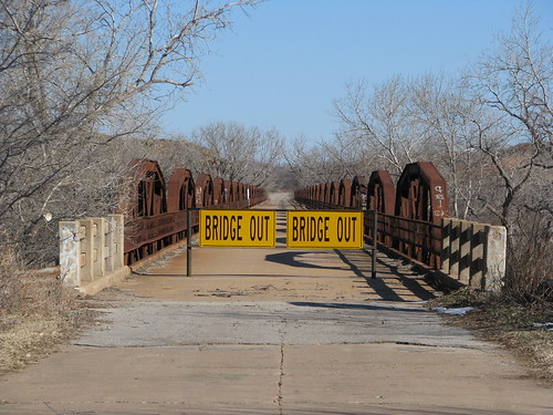
The problem became an opportunity. While I had driven this road several times before, I had only seen it at 35 or 40 miles per hour. It was a sunny, cold day, but I was bundled up and the wind wasn't too bad, so I decided to go for a walk.
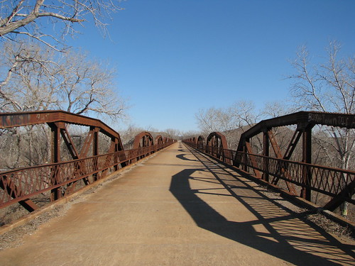
The walk gave me a nice view of the North Fork of the Red River, once claimed by Texas to be the main branch of the river and therefore the border between Texas and Indian Territory. To the west, between the two forks of the Red and the 100th Meridian was Greer County, Texas. A U. S. Supreme Court decision in 1896 proclaimed that this land belonged to Oklahoma. (Here's Texas' side of the story.)
The shallow river was still mostly ice. This photo is looking south toward the BNSF (formerly Frisco) tracks.
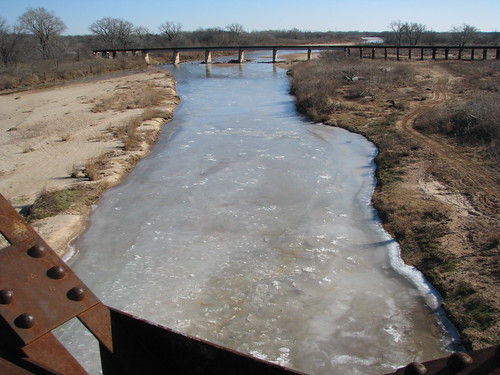
The bridge and road are actually in very good condition, but the railroad overpass beyond it is closed and in need of repair.
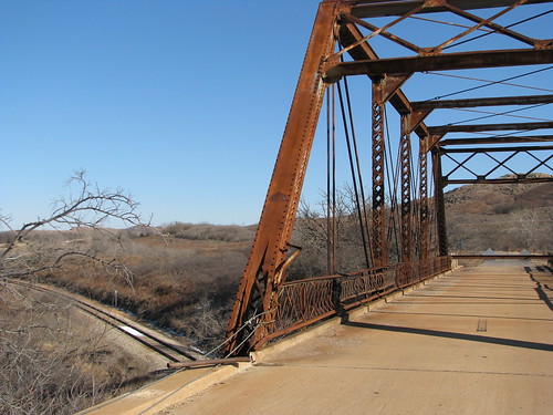
With the railroad overpass closed, the river bridge (when it was open) formed a very lengthy cul-de-sac, a fact that seemed to have been noted by the area's unruly youths:
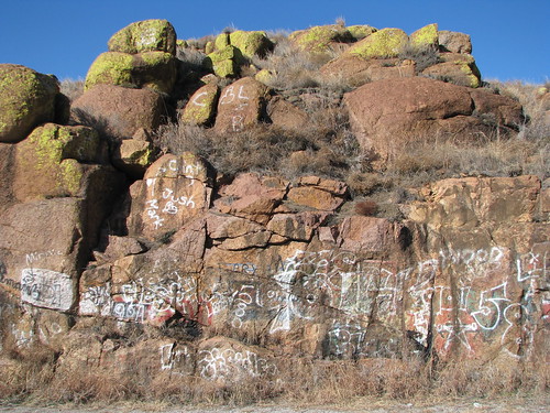
According to the Oklahoma Bridges website, the river bridge was closed in October 2009. Built in 1929, the bridge has 23 trusses, is 1,924 feet long. The posted weight limit is 17 tons. It was US 62 until a new, more direct alignment between Altus and the river was opened in 1970.
Regarding the railroad overpass, the Oklahoma Bridges website says:
The left endpost looks as though it was struck, as all the concrete guard rail is missing on the north side of the west approach, and the cover plate on the endpost is damaged. Despite these deficiencies, the bridge was given satisfactory and fair marks in its 2007 inspection. Despite this, and despite the fact it is a heavy bridge, Tillman County decided to close this bridge on Oct. 26, 2009....We at Oklahoma Bridges are hopeful that repairs will be made to this bridge and that it will be reopened. Its closure has also affected another nearby bridge, the Old US 62 North Fork Red River Bridge, which was also closed by neighboring Jackson County because, with this overpass bridge closed, the river bridge dead ends.
So back to the car:
(After the 1.5" of ice they got in late January, I'll bet those trees aren't overhanging the road anymore.)
And back down the highway...
... to my next adventure:
Click any of the above photos to see bigger versions and to explore the rest of my Flickr photoset of my southwest Oklahoma trip, including photos of a monument to the vanished APCO refinery in Cyril and interesting buildings in downtown Altus (before the massive ice storm that knocked power out for more than a week).
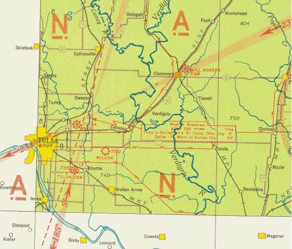
Via the Google Earth Library blog, I found a collection of historic navigational charts for air and sea travel on the website of the National Oceanic and Atmospheric Administration. It's the Historical Map and Chart Project of the Office of Coast Survey. You can search the collection by state, date, type of map, or keyword. Here are a few that may interest you:
Civil Airways and Mileage, 1948
This map shows major airports and the designations for airways connecting them. With a few exceptions the US three-letter airport codes were then as they are today -- e.g., INK for Wink, Texas -- although the Canadian two-letter codes later had a Y prefixed to them.
Tulsa section of United States Airway Map, 1934
Wichita section of United States Airway Map, 1933
These maps show airports, navigational aids, and land features visible from the air -- tank farms, highways, railroads, electric transmission lines, and bodies of water. The two maps together show the areas west, north, and east of Tulsa in the early '30s.
The Tulsa map shows the old alignment of US 66 through Tulsa, which jogged north from 11th St. to Admiral Pl. on Garnett (or so it would seem on this map. The fairgrounds race track is depicted. Note that what is now US 69 through Welch, Vinita, Pryor, and Chouteau used to be called US 73. Notice too that roads that these days travel diagonal paths used to jog back and forth on section line roads. The map shows Tulsa's main airport on N. Sheridan, Tulsa Commercial Airport at 51st and Sheridan, and Wilcox Airport, which may be the predecessor of Harvey Young Airport.
The roads depicted nearest Tulsa are a bit puzzling and don't seem to be to scale, but it looks like Peoria, Lewis, and Harvard extending to the south. It appears to show 96th St. going from the Jenks bridge to Mingo Rd., but perhaps that's meant to be 101st.
The Wichita chart shows Tulsa and the areas north and west. That road extending east of Jenks is labeled US 64 -- probably an error, but perhaps not. Look west of Sand Springs to see the now-inundated town of Keystone and the path of US 64 before Keystone Lake and Dam.
Up in Osage County, there's a substantial-looking place named DeNoya. The town, informally known as Whizbang (a name deemed too undignified to grace a post office), is now a pasture. When I was last there, in 1988, nothing remained but the footings of a few buildings.
The red stars on the map mark flashing or rotating beacons that marked the path of airways for nighttime navigation.
Oklahoma City sectional chart, 1950
This more recent map covers a smaller area than the 1930s sectional charts. It's interesting to see how small (relatively speaking) and fragmented Oklahoma City was, before the massive annexation about a decade later.
Just saw a promo on OETA: Documentary-maker Ken Burns is planning a series on the Dust Bowl, in the same vein as his works on the Civil War, jazz, and baseball, and he's looking for help from Oklahomans:
Hello,I'm asking Oklahomans to help me with a new public television series I'm now working on: The Dust Bowl.
Like our earlier films on World War II, Jazz, Baseball, and The Civil War, we think the Dust Bowl is an important event in all of American history.
We're in the early stages of our research, but we know that Oklahoma will be a major part of the Dust Bowl story we want to tell.
We're looking for first-person stories of Oklahomans who lived through those hard, hard times, especially out in the Panhandle, where the Dust Bowl was the worst.
We hope to find people who can share their experiences with us - or their photographs, diaries, or home movies from the 1930s, to help us tell this important story.
If you or someone you know can help in this research project, please contact OETA at 1-800-846-7665
Or Send a Note to:
OETA Dustbowl Stories
P.O. Box 14190
Oklahoma City, OK 73113All we need at this stage is a short, written note explaining how you could serve as a resource. Or, please call OETA with a brief description of your Dust Bowl experience. We'll take it from there.
Thank you for helping in this important project.
Ken Burns
Florentine Films
I don' t have any Dust Bowl stories in my family, but I have a couple of suggestions:
Run ads in California's Central Valley, places like Bakersfield and Fresno, where many Okies wound up and where their descendants still live.
Include western swing and its precursors (old-time fiddle music, Texas blues) in the soundtrack. Woody Guthrie may have been writing folk songs to tell the story of the masses, but the masses were at the neighbor's house, rolling up the rug, pushing back the chairs and tables, and dancing to the kind of music that Bob Wills, Milton Brown, Hank Penny, and Spade Cooley would forge into western swing.
In particular, Cindy Walker wrote a song called "Dusty Skies," which the Texas Playboys recorded in 1941. I don't remember where I read this, but it's said that Tommy Duncan choked up the first time he sang it, recalling the dust storms that devastated his family's farm in Texas. In his Guardian obituary of Cindy Walker, Tony Russell wrote of "Dusty Skies":
As delivered by Wills' vocalist Tommy Duncan, it is among the most affecting of country epitaphs, as true a memorial of its time and place as the Dust Bowl Ballads of Woody Guthrie.
(A side note: If you want to find good biographical sketches of western swing musicians, check the archives of British newspapers like the Independent, the Telegraph, and the Guardian.)
Here are the lyrics:
Dusty skies
I can't see nothing in sight
Good old Dan you'll have to guide me right
If we lose our way the cattle will stray
And we'll lose them all tonight
Cause all of the grass and water's gone
We'll have to keep movin' onSand blowin' I just can't breathe in this air
Thought it would soon be clear and fair
But dust storms played hell
With land and folks as well
Got to be moving somewhereHate to leave the old ranch so bare
But I've got to be moving somewhereSo get along dogies
We're moving off of this range
Never thought as how I'd make a change
But the blue skies have failed
So we're on our last trail
Underneath these dusty skies
This ain't tears in my eyes
Just sand from these dusty skies
After the jump, a video of the song. (The video is a bit odd, but it's Tommy Duncan's 1941 version on the audio.)
There are a couple of tours happening in and around Tulsa this weekend that may tickle your fancy:
An all-day bus tour of historic all-black towns will take place this Saturday, from 7 am to 5 pm. Freed slaves from the Muscogee (Creek) Nation founded a number of towns south and east of Tulsa around the turn of the 20th century. Other towns were established in the newly opened Oklahoma Territory at the end of the 19th century as part of a black statehood movement.
The tour is $30. For information and to make reservations call 918-596-7280. (Found via TheMidtowner.)
This New York Times story is a good introduction to Oklahoma's all-black towns. Alison Zarrow has made her photoessay on Oklahoma's black towns, Wish You Were Here, available online.

This Saturday evening, 5:30 to 8:30 pm, the Modern Tulsa committee of the Tulsa Foundation for Architecture is hosting a tour of homes in the mid-century modern neighborhood of Lortondale, east of Yale Ave. between 26th and 28th Streets.
Designed and built in 1954 by Tulsa duo Donald Honn (architect) and Howard Grubb (builder), the Lortondale Neighborhood was the recipient of a multitude of national design awards. The neighborhood was featured in an array of magazines including House and Home and Better Homes and Gardens.In recent years Lortondale has experienced something of a rebirth. A new generation of homeowners, interested in modern design, are snapping up the houses just as fast as they come on the market. After decades of neglect, many of the houses in the neighborhood are being restored to their former modern glory. Most importantly, the Lortondale Community is experiencing the same restoration.
This year's tour seeks to convey the energy that is the Lortondale Neighborhood today. Featured are 6 houses in various stages of completion. From the beginning stages of a restoration to a virtually complete example of HiFi-modern bliss, this tour of Lortondale will show you what all the buzz is about.
Tickets are $10 in advance, $15 the day of the tour, and available at Dwelling Spaces, Urban Furnishings, Ida Red Boutique, and the Tulsa Foundation for Architecture office. All the details are available at the Modern Tulsa website.
The tour is self-paced. You can start at any home and purchase a ticket at the first house you visit:
- 4912 E. 26th Terrace
- 5331 E. 26th Pl.
- 5342 E. 26th Pl.
- 4953 E. 27th St.
- 4958 E. 27th St.
- 5312 E. 27th St.
There's an ongoing online tour you can follow vicariously. A family is visiting all 77 of Oklahoma's counties, taking photos, and recounting their travels. You can follow their progress on the 77 Counties blog. (The latest entries will also be linked on the BatesLine Oklahoma headlines page.)
More linkage, less thinkage, until I get out from under the pile:
Abandoned Oklahoma is a website devoted to photography of abandoned places around the state. Homes, industrial sites, parks, schools, churches. Sites include the Labadie Mansion in Copan (north of Bartlesville), the Santa Fe Depot in Cushing, the Page-Woodson School in Oklahoma City, the Hissom Memorial Center near Sand Springs. The photos are fascinating, often poignant.
A similar site, Underground Ozarks, has several pages devoted to Monte Ne, southeast of Rogers, Ark.
The abandoned million-dollar resort known as Monte Ne was the dream of former Liberty Party presidential candidate William Hope "Coin" Harvey. In 1901, the eccentric Harvey purchased 320 acres near Rogers, Arkansas to become a health resort, political headquarters, and place for civilization to arise after the apocalypse (which Harvey believed was imminent). The resort had two massive hotels, an enclosed plunge bath, a golf course, and gondolas to ferry visitors across the lagoon. In later years, Harvey even added a Roman amphitheater, which is now submerged under Beaver Lake.
Russell Johnson has much more information about Monte Ne and Coin Harvey.
And now for a deliberate, man-made ruin:
(This really deserves an entry of its own, but for now I just want you to see the link.)
 Blair Humphreys is getting caught up on his blogging, and the most dramatic thing he's posted is this map of the Oklahoma City urban renewal plan. The map, created in 1965 by MIT-trained architect I. M. Pei and Carter & Burgess, defined the areas of downtown to be cleared and redeveloped according to the Pei plan. Blair has shaded the map to highlight the doomed zones. It's nearly everything from NW 6th to SW 3rd, from Western Ave. to the Santa Fe tracks. (Bricktown, east of the tracks, was spared.) Click through to see a much larger image and to read Blair's comments.
Blair notes that "old plans can tell us a lot about how the city came to be the way it is." He has scans of many important Oklahoma City plans and hopes to put them all online in the future.
KOTV's Dan Bewley went to Yale, OK, today to report on the demolition of Yale's Norma S. Velvin auditorium, the only remaining piece of the 1930s high school building. According to the report, Superintendent Mike Wilson claims that there are no student records or transcripts in the building and that anything remaining is infected with mold or beyond repair. Alumni who object to the demolition say there are still computers, printers, and trophies in the building.
At this point, it would be very difficult for someone to check on the contents of the building, although I'm told that demolition has been halted or at least slowed over concerns about a failure to remove asbestos. If in fact there is nothing of value left in the building, the superintendent would be more persuasive if he released a complete list of what was left in place and what was removed. Likewise, it would be easier to believe that no transcripts or student records were left if he would account for where all student records are currently stored.
Click the link to see the KOTV video:
A passing mention by Skye of German prisoners of war in Pennsylvania reminded me that a fair number of them -- tens of thousands -- were held here in Oklahoma, too, during World War II, at places like Ft. Reno, Ft. Sill, and Camp Gruber. Here are some links (with an excerpt or two) for learning more:
Oklahoma Journeys story on German POWs in Oklahoma
Encyclopedia of Oklahoma History and Culture entry on Prisoner of War camps
By May 1943 prisoners of war began arriving. Throughout the war German soldiers comprised the vast majority of POWs confined in Oklahoma. Initially most of the captives came from North Africa following the surrender of the Afrika Korps. After the Allies invaded France in 1944, the camps received an influx of soldiers captured in Europe. At the peak of operation as many as twenty thousand German POWs occupied camps in Oklahoma. Seven posts housed enlisted men, and officers lived in quarters at Pryor. At each camp, companies of U.S. Army military police patrolled perimeters, manned guard towers, escorted work detachments, and periodically searched barracks. Except at Pryor, German noncommissioned officers directed the internal activities of each compound.
"For the Duration: Behind Fences in Oklahoma" tells of the POW and enemy alien internment camps "that existed in 26 counties around the state." Oklahoma hosted mainly German POWs, but also Japanese, Italian, and German aliens "picked up in Midwestern and north central states, South and Central America." Ethel Taylor compiled the information from the Chronicles of Oklahoma and newspaper accounts.
A program was in effect to segregate the Nazis and Nazi sympathizers from the general camp population, that was never fully successful. The Nazi and their sympathizers that were segregated were sent to camps with higher security. They tried to keep the general population from wavering on the Party line, using fear and physical punishment to achieve this. The pressures were great and several of the POWs that committed suicide were thought to have done it under pressure. The "hard liners" carried out some "executions". One such case was at Tonkawa, where Johannes Kunz was "tried" and found "guilty of treason". His body was found in the compound the next morning. The five leaders of the group that had "tried" Kunz, were courts martialled by the US Army and executed at Fort Leavenworth Military Prison in Kansas. Any prisoner that could read or speak English had to be especially careful when reading an American newspaper or talking to an American. They could never be sure just who to trust, and above all, they had to survive.
A separate page provides details on each of the camps, its size, and the types of prisoners it held. The closest one to Tulsa was north of Bixby.
BIXBY -- Located west of S. Mingo Rd. at 136th St and north of the Arkansas River from Bixby, this branch of Camp Gruber opened April 1, 1944. There could have been POWs in the area earlier, being trucked in daily from another camp. It confined 250 prisoners and closed Dec. 15, 1945.
An interesting note from the entry on the Pryor camp:
It was amazing to the local guards as to the number of cars with tags from the N/E states who came each visiting day-- prisoner's family members who were U.S. citizens.
The history of Camp Gruber, from the Three Rivers Museum website, includes much about the POWs held there:
Camp Gruber had its own celebrities. In civilian life, Private Arthur Johnston, 88th Division, 351st Medical Detachment, was the Hollywood composer of hits such as "Pennies From Heaven," and "Just One More Chance." Another notable soldier stationed at Camp Gruber was actor William Holden. Ironically, Holden was stationed at a camp where Americans held German POWs, but one of his most famous roles was as an American POW in Stalag 17....Camp Gruber made local headlines on June 5, 1943, when the Muskogee Phoenix released an army disclosure of plans to establish a prisoner of war camp at Gruber. When completed, the facility had a capacity of 5,750 prisoners, with branches located at Bixby, Haskell, Morris, Okemah, Okmulgee, Porter, and Wetumka. In 1944, Glennan General Hospital in Okmulgee was added as a branch for the treatment of POWs.
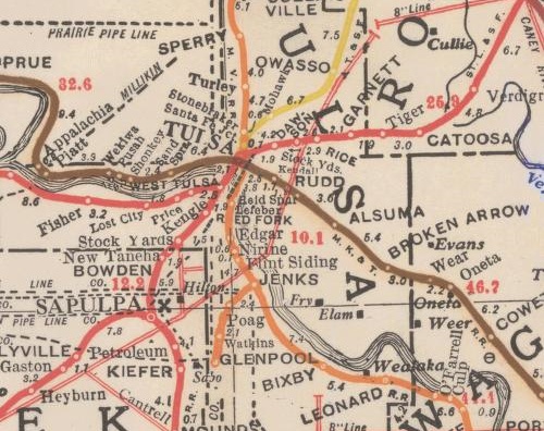 Too tired tonight to do much more than link. I've been working on a post about the Oklahoma City Union Station rail yard / I-40 relocation controversy, but it's not ready. For now, here are links to some maps and other information about the history of the state's rail network, from most recent to oldest:
From the Oklahoma Department of Transportation's website. (Note how much of the network is owned by ODOT and leased to various railroads, including the entire Frisco route from Tulsa to Oklahoma City.)
- Oklahoma 2009 railroad map
- Oklahoma 2009 railroad map - reverse showing city detail
- Oklahoma Centennial 2007 railroad map
University of Alabama collection of historical Oklahoma maps. The browser is annoying, and you can't download high res copies, but there's some very interesting material here, including:
- A 1921 Rand McNally state map with railroads and interurbans, with more interurban station names
- 1917 Corporation Commission map of railroads and pipelines: The Tulsa County section is shown above
Note the interurbans connecting Bartlesville to Dewey, Nowata to Coffeyville, Oklahoma City to Norman, El Reno, and Guthrie, Lawton to Ft. Sill, McAlester to Hartshorne, Shawnee to Tecumseh, and Miami to the rest of the Tristate mining region. As far as I can tell, only Tulsa's interurban lines -- Sand Springs and Tulsa-Sapulpa Union (originally the Oklahoma Union Traction Ry.) -- remain in operation, as freight-only short lines.
OkGenWeb's 1915 state map with a list of railroad names and abbreviations -- high res scan
Doug Loudenback's high res scan of a 1905 map and gazetteer of the Twin Territories, with Doug's observations. The original: 1905 Premier series map of Oklahoma and Indian Territory (Library of Congress)
UPDATED 2023/12/29 to fix broken links to the University of Alabama map archive and to update the okgenweb.org link to point to okgenweb.net
Here are some interesting publications relating to early-day Oklahoma on the websites of the National Archives and the Internet Archive.
The National Archives has an online sample of documents from their Center for Legislative Archives about Oklahoma's path to statehood including:
- Survey Map of Oklahoma and Indian Territory showing distances, municipal towns, and post offices, published by George Cram, 1902
- President Benjamin Harrison's nomination of George Washington Steele to be the first Governor of the Oklahoma Territory, May 8, 1890
- First page of the Joint Statehood Convention, Oklahoma City, July 12, 1905
- HR 12707, A Bill to enabling the people of the Indian and Oklahoma Territories to form a state constitution and State government, January 20, 1906
- Pages from a pamphlet called "Souvenirs of Tulsa - Indian Territory," 1906, which was submitted to Congress as evidence of Oklahoma's readiness to be admitted to the Union
- Telegram from T.H. Marlin of the Indian Territory to Joe Cannon, March 13, 1906
- Letter from Edwin Meeker of the Oklahoma Territory begging the House to concur with the Senate's amendment to the statehood bill, March 13, 1906
- Engrossed HR 12707, An act to enable the people of the Indian and Oklahoma Territories to form a state constitution and State government, first page, June 16, 1906
- Engrossed HR 12707, An act to enable the people of the Indian and Oklahoma Territories to form a state constitution and State government, endorsement, July 16, 1906
The main page has thumbnails of each item, which you can click on to see an enlarged view. You can also download a high-resolution scan of each item. (For example, the full-res version of the map is 68 MB.)
The Internet Archive offers a 1916 book, now in the public domain, called Men of affairs and representative institutions of Oklahoma. It comes from the collection of the New York Public Library. It features photographs and descriptions of important Oklahomans of the day, with an emphasis on Tulsa. You can view the book online, or download it as a PDF and in various other formats. I found it while looking for information about Tulsa's streetcar companies.
Cyrus Stevens Avery, who would become the father of Route 66, is one of the featured "men of affairs":
oil producer and farmer, Tulsa, born in Stevensville, Pa., on August 30, 1871, son of James A. and Ruie Avery. Educated in the public schools. Received A. B. degree from William Jewel College, Liberty, Mo. He is a Democrat and has served two terms as commissioner of Tulsa county. Is a Mason of high degree, being a member of the Consistory and Mystic Shrine. Member Board Directors Chamber of Commerce, Tulsa, and president Good Roads Association of the State.
Other Tulsa notables include Glenn T. Braden, founder of ONG and namesake of Braden Park, Patrick J. Hurley, Robert Galbreath (the man who discovered the Glenn Pool), and Harry Sinclair. Pat Malloy, Sr., is in the book -- former county attorney, Notre Dame graduate: "Mr. Malloy was left an orphan at the age of 14, a cyclone at Salix, Iowa, having killed his father, mother, two brothers and a sister."
Toward the back of the book there's a photo and description of the late lamented Manhattan Court apartments at 11th & Cincinnati:
On the opposite page is shown Manhattan Court, Cincinnati avenue and Eleventh street, owned by David J. Kelley, of the Manhattan Oil Co., Tulsa, the most beautiful and most exclusive apartments in the Southwest. The suites are three rooms and bath; interior trimmed in mahogany; quarter-sawed oak floors throughout; specially designed electric light fixtures; building scientifically ventilated; construction, asbestos and fire-proof stucco. Manhattan Court has its own pure water system connected with each apartment for all purposes; instantaneous hot water; steam heat; all kitchens open on beautiful interior court with its fountain of pure water and lawn; under personal direction of superintendent, always on premises; iron grill entrance for trades people in rear, adding to the exclusiveness and privacy of the occupants; special store room for each occupant in the basement; kitchens completely furnished with gas range, pantry kitchen table, sanitary refrigerator, connected with air vents and flush drains; garbage container furnished; garbage and waste burned; container thoroughly cleaned daily; each department connected with vacuum cleaner, work done by superintendent; sanitary bed in each apartment; large closet with modern appliances for clothing; bathrooms tiled and white enamel; recessed tubs, porcelain fixtures, plate-glass mirrors, medicine cabinets recessed in the walls; adjustable head shower baths; all bath rooms fitted with white enamel accessories: highest standard of plumbing and modern fixtures with latest sanitary appliances of approved design.Manhattan Court occupies a convenient and attractive site in Tulsa. The artistic and attractive exterior of this structure, combined with its modern, luxurious and convenient interior, offers a must desirable residence for discriminating and appreciative people who understand that it is not how much money one spends, but what
is received in return for such expenditure.Manhattan Court is not excelled by any similar structure in the United States and it is with some degree of pleasure that the owner has been privileged to contribute his share in this manner to the welfare and upbuilding of Tulsa. These flats are all rented a year ahead, and have a large waiting list.
Other back pages are devoted to a four story building called the Oklahoma Hospital, somewhere in Tulsa, the Tulsa Pathological Lab at 3rd and Cheyenne, the R. T. Daniel Bldg at 3rd & Boston, Boswell's Jewelry, the Gallais Building (now known as the Kennedy Building), the seven-story Brady Hotel, the three-story Overton Grocery.
Construction in the new Maple Ridge neighborhood is highlighted in a two-page ad for Stebbins, Eisenbach, Tucker, and Darnell, General Agents. They project that Tulsa will soon pass Oklahoma City. "[H]ere is to be the great city between the Missouri river and the Gulf coast...."
One page is devoted to Oklahoma City's extensive streetcar and interurban system. Nowata's Savoy Hotel and Mineral Baths gets a page. Several two-page spreads are devoted to various Oklahoma oil refineries. There were once many more in Tulsa besides the two that remain.
Photos of the original Kendall College building and Kemp Hall (the girls' dorm) will make you mad at TU all over again:
The present college is located at College Hill, and has a thirty-acre campus with five college buildings. Three hundred and fifty young men and women can be accommodated. Kendall likes Tulsa and Tulsa likes Kendall. The city has given the ground and about $200,000. The college work consists of nine departments, instructed by a University-trained corps of twenty-five men and women. The course is four years, leading to classical degrees, academic course of four years, corresponding to first-class high school courses. Also special courses in music, art, expression, domestic science, oil geology, business a'nd normal training. The dormitory facilities are unexcelled in the state. Every room is an outside room, and the chapel seats 550. A 55,000 pipe organ was installed in 1915. The gymnasium is one of the best in the state: building 65x90 feet, with a basket ball court. 40x70 feet. Visitors' gallery that will seat 500, bowling alleys, dressing rooms, equipped with lockers and shower baths.
Gone, every last bit of it.
The big surprise was seeing Moman Pruiett in this august and respectable company: "Prior to April 15, 1916, Mr. Pruiett had defended 346 men and women charged with murder; and he now has on his docket thirty-nine similar cases. In addition to this record, he has assisted in the prosecution of 37 charged with murder; and has been equally successful as a prosecutor. It is said that he had defended and caused to be acquitted more men for murder than any other lawyer in the world, and he has not yet been practicing twenty years." I didn't expect that he'd be respectable enough for inclusion. A recent biography of Pruiett is titled He Made It Safe to Murder.
A search of the Internet Archive for Tulsa turns up quite a lot of video of city council meetings, public forums, and other events by David Schuttler. It's interesting to realize that the work of this enterprising blogger/videographer is better preserved and more accessible to the public than the news coverage of local TV stations. Many sermons by Dennis Gunderson of Tulsa's Grace Bible Church turn up as well.
MORE to come: Jack Blair of the Tulsa City Council staff has sent along a number of city documents about our streetcar companies -- very interesting stuff that I hope to get posted in the not too distant future.
UPDATE: The films discovered by Currie Ballard, filmed by Rev. Dr. Solomon Sir Jones, are now available for viewing and download on the website of Yale University's Beinecke Rare Book and Manuscript Library. More about the Rev. Dr. Solomon Sir Jones and his films here.
A couple of years ago, I told you about historian Currie Ballard's amazing find of films taken in Oklahoma in the 1920s of African-American families, communities, businesses, and events. (This YouTube user has some clips from the films.)
These were in the news again recently, and in looking for more information I came across the website of Global ImageWorks, a service that provides stock footage. They list Ballard's collection in their online catalog:
BLACK AMERICAN TOWNS FROM 1920sGlobal ImageWorks is exclusively representing a rare and unique film collection discovered by historian Currie Ballard consisting of six hours of film documenting the daily lives of successful black towns in Oklahoma thriving in the aftermath of the infamous Tulsa Riots of 1921. The footage illustrates a little known piece of history and includes footage showing entire black communities visiting one another's country homes, parading through downtown Muskogee in some two dozen Packards, crowding an enormous church in Tulsa not long after the riots, gathering at the National Baptist Convention, and traveling to Europe. It includes black cowboys riding horses amidst oil derricks rising from their ranches, various sporting events including rare footage of the 1928 Los Angeles to New York "Great American Foot Race" in which three of the finishing runners were black Americans. The material found by Ballard came in 29 cans and was shot by the Rev. S. S. Jones, a circuit preacher assigned by National Baptist Convention to document the glories of Oklahoma's black towns of Guthrie, Muskogee, and Langston.
The embedded video on that catalog page is a series of short clips from the collection, which appears to have been beautifully restored.
A site search turns up six "tapes" containing footage from the collection. Here are the titles links to each item page, each of which includes a detailed list of the scenes contained therein:
OKLAHOMA COVERAGE 1924 -1928 - MIDDLE CLASS BLACK LIFESTYLE Tape #: 3382 | Date: 1920s | Location: Clearview, Muskogee, Langston, Bristow, Tulsa, Oklahoma | Length: 60:00 | Master Format: film - 16mm video - digi beta | B/WOklahoma coverage of middle class black family life in Clearview, Muksogee , Langston and Bristow showing families on their farms and their oil wells. Unique footage from the Currie Ballard Collection. 1925-1927
AFRICAN AMERICAN MIDDLE CLASS LIFESTYLE IN BLACK RUN TOWNS IN OKLAHOMA 1920S
Tape #: 3383 | Date: 1920s | Location: Muskogee, Harlinville, Depew, Boley, Duncan, Okemah,Taft, Oklahoma | Length: 60:00 | Master Format: film - 16mm video - digi beta | B/WScenes of black middle class lifestyle in Oklahoma in completely black run towns of Muskogee, Duncan etc. in 1920s. Church, train scenes, Antioch cadets, black kids in school, grocery and filling stations, farms, and local commerce. From the Currie Ballard Collection.
PEOPLE AND LIFESTYLE IN BLACK RUN TOWN OF MUSKOGEE, OKLAHOMA IN 1925
Tape #: 3384 | Date: 1920s | Location: Muskogee, Oklahoma | Length: 60:00 | Master Format: film - 16mm video - digi beta | B/WVarious residences of people living in Muskogee, Department store, basketball team and high school speling contest, classes, faculty etc. From the Currie Ballard Collection
MIDDLE CLASS LIFE STYLE SHOWING RESIDENCES, FAMILIES AND SCHOOLS.
Tape #: 3385 | Date: 1920s | Location: Okmulgee, Tulsa, Oklahoma | Length: 60:00 | Master Format: film - 16mm video - digi beta | B/WMiddle class life style showing residences, families and schools. From the Currie Ballard Collection
OKLAHOMA - AFRICAN AMERICAN LIFESTYLE
Tape #: 3386 | Date: 1920s | Location: Oklahoma | Length: 60:00 | Master Format: film - 16mm video - digi beta | B/WVarious towns of Oklahoma, residences,schools, baptism, construction, lifestyle, Masons parade, Masonic lodge, Church. From the Currie Ballard Collection.
OKLAHOMA AFRICAN AMERICANS
Tape #: 3387 | Date: 1920s | Location: Germany, Jerusalem, Italy, Oklahoma | Length: 60:00 | Master Format: film - 16mm video - digi beta | B/WOklahoma African Americans from the Currie Ballard Collection.
Some of the Tulsa-related scenes:
- The Oklahoma Eagle Divinity Company, Greenwood Street 1927 Tulsa
- Tulane Avenue Baptist Church Bus from New Orleans, Louisiana at Gen Convention Tulsa Brady Theater 1927 Tulsa
- Church members leaving church winter brick church inner city
- Scenes from Thanksgiving Day 1925 parade and football game: "MTH Muskogee vs. BWH of Tulsa" (Tulsa won, 13 to 9)
- Mr. Jessie Brown new $75,000 Funeral Home, 540 E. Easton 1928 Tulsa
- Brown Funeral Service 1928 Tulsa
- Union Baptist CadetS at State SS & BYPU Convention, Rev. D.C. Cooksey August 4, 1928 Tulsa
- Train loaded with cars, oil derrick in background
- Church Baptist Cadets
- Ground Breaking Union Baptist Church Pastor D.C. Cooksey Officers and Members August 4, 1928 Tulsa
- Church ground breaking (older Church burned down during Tulsa Race Riot 1921)
- Tulsa Business League Dr. S.S. Jones (right to left) Tulsa
- Dr. S.S. Jones eyeglasses Tulsa
- Mt. Zion Baptist Church after the Riot Photo Stills (right to left) Tulsa
- Greenwood Street seven years after Tulsa Race Riot 1921
- C.B. Bottling Works, 258 E. Archie (right to left) Tulsa
- Soda Pop Bottling Company
- Jackson's Undertaker Co. (right to left) Tulsa
- Booker T. Washington High School, noon hour Tulsa
- Dunbar Grade School (right to left) Tulsa
- Dunbar Agri Gardens (right to left) Tulsa
There are scenes from many Oklahoma cities and towns, including Okmulgee, Muskogee, Haskell, Coweta, Ardmore, Langston, Bristow, Taft, El Reno, Oklahoma City, Lawton, Depew, Boley, Wewoka, Boynton, Gibson Station, Wetumka, Eufaula, Red Bird, Porter, and Holdenville plus scenes from travels to Paris, London, Chicago, and the Holy Land.
These, along with old street directories, newspaper microfilm, and Sanborn fire insurance maps, could be the makings of a fascinating documentary.
MORE: From an Oklahoman story on the films from September 2006:
The significance, he said, is the "positive light it puts on blacks in this state. Under the heat of Jim Crow laws, it showed that blacks were prosperous."Many blacks living in the 1920s were former slaves, and the films show a bustling and prosperous way of life, Ballard said.
"It was rare for a white person to have the camera and equipment in those days," he said. "For someone black to have a camera was unreal. That's what makes it so rare. The movies are from an African-American point of view....
Some of the movies were taken just a few years after the Tulsa race riots of 1921, which virtually destroyed the city's Greenwood district. Jones chronicled the 1925 (black) National Baptist Convention in Greenwood and an accompanying parade.
"The movies showed the strength and resilience of the people of Greenwood to pull off a national convention and to rebuild what was burnt to ashes," Ballard said.
That's the footage that also impresses Blackburn. Like Blackburn, he said it shows the people were able to not only recover but to prosper.
"It would have been easier to be intimidated and to run away and go to St. Louis or Chicago," Blackburn said. "This film footage is very important."
What is interesting, Blackburn said, is that the films show no signs of destruction, but vitality of the Tulsa black community.
STILL MORE: Currie Ballard was recently appointed Assistant Secretary of the Oklahoma State Senate.
On May 20, 2008, the famed Rock Cafe on US 66 in Stroud was gutted by fire, but the stone walls remained standing. Owner Dawn Welch was determined to rebuild. After some false starts, reconstruction is on track for completion in late spring, according to Dawn's latest update, posted on January 20. The interior framing is complete and the roof trusses are now in place. If she meets that late spring target, the cafe would open just about a year after the fire.
It gives me hope for the old Temple Israel building at 14th and Cheyenne, which was gutted by fire in late January. The brick walls are still up, and I'm hopeful that Kevin Stephens, who owns the historic building and adjacent lots, will press ahead with his planned restoration and repurposing of the building. It's an important part of our city's history. After Temple Israel moved away in the '30s, to 16th & Rockford (now home to a playground for Christ the King Parish), the building was home to the Reorganized Church of Jesus Christ of Latter-Day Saints.
Its companion, the original home of Congregation B'nai Emunah, just three blocks away near 11th and Cheyenne, was torn down some years ago for parking for the Teamsters hall next door.
In last week's issue of Urban Tulsa Weekly, I urged making cultural heritage tourism the focus of Tulsa's efforts to attract visitors. Rather than marketing Tulsa as an "ocean of sophistication in a cultural desert," Tulsa should embrace its place in Oklahoma as "the capital of a region where visitors can experience the untamed, exuberant spirit of the American West in all its variety."
For whatever reason, the people we pay to promote Tulsa to the world -- the Tulsa Metro Chamber's Convention and Visitors Bureau -- seem uncomfortable promoting the unique aspects of our region. They position Tulsa as superior to and separate from the rest of Oklahoma, an oasis of sophistication in a cultural desert.It's a distinctly Midtown Money Belt point of view, and it makes Tulsans seem like a bunch of insecure, provincial rubes, putting on airs -- the urban equivalent of Hyacinth Bucket.
While we should be proud of the cultural amenities that make Tulsa a great place to live, our tourism marketing should focus on what sets our region apart from the rest of the world.
A Milanese woman who lives a few miles from La Scala and the salons of Versace and Prada isn't likely to visit Oklahoma for the opera or Utica Square shopping, but she might come here to eat a chicken fried steak on Route 66, experience Oklahoma! in an open-air theater, or attend a powwow.
A resident of Berlin wouldn't cross the pond to see a Tulsa production of the plays of Bertolt Brecht, but he might travel here to two-step across Cain's curly maple dance floor, search out Ponyboy Curtis's hangouts, or attend the annual Kenneth Hagin Campmeeting -- depending on his particular passions.
Tulsa should position itself not as an enclave of Eastern sophistication but as the capital of a region where visitors can experience the untamed, exuberant spirit of the American West in all its variety.
Read the whole thing, and read more about how other cities and regions have successfully used their history as a tourist draw at culturalheritagetourism.org.
Just found this, from Tulsa Business Journal's October 27 edition: The Max Campbell building, with its distinctive roof of multicolored clay tiles, is going to be restored as a hotel and retail space. That's the original function of this 1926, block-long building on 11th Street between Birmingham and Columbia.
Aaron Meek, owner of Group M. Investments Inc. said he plans to restore the building turning the space into a hotel with an events center and restaurant in the bottom level."It is my understanding that the building was originally a hotel on the top stories, and the bottom was used as retail space," Meek said. "We have gotten enough interest to where we are going to go back to that original purpose."
The project isn't new territory for Meek, who he said worked primarily on the restoration of older homes and properties in the mid-town area.
"We love the old buildings and love getting them back to their original state," he said. "We're working on another project down the street that we're turning into lofts.
In 1957, this building was home to a drug store, an auto parts store, a barber shop, an office supply company, and, upstairs, the Casa Loma hotel.
It's a neighborhood landmark that has been in that spot since before Route 66 was routed down 11th Street.
In the story, Meek notes how costly it is to restore a building. Hopefully, he'll think to apply for the historic register status to which the building is entitled, which would qualify him for state and federal tax credits. This restoration seems like it would also be a good candidate for the Route 66 Corridor Restoration Program. That program was used to help accomplish the restoration of the Vickery Phillips 66 station at 6th and Elgin, which is being reused as an Avis car rental location.
Unfortunately, reauthorization of the Route 66 Corridor Restoration Program is being blocked by our own Sen. Tom Coburn. Here's a link to Coburn's statement and the key excerpt:
Several tourism related measures, including a couple that have already become a favorite piggy bank to pay for congressional earmarks, such as the Save America's Treasures program, the Preserve America program, and the Route 66 Corridor Preservation program. The Route 66 program is currently restoring aging gas stations, motels and restaurants. Unfortunately, tourism has declined with many Americans unable to afford the cost of gas and, as evidenced by this bill, Congress' misplaced priorities threaten to drive up the cost of travel.
While I understand his perspective, this program is administered by the National Park Service and is in keeping with the NPS's mission of protecting the nation's heritage and making it accessible to visitors from our own country and from overseas. Interest in Route 66 has been growing (a long-term, Internet-fueled trend that has received a giant boost from Pixar's Cars), but at the same time, landmark roadside buildings continue to be lost to purposeful demolition and to demolition by neglect.
As Route 66 expert and author Emily Priddy points out, cruising the Mother Road is a very affordable vacation destination, and people looking for cheap ways to see America are rediscovering Old 66:
I don't know where Coburn is getting his information. Yes, some Americans are having trouble buying gas, and no, they're not traveling as far. But in my extensive travels on Route 66, I have met literally hundreds of small business owners. I've spoken with many of them this year. They are all in a position to know what's going on along the Mother Road -- and what's going on is that Route 66 is thriving, largely because of increases in foreign travelers (who are used to unholy gas prices); locals (when you can't afford Disneyworld or the Grand Canyon, you explore your own backyard); and bargain hunters (fuel-efficient speed limits and great values on food, lodging and entertainment make Route 66 a penny-pincher's dream).
The Route 66 Corridor Restoration Program is not an earmark. Congress appropriates money for the fund, but the NPS processes applications for the grants, which must be matched, and must go to projects that meet the NPS's standards for the treatment of historic buildings. No money has been earmarked by Congress for specific projects. Originally envisioned as a 10-year, $10 million program, only $1.2 million in federal money has been granted over the first seven fiscal years. The program ends at the end of Fiscal Year 2009. The new bill asks Congress to authorize $8 million over 10 years, starting in FY 2010.
Compare that to the $15 million allocated by Vision 2025 for the highway, which would work wonders on Tulsa's stretch of 66 if it were used as matching grant money for neon repair and building restoration. (It won't be, sadly.)
This may be one of the government's most cost-effective programs to encourage historic preservation and tourism, as the government foots less than half of the bill and doesn't have to pay for ongoing operation and maintenance of the sites that are improved.
Along US 60, halfway between Bartlesville and Nowata, there are a pair of curves that shifts the road south by a mile as you go east. On the northside* of the road, near the western curve, there was a gas station and a few houses.
Once upon a time, way back in the 1930s, there was a dance hall there. I received an e-mail today from Nowata resident Rick Holland:
While searching the web recently, I came across a teaser on a Google about Bob Wills playing in Glenoak, Okla. that led me to your blog, but I could never find any mention of Glenoak. I grew up listening to Bob Wills music in the 50's and 60's and still do. There is a Bob CD in player at all times and have even got my 18 yr. old daughter hooked on it. Repetitive brain washing I guess.Back when Bob played in the Tulsa area, he used to play at Glenoak between Bartlesville and Nowata. My Dad used to bounce at all of the dances in this area and he became friends with Bob and Tommy. Bob also used to buy cattle at the Faulkner Farms just north of Delaware where I was raised. One night after several hours of dickering over cattle price and a few drinks Tommy sat down in the kitchen of the Faulkner's home over coffee and wrote a song. Grandma Faulkner told me the name of the song but I have forgot it over the years.
Enough rambling, I am looking for any information on the dances that used to be held at Glenoak. If my father were alive he would be 93 yrs.old and most of his age group has passed. I have been able to find exactly where it was located and have been out there several times. I've even remember seeing old flyers that were passed around for the dances they held, but that has been years ago. I guess my obsession with Bob Wills is because when you listen to Bob it takes you back in time when life was not as fast paced and the little things in life didn't bother you. Any information you could give me would be greatly appreciated.
My grandfather, Johnny Bates, who lived in Nowata for nearly all his adult life (from his 18th birthday in 1935 until his death in 1999), told us about going to hear Bob Wills at Glenoak. He told me he once went up to sit on the stage to stay out of the way of a fight on the dance floor. His two years as a single adult -- 1935 to 1937 -- were spent in the Nowata branch of the Civilian Conservation Corps, and they coincided with the years Bob Wills was based in Tulsa -- 1934 to 1943. During that era, the Texas Playboys had a daily noon broadcast on KVOO 1170 (now KFAQ) from Cain's Ballroom, and every night (except Thursdays and Saturdays when they played the Cain's) they drove to play a dance hall somewhere in the KVOO listening area.
Anyone else out there remember Glenoak or remember hearing about it from older relatives?
RELATED: Can anyone tell me if Johnnie Lee Wills' "Reunion" album, recorded in the late '70s on the Flying Fish label, has been issued on CD?
UPDATE 2016/03/11: An excerpt from Al Stricklin's memoir about the very first dance he played as a member of Bob Wills and His Texas Playboys, at Glenoak on September 6, 1935. At that same link, a story from a bouncer at that dance hall back in the day.
*NOTE: One of my correspondents believes that the dance hall was on the south side of the road. County maps from the period (here is the Oklahoma State Highway Department's 1936 map of Nowata County) locate Glenoak on US 60 just east of the Nowata-Washington County line, and they show homes and a commercial building on the south side of the road at that point. The 1936 WPA map of ownership and assessed valuation in T26N R14E shows that most of Section 22 was owned by Harry Benear, but there were a couple of smaller parcels at the northwest corner of the section (about 5 acres each) where the highway map indicates a commercial establishment was located.
The 1950 Nowata County highway map shows the commercial building still there, but by the 1962 Nowata County map, homes are shown in its place. (This map was current as to highways in 1968, but the cultural features -- homes, businesses, schools -- had not been updated since 1962.) Off-topic but interesting: The schoolhouse shown two miles east and two miles north of Glenoak in 1936 is shown as "not in use" in 1950 and has vanished by 1962. Another interesting thing about the 1962 map: It shows the relocation of Alluwe to make way for Oologah Reservoir, but the reservoir isn't there yet.
One more mostly unrelated observation from these maps: As early as 1937 US 169 crossed the Missouri Pacific tracks south of Nowata and skirted the east side of the city. (The unmodified 1936 Nowata County map, used as the basemap for this 1940 Census Enumeration Districts map, shows US 169 going through the heart of Nowata, however, approaching from the south on Mississippi Street (N4130), then east on Galer (N0230), north on Maple, east on Choctaw, then curving north to Ash/Berrian (N4140). The 1950 map shows the creation of a business loop through downtown on Maple Street and Choctaw Ave. The 1962/1968 map shows the intention of rerouting US 60 north of the city (see the dirt section line road labeled "F. A. P." -- Federal Aid Primary -- and the proposed road that links it to US 60 east of town).
That 1937 map also shows the route of the Union Traction (U.T.) interurban line, also known as the Union Electric Railway, which started in downtown Nowata and paralleled US 169 north to Coffeyville.
UPDATED 2022/01/17 to fix some dead links -- OSU has reorganized its digital collections, and to add a link to this 1937 Nowata County map of land ownership, drawn by E. A. Nesbitt, 1042 N. Gary Pl., Tulsa, updated to 1941
Johnstone Park and its attractions and monuments were an important part of my early childhood years in Bartlesville. One of those monuments was a replica of the Nellie Johnstone No. 1 oil well, the first commercially producing well in Oklahoma. (There's a picture of the old replica in this blog tribute to Bartlesville.) The old replica was wooden, and sitting as it did on the bank of the Caney River, it had to have suffered a great deal of damage over the years.
The old replica was taken down a year or so ago, but a new replica is taking its place, part of Discovery 1, an outdoor exhibit on Oklahoma's petroleum heritage. The new replica will be dedicated a week from Saturday on October 18th at 3:30.
A brief opening ceremony will be climaxed by a "blow out" of water from the 84-foot tall wooden derrick.The inauguration of the fully operating cable-tool derrick will precede the start of two popular seasonal events for area children being held at nearby Kiddie Park -- the Fall Fun Fest and Spook-A-Rama.
The Fall Fun Fest, organized by the Bartlesville Rotary Club and featuring booths and games, will operate from 4 p.m. to 6 p.m. Spook-A-Rama, sponsored by Kiddie Park, will be open from 6 p.m. to 10 p.m.
The inauguration of the "new Nellie" marks the completion of phase II of the Discovery 1 Park project.
Phase I entailed removing the deteriorated, non-operating derrick replica previously on the site and raising funds to plan and build the new animated re-creation.
The next and final phase of the project calls for constructing a Visitor Center and building a Path of Petroleum Pioneers that will recognize local individuals and enterprises that have made their mark in the energy industry.
Discovery 1 Park, which eventually will cover about five acres, is located at the exact spot where the historic well was drilled more than 110 years ago.
Congratulations to a transplanted Tulsa couple who received well-deserved national recognition for promoting Route 66. Ron Warnick and Emily Priddy were honored last weekend at the 2008 National Route 66 Festival in Litchfield, Illinois.
Ron received the "Person of the Year" award for his blog, Route 66 News, a clearinghouse for news from Chicago to Santa Monica and everywhere in between along the Mother Road.
Emily was selected by author Michael Wallis for the inaugural Wallis award for (as she put it) "for being a noisy writer/photographer/firebrand." Denny Gibson put it another way: "In [Wallis's] description of the award, he used the words talent, energy, and passion and those certainly apply to the first Wallis 66 award winner, Emily Priddy."
As he describes in an entry earlier this week, Ron saw a need three years ago and stepped in to fill it, creating a central clearinghouse for news from the highway -- positive and inspiring stories of entrepreneurs restoring a piece of roadside history and local officials getting clueful about the tourism value of the highway, alerts about endangered properties, happy news of festivals and foreign roadies here to encounter Americana firsthand, sad news of the passing of Route 66 pioneers and Route 66 landmarks.
Through Route 66 News, historic highway lovers learned of the impending doom of the El Vado Motel and were able to communicate with Albuquerque's city leaders to help them understand the value and significance of the property as a historic asset. Route 66 News notified us of the tragic fire at the Rock Cafe, helping to rally support for clean up and restoration.
Ron's reflection on winning the award is worth reading. He writes about how experiencing Route 66 changed his life, why he started Route 66 News, and why he chose the blog format for the site:
Route 66 News was never intended to be a blog. But the more I investigated the Internet avenues available, it became clear that blogging -- with its ease of writing stories, its archives and its multimedia capabilities -- was the way to go. So here we are, in the blogosphere.
The winner of the Will Rogers award this year is another Route 66 internet pioneer. Swa Frantzen of Belgium launched his Historic66.com website in 1994, which has to make it one of the oldest sites on the World Wide Web still in operation. Looking in vain for the kind of turn-by-turn guide needed to tour the decommissioned highway, he created one of his own, a resource for his fellow archaehodophiles the world over.
Heartbreaking news from Stroud: Route 66 News reports that the historic Rock Cafe was destroyed by fire last night:
Dawn Welch, who has owned the Rock Cafe since 1993, called us late Tuesday to let us know about the blaze. As of this writing, shortly after 1 a.m., firefighters were still working to contain the fire. Only the restaurant's stone walls were still standing.
The restaurant was a favorite stop for our family with happy memories.
Watch Route 66 News for updates on the situation. We sure hope owner Dawn Welch rebuilds.
UPDATE: Route 66 News has photos and video. The roof has collapsed, the interior is gutted, but the rock walls are intact, as is the neon sign, and Dawn intends to rebuild.
I've uploaded some of our photos from Friday's centennial reenactment of Oklahoma's statehood day in Guthrie, the territorial capital and first state capital city. I have more to upload later tonight or tomorrow. There are three sets:
 Oklahoma Statehood Centennial - Procession: This set begins with the Jack Love group gathering at the State Capital Publishing Company at 2nd and Harrison (now home to a publishing museum). Jack Love was one of the first Oklahoma Corporation Commissioners and, in fulfillment of a campaign promise, he hired special railroad coaches to bring 60 girls from Woodward to Guthrie for the inauguration, and then had carriages to bring them to the Carnegie Library where the swearing-in took place. A gun was fired to signal that President Roosevelt had signed the statehood proclamation, the cavalry fired their guns in the air in reply, and the procession headed down Oklahoma Street to the library.
For the reenactment, Jack Love's group was made up of schoolchildren from around the state and their parents. We had to be properly attired in Edwardian dress, and it took some doing to find all the pieces: Some of it -- my suit, my son's jacket, my daughter's pinafore -- we rented from Top Hat at 41st and Yale; other pieces we bought. My wife had a skirt and blouse made, and she took a plain hat and adorned it with a feather boa. My daughter's dress was rented from Theater Tulsa's collection, and our school's drama department had a top hat we could borrow. Because I couldn't find the kind of shirt collar I needed, I took a tuxedo shirt with a standard collar and flipped the collar inside out. I'm not sure how authentic we were, but a four or five people were impressed enough to stop and ask us to pose for a picture.
(In case you're wondering, the 22 month old was with Grandma and Grandpa. The day would have been too long for him.)
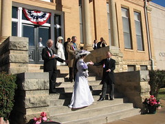
Oklahoma Statehood Centennial: inaugural reenactment: The second set is at the Carnegie Library: the reading of the statehood proclamation, the mock wedding between Miss Indian Territory and Mr. Oklahoma Territory, and the swearing-in of the new state's first officers. Mr. Oklahoma Territory was appropriately melodramatic in declaring his proposal of marriage to Miss Indian Territory. I hope to find that speech online somewhere -- it's an interesting spin on the debate over whether Oklahoma should have been admitted as one state or two.
Many of the reenactors were state officials, including the three Corporation Commissioners representing their 1907 counterparts. Oklahoma Historical Society chairman Bob Blackburn narrated, and Lt. Gov. Jeri Askins spoke briefly. (Gov. Henry was strangely absent.) Our group was seated very close to the action, on the lawn of the library. Afterwards we stayed there to watch the parade.
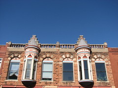
Rooflines of Guthrie: The third set is a collection of roofline photos of Guthrie's 1890s buildings. I loved the contrast between the red brick and terra cotta and the cloudless blue sky. The day could not have been more perfect, with temperatures in the 70s.
Other Flickr photographers have posted plenty of photos of the parade and the rest of the day's festivities:
If you find other blog posts or photosets about the Guthrie centennial celebration, please post links to them in the comments.
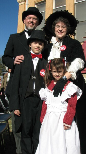
It couldn't have been a more beautiful day for a celebration. We were in Guthrie for the Centennial celebration of Oklahoma's Statehood Day. Here we are after witnessing (and participating in) the reenactment of Gov. Haskell's swearing in on the steps of the Carnegie Library.
More words and photos later this weekend.

100 years ago today at 9:16 a.m. local time, President Theodore Roosevelt signed a proclamation declaring Oklahoma the 46th state of the United States of America. Word was received by telegraph in Guthrie, the territorial and state capital, at the local newspaper office. Dr. Hugh Scott, secretary to Frank Frantz, the last territorial governor, dashed out of the building and fired his pistol in the air to signal that Oklahoma was now a state. Wagons hired by Corporation Commissioner-elect Jack Love took 60 girls from his hometown of Woodward from the newspaper office to the Carnegie Library (seen in the photo above), where Charles N. Haskell was sworn in as first governor. A parade wound through the streets, culminating in a free barbecue at the city's park.
We'll be busy celebrating today, but I hope to post a report and some reflections late tonight.
(Photo and historical details from the travelok.com Oklahoma Statehood Day Media Room.)
My wife would like to know if you know of any special events in and around Tulsa to commemorate the 100th anniversary of Oklahoma's statehood, coming up a week from Friday on November 16. True, Tulsa already had a big downtown fireworks display on the 99th anniversary and our big moment in the spotlight was in June with the buried Belvedere's exhumation, but I assume there will be some sort of commemoration here on the day itself.
Guthrie, Oklahoma's first capital city, has a week-long celebration beginning Saturday the 10th and continuing through Sunday the 18th. The apex of the week will be Statehood Day, with re-enactments of the events of November 16th, 1907: the announcement of statehood in downtown Guthrie at 9:16 a.m., the symbolic wedding of Mr. Oklahoma Territory and Miss Indian Territory, and the swearing in of the first Governor, Charles Haskell. There will be a centennial parade at 11:45 a.m. from the Masonic Temple to Mineral Wells Park featuring 13 marching bands and hundreds of participants in period attire, followed by a barbecue.
One of the greatest singing cowboys of all time is just six weeks older than the great State of Oklahoma, and this weekend the town named for him is hosting a big celebration in his honor, the Gene Autry Oklahoma Museum Film and Music Festival.
Gene Autry (the town) is a little ways north of Ardmore in south-central Oklahoma, about seven miles east of I-35 on OK-53.
The big party, featuring screenings of Autry's films and performances by cowboy singers and poets, began on Wednesday and winds up on Sunday.
The high point of the celebration is today, the actual centennial of Autry's birth on September 29, 1907. Riders in the Sky, who have been upholding the tradition of cowboy music for over a quarter of a century, will give two performances, at 3:10 and 8:30. They'll be preceded on stage by Steve Mitchell, the Les Gilliam Trio, and Johnny Western. Riders in the Sky put on a great show for the whole family -- a mix of comedy and beautiful western harmonies.
Tickets are $20 each for the matinee show and the other events, except for the evening stage show, for which tickets are $35 for reserved seats, $25 for general admission. Check the festival page for all the details and contact information.
Tulsans will be able to catch Riders in the Sky a little closer to home on Sunday -- they'll perform at the Bartlesville Community Center at 2 pm on September 30. There are still a fair number of tickets available, ranging from $15 to $43 for adults, $5 to $20 for students.
(I've seen the Riders perform at the Cowboy Hall of Fame in Oklahoma City, at the Poncan Theatre in Ponca City, at the fair in Springfield, Missouri, and at the Walton Center in Fayetteville, Arkansas. As far as I know, they have never performed in Tulsa, even though their radio show used to air on KWGS and KVOO.)
On a visit to Bartlesville's Kiddie Park last weekend, I was surprised to see bare dirt on the southeast side of the road, just across from the steam engine and the Hulah depot.
That empty space used to be home to a fixture from my early childhood -- a replica of Oklahoma's first commercial oil well, the Nellie Johnstone No. 1, drilled on that spot in 1897. We passed it often on the walk between our house on Delaware and the playground at Johnstone Park. There was some sort of marker on the site with the Cities Service Oil Company trefoil, so I assume the company had something to do with the replica's construction. (My dad worked for Cities from 1965 to 1985.)
The reason it's gone is that the current replica was "badly deteriorated." I can't imagine the repeated flooding of the Caney River was good for it. The replica was pulled down in mid-August. It had been built in 1964, replacing an earlier replica built in 1948. Sometime in September will be a groundbreaking for a new replica, sponsored by the Centennial Commission.
... no matter what Principal Chief Chad Smith says.
From the 1866 post-Civil War treaty between the U. S. and the Cherokee Nation (emphasis added):
ARTICLE 9.The Cherokee Nation having, voluntarily, in February, eighteen hundred and sixty-three, by an act of the national council, forever abolished slavery, hereby covenant and agree that never hereafter shall either slavery or involuntary servitude exist in their nation otherwise than in the punishment of crime, whereof the party shall have been duly convicted, in accordance with laws applicable to all the members of said tribe alike. They further agree that all freedmen who have been liberated by voluntary act of their former owners or by law, as well as all free colored persons who were in the country at the commencement of the rebellion, and are now residents therein, or who may return within six months, and their descendants, shall have all the rights of native Cherokees: Provided, That owners of slaves so emancipated in the Cherokee Nation shall never receive any compensation or pay for the slaves so emancipated.
I doubt I would agree with U. S. Rep. Diane Watson on much, but she's right about this.
Via Gene Veith I found an interesting new blog called Strange Maps, which is exactly what you would expect -- unusual depictions of geography both real and imaginary.
Some of the maps are of never-realized political entities, such as the county lines drawn by the 1905 constitutional convention of the proposed State of Sequoyah. The accompanying text explains the formation of the Twin Territories, the history of the convention and the reason the state, which would have included the territory of the Five Civilized Tribes, never came into being. The map has the Sequoyah counties superimposed on the same range and township grid that we still use today, so it's easy to tell that Coweta County would have been east of Yale, between Archer and the Arkansas River, with Euchee County to the west and Cooweescoowee County to the north. Oklahoma's state seal owes much to the Sequoyah seal.
What caught my eye was this map, apparently from the wall of a Niketown store, of the "United Countries of Baseball" -- an attempt to map fan loyalties to Major League Baseball teams. It's especially interesting to see where they place loyalties to teams that share a city (Cubs/White Sox, Yankees/Mets) and how they split areas that are roughly equidistant from more than one MLB city. I think the Cardinals/Rangers line is too far east; Tulsa should be right on the border.
Here is a site called CommonCensus which is collecting and using online survey data to plot the same sort of map, not only for baseball, but for other major league sports, college football, and city spheres of influence. The baseball map puts northeastern Oklahoma predominantly in Cardinal Country. There are some surprisingly large Boston Red Sox enclaves in upstate New York, particularly in the Finger Lakes and Adirondacks regions. (Guess I shouldn't have been too surprised.)
The city-influence regions seem to follow TV and newspaper market areas pretty closely. Tulsa's zone is the 918 area code, plus a bit of southeastern Kansas, minus a strip along the Arkansas border that more closely identifies with Fayetteville or Fort Smith.
commoncensus.org are still collecting data, although they haven't updated their maps in many months. You can participate in their survey from the home page.
I learned some things I never knew about the causes of the great dust storms of the 1930s in George Will's latest column, a review of a recent book about the Dust Bowl:
Who knew that when the Turks closed the Dardanelles during World War I, it would contribute to stripping the topsoil off vast portions of Texas, Oklahoma, Colorado and Kansas? The closing cut Europe off from Russian grain. That increased demand for U.S. wheat. When America entered the conflict, Washington exhorted farmers to produce even more wheat, and guaranteed a price of $2 a bushel, more than double the 1910 price. A wheat bubble was born. It would burst with calamitous consequences recounted in Timothy Egan's astonishing and moving book, The Worst Hard Time: The Untold Story of Those Who Survived the Great American Dust Bowl.After the war, the price plunged and farmers, increasingly equipped with tractors, responded by breaking up more prairie, plowing under ever more grassland in desperate attempts to compensate for falling wheat prices with increased volume. That, however, put additional downward pressure on the price, which was 40 cents a bushel by 1930.
The late 1920s had been wet years, and people assumed that the climate had changed permanently for the better. In that decade, another 5.2 million acres -- equivalent, Egan says, to the size of two Yellowstone Parks -- were added to the 20 million acres previously in cultivation. Before the rains stopped, 50,000 acres a day were being stripped of grasses that held the soil when the winds came sweeping down the plain.
In 1931, the national harvest was 250 million bushels, perhaps the greatest agricultural accomplishment in history. But Egan notes that it was accomplished by removing prairie grass, "a web of perennial species evolved over 20,000 years or more.'' Americans were about to see how an inch of topsoil produced over millennia could be blown away in an hour.
The article goes on to describe several of the great storms that occurred over the next five years: "Storms in March and April 1935 dumped 4.7 tons of dust per acre on western Kansas, denting the tops of cars." If that weren't bad enough, the storms brought clouds of ravenous grasshoppers in their wake.
We've read about government-induced or -abetted environmental disasters in places like the Soviet Union (see Aral Sea), but they've happened here too (see Mono Lake). Looks like the Dust Bowl is another example of a catastrophic unintended consequence of a well-intentioned government program.
Voting on Oklahoma's state quarter begins tomorrow. There are five finalists, which aren't yet displayed on the voting page, but you can see them here, cleaned up for coin production by the U. S. Mint. Voting ends at 5 p.m. on April 27. The coins will come out in early 2008. (Hat tip to recyclemichael for the link.)
I'm leaning toward the scissor-tailed flycatcher and Indian blanket, although the simplest of the pioneer woman designs (with the bigger state outline and calumet) isn't bad. What do you think?
MORE: Mike at Okiedoke has the vote totals from the first round and the recommendations of the experts.
RELATED: The QuarterDesigns.com website has the selected designs for each state and those early concepts that were passed over. If you wonder what designs Montanans rejected in order to pick a bison's skull (subliminal message: Californians, this is a dry, desert state where you will die of thirst -- please stop moving here), you can find out here.
Arizona's page has quite a few tongue-in-cheek proposals which were submitted to the Arizona Daily Star, including a bulldozer knocking over a saguaro, a border scene, and an assessment of the state's progress since statehood. The one with the Mission of San Xavier del Bac is actually quite nice, albeit astronomically impossible.
I like the simpler designs the best. My favorite is Texas (the quarter that looks most like the currency of a sovereign nation), followed by Rhode Island and West Virginia. The least attractive quarters resulted from states trying to cram an entire tourism brochure onto the coin.
Bronwyn at WFMU's Beware of the Blog loves the Montana quarter:
Here’s the new state motto: “Montana! Abandon hope, all ye who enter here!†The best thing is that you can put the Wisconsin quarter (2004) next to the Montana quarter, and it’s like a little before-and-after demonstration. Here’s Bossy, all fat and happy and emitting buckets of delicious milk in Wisconsin, and then she moves to Montana: Uh-oh!
In memory of Max Meyer and the natural stone tourist court he built on Route 66 north of Kellyville, an excerpt from Preposterous Papa by Lewis Meyer (pp. 99 - 102, 132-135):
Papa was a compulsive builder. He went on building binges the way an alcoholic goes on drinking sprees. When the urge to construct came over him he was powerless to resist. Appeals to reason were useless. The shortage of money didn't deter him. Nor did the nonessential nature of what he planned to build. When the building bee bit him he got a look in his eye, a tenseness in his body. He was a slave to this uncontrollable habit....After the Big House and the original barn, Papa conceived the lake and the bathhouse and the silos. Then he dug a deep water well and installed a vast underground network of pipes which brought running water to most of the houses and buildings on the ranch. When the water didn't run, it walked. Often it stopped entirely when the electric pump broke down.
After the silos, Papa dreamed up the chicken houses (which covered half an acre) and the Dance Pavilion and the tourist camp. Then came service station No. 1 (with a two-story house attached) and the tavern (with a five-room apartment in the rear) and service station No. 2.
These were his major works, his symphonies. In between them, Papa kept himself tuned up by building houses. Along WPA Row, he built six tenant houses, each with a wood-burning fireplace and a native stone outhouse. (This row of houses got its name during Depression days when Papa had his own private WPA setup, inspired by and fashioned after the government's relief program.)...
Just as a musician has his favorite motif so did Papa have his. It was building with rock. Only he didn't call it "rock"; he called it "natural stone." All of his creations, beginning with the huge, two-story Big House and ending with the wall around the lake, were built with the rocks which were so abundant on the ranch. Papa often pointed to the hill across the highway and said, "There's enough natural stone there to build a dozen cities!" (He, of course, would be the builder of them all.) He had his own rock quarry where the stones were shaped, trimmed, and cut to size. Some of his walls were made from dark, moss-covered, unchiseled stone; others were faced with quarried rock of a light sandstone color. Papa called natural stone the perfect building medium. It never had to be painted and it stood the years perfectly....
A few yards from the Dance Pavilion, situated on a quiet little dirt road leading to the highway, was Papa's tourist court. Built long before the word "motel" was coined, these cottages of Papa's caught the eye of the tourist. Ernie Cooper had built them from his loveliest quarried sandstone. Their gabled roofs were covered with bright green shingles. Each cabin contained two bedrooms, a kitchenette, a bath, and a back porch. True, the bath wasn't tiled, the kitchenette wasn't equipped, and the beds sagged. Still, Papa could proudly proclaim (and he did): "There's not another tourist court in the whole U.S.A. with a wood-burnin' fireplace in every unit!"
The tourist court surprised everybody, including Papa, by turning out to be a good investment. During World War II all six houses were rented by the month to workers of the Douglas plant in Tulsa. Papa preferred "family people" to overnight trade. He lacked the temperament of an innkeeper. He worried too much about people's morals, motives, and emotions. "I can't stop thinkin' about what's goin' on in each one of 'em," he admitted.
The tourist court was not rented during one of my summer vacations from college. I wanted to run it to make some money. My brother was defying the Depression with his operation of the tavern on a snob basis. Up and down the road in both directions he placed signs saying: Welcome Harvard, Welcome Yale, Welcome Dartmouth, and Welcome Princeton. He figured that if anyone in America had any money left to spend, it would be an alumnus of one of these Eastern schools who was driving through Oklahoma. He was right. Ivy Leaguers saw the signs and stopped for food. He even extended his sign campaign to include Welcome Williams, Welcome Notre Dame, and Welcome Big Ten.
The snob approach worked in the tavern, but it wouldn't work in the tourist court. You couldn't expect a snob to pay his money to sleep on one of those dreadful mattresses. So I decided to charge bargain rates and settle for the common people.
Papa was opposed to my running the tourist court. He tried every way he could to discourage me.
"I know the score, Papa," I assured him. "I'm in college, remember?"
Papa wasn't sold on the idea yet. "I know you can do it, Sonny, but I ain't so sure I want you to do it. Y'see, many people who want to stay in the tourist court aren't really tourists. I mean -- well, you've gotta take the bitter with the sweet, and --" He could see that being delicate was getting him nowhere. He decided to lay the cards on the table.
"Pull up a chair and sit down!"
I pulled up a chair and sat down.
"Now, Son, I'm gonna let you run the tourist court this summer because your brother has the tavern and you can use some money, too. But somebody's gotta tell you what you have to know, so it might as well be your old Dad. Rule One: Always have plenty of hot water."
"But Papa! When it's a hundred degrees outside, a person doesn't --"
"In college, huh? Do as I say. Always have hot water. You'll lose half your customers if you don't have it."
Now that he was launched, Papa threw himself wholeheartedly into his indoctrination course. "Rule Two: Some people get tired drivin' and want to rent a cabin for maybe just an hour or two to get a little rest. Don't look at 'em like you don't believe 'em. Keep still and mind your own business."
"Rule Three: Some of the people who look the tiredest from drivin' will have license plates from our own county. If they pay in advance, you've gotta believe 'em when they say they're tired!
"Rule Four: When ten couples in a row register as 'Mr. and Mrs. John Smith,' don't make any wisecracks. It's a very common name.
"Rule Five: Nobody ever got into trouble by keepin' his mouth shut."
He took a deep breath.
"Sonny boy, it's a degradin' kinda business. Bein' exposed to it can make you tough if you're not strong. But I know my son! You're gonna see what's wrong and you're gonna know what's right and you're not gonna let the wrong kinda people influence your life!"
That was as close as Papa ever came to telling me the Facts of Life. I soon found that with a tourist court I didn't need any further instruction.
With the cabins gone, I wonder if anything remains of Max Meyer's natural stone empire. Are there any photos of the ranch in all its glory? (This link will show you a Google satellite image centered on the site of the cabins.)
UPDATE 2022/11/13: In the Dartmouth Authors section of the January 1960 issue of Dartmouth Alumni Magazine, Herbert F. West '22 reviewed Preposterous Papa by Lewis Meyer '34:
This is a book well written, and a fine tribute to an extraordinary individual who came to Sapulpa, Oklahoma, in 1906 and more or less made it his own. He was no fool, Max meyer; he bought land against everybody's advice which later turned out to be land rich in oil. When the government was paying farmers for not planting crops, Max Meyer got paid for not planting crops he never had any intention of planting....The book is full of humorous episodes, and Mr. Meyer succeeds extremely well in presenting his father clearly and with great affection. There is much more in this book than a picture of a human geyser spreading himself all over Oklahoma. There is also an amusing and, I suspect, most accurate picture of Oklahoma since 1906. It is a state I have a lot of affection for, as I have many friends there, and I personally thank the author for making it relive again in my memory. I hope some day I may meet the fabulous Max.
Growing Up Jewish contains an excerpt from Preposterous Papa about the temple Max Meyer built in Sapulpa to accommodate the full range of Jewish observance and worship. If you've signed up for a free Internet Archive account, you can borrow the book and read it. Alas, they do not yet have a copy of Preposterous Papa available for lending, but they do have several other of Lewis Meyer's books.
One more excerpt from Preposterous Papa, when Max's friends invited him to join the KKK.
First, Doug Loudenback has a story and lots of vintage photos about a place that's been gone a quarter of a century: Springlake Amusement Park in Oklahoma City, which had its origins as a spring-fed swimming lake in 1918. In addition to a big wooden roller coaster and other rides, there was a swimming pool and a ballroom.
A sad and recent loss: Ron of Route 66 News reports the demolition of a local literary landmark, the native stone tourist cabins north of Kellyville, just southwest of the OK 33 junction. The cabins were built by Max Meyer and described in his son Lewis Meyer's bestselling and hilarious bio of Max, Preposterous Papa. I'll try to post an excerpt from the book later tonight.
(Here's a link to a different excerpt, about the time that some of Max's friends came to ask him to join the Klan.)
UPDATE: Please read Doug Loudenback's update in the comments. He makes some worthy points about the way a newspaper owner's business interests and personal animosities may affect the paper's coverage of a story, as it appears to have done in the Oklahoman's coverage of racial strife at Springlake Park. (Also, he mentions that he has some more photos up in his Springlake story.)
Also, on the way back from OKC on Wednesday, I drove past the old Max Meyer spread. There is one other natural stone building still standing -- part of the dairy barn? -- as well as two of his three impractically tall silos. But there were backhoes and other heavy equipment busy in the vicinity, and I expect that they will fall as well. The other natural stone building is on the south side of a metal building back from the road. You probably wouldn't notice it if you're headed westbound on 66; I spotted it (for the first time ever) driving eastbound.
About a year ago, James Lileks posted a picture of a matchbook from a chain of cafes called Harris Lunch, with locations in Ponca City, Oklahoma, and Wellington and Kingman in Kansas.
(UPDATE 2018/03/07: Lileks has since reorganized his matchbooks; here is the location of the Harris Lunch matchbook as of 2018.)
The matchbook advertises as the speciality of the house "Preacher Style Fried Chicken" and "$400 Waffles." Lileks couldn't find those phrases on the web:
Perhaps there was a contest that gave $400 for Waffle recipes, and the Harris folk won. Perhaps "preacher style" meant all white meat, since you'd give the visiting pastor the best. Who knows? These are the details we lose every day.
Does anyone reading this remember the Harris Lunch or know anything about Preacher Style Fried Chicken or $400 Waffles? Please post a comment below, or e-mail me at blog -at- batesline -dot- com.
UPDATE 2009/06/30:
Two and a quarter years after I posted this, the Long Tail of the Internet works its magic. Al Harris, son of the man who owned Harris Lunch and invented Preacher Style Fried Chicken and $400 Waffles, stopped by to post an explanation in the comments:
I happened across this article on matchbook advertising and was delighted to see this one from my father's restaurants. He built and owned several restaurants throughout Kansas, Oklahoma and other states. The Harris Lunch restaurants were very popular in Kingman, Wellington and Ponca city. My father, U.P. Harris operated the restaurants in Wellington and Kingman, while his good friend, Raymond Elmer, Sr. operated the one in Ponca city. My father had developed a secret ingredient waffle batter which he entered in a national food show competion (I believe in Chicago) in the late 1930's or early 40's. He won best of show and a $400 prize for the waffle. At that time that was a great deal of money. He also perfected a special batter and method of cooking chicken that was good enough to bring your preacher to dinner, thus the term "preacher style chicken". The old Harris Lunch in Kingman, Kansas was moved from its original location along Highway 54 to the fair grounds where it was used for many years. I have run across an old photo of this restaurant in Kingman recently while attending a family funeral in Kingman.
UPDATE 2016/05/30:
Gary Hodges from Waldport, Oregon, worked for the Preacher-Style Fried Chicken outlet in Ponca City, and his sister was married to the son of the owner. He sent a note last summer (which I'd intended to post at the time) and a photo:
I worked for Raymond Elmer Sr. (after school) in Ponca City. My sister married Raymond Elmer Jr. in 1946. In 1948 my brother and I rode the "Doodlebug train" from Ponca to Kingman Kansas to see my "big sister" and brother in-law.Both of them worked at the Harris Cafe for Raymond Sr. and wife Sarah Elmer. At that time we were introduced to Preacher chicken and $400 waffles. I later worked at the Elmers' cafe in Ponca, when it opened in 1950. I was the after school chief dishwasher.
Had a lot of fun and at later got to do some of the prep work for the chicken and waffle batter. Having made the batter 65 years ago, I should be able to replicate the $400.00 waffle, but, I can't. I think mine turn out to be $4.00 waffles.Those were $400.00 waffles and the chicken good for a preacher or a king. In Ponca, Raymond Sr. had 3 double waffle irons on the line, and what a terrific smell that was when you walked in for breakfast.
Doodlebug? It was a self-propelled railcar -- effectively an interurban car carrying its own gas-powered generator to run the traction engine, rather than drawing power off of an overhead trolley wire.
Gary also sent this photo of Raymond (Sr.) and Sarah Elmer in front of the Harris Lunch in Ponca City:
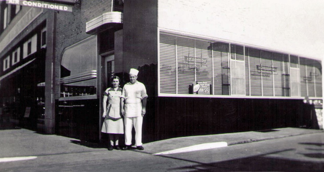
Gary wrote again this week, with more details about the process:
I worked for Raymond and Sarah Elmer in the late 40s in Ponca City. My Sister Patty was married to their son Raymond Elmer Jr. Both Patty and Raymond jr. are deceased.I was the Elmers' Cafe "pearl diver" for a couple of years while I was in middle school in Ponca City. At the time, they were operating the Elmers' Cafe on west Highland st. in Ponca. The waffles were outstanding and I think their quality was more about the process they used to mix them and the irons that were used to cook them. Otherwise, they contained basic waffle ingredients. Their heated butter, syrup and hot plates greatly added to their popularity.
Related to the origin of Preacher Fried Chicken, As I remember it, Ray Sr. wanted a chicken which could be ready to eat in a few minutes from the time it was ordered by the preacher and people just getting out of church. As a result he par boiled cut chickens and cooled them. The chicken served out of the deep fryer was extremely tender and when the chicken pieces were dipped in flour and batter and cooked in a deep fryer the results were prompt and super tasty. As I recall, it would take 7 to 10 minutes depending on the size of the chicken portion, to prepare a plate of chicken, potatoes, cream gravy, green veg, and hot rolls ready to be served. I certainly enjoyed working for them and learned a lot about the world of work as a 8th and 9th grader while washing the dishes, etc. To this day, I still prefer fried chicken prepared the Elmers way.
UPDATE 2018/03/07:
Jeff Elmer, son of Raymond Elmer Jr., wrote with more information about the restaurants that the Elmer family operated in Ponca City:
I was very happy to see an article referring to my family. I read your article about the Harris Lunch in Kingman and Mr Harris' reply regarding his father and my grandfather, Raymond Elmer Sr. (March 2007 continuing to 2009). Gary Hodges that replied is my mother's brother.My grandfather helped to run the Harris Lunch in Kingman and later relocated to Ponca City at the Harris Lunch there until he opened the Elmers' Cafe on west Highland in Ponca City in the late 40's which him and my grandmother operated until the mid 60's.
I was born in 1952 and grew up in the Elmer's Cafe. I spent a lot of time there in my younger years before I started school. Chicken and Waffles was something people ordered.
Mr Harris' story about the preacher fried chicken was probably how the name came about and it was very unique too. What made it special was the way it was prepared. It allows for part of the cooking preparation to be done ahead of time. The raw chicken is cut up into its appropriate parts and boiled. I am sure he seasoned it some. Then the chicken along with the water (broth now) it was boiled in was put in containers and refrigerated. So the chicken is now already cooked and waiting for an order.
To prepare this to serve it must be battered and deep fried to golden brown. To do this there is a pan with water (I think that there might have been something else in the water but it might just be cloudy after being used a few times battering the previous orders) and another pan with a mixture of flour, and pepper (could have had another spice or 2). The chilled chicken pieces are taken from the water they are in and rolled/dredged through the flour, then in the water and back in the flour. These are placed in the deep fryer just until the coating is a light golden brown and the chicken has been heated up, making that first bite piping hot and delicious.
There is still a restaurant in Ponca City in approx the same location as the Harris Lunch was and a restaurant still in the same location as the Elmer's Cafe. I guess my grandfather knew good locations.
The Harris Lunch building now houses the Happy Days Cafe, on the northwest corner of 5th and Grand in downtown Ponca City, although the chrome and Vitrolite (or is it Carrara?) you see in the photo above are long gone. The menu of the Happy Days Cafe lists its predecessors on that corner, beginning in 1939 with the Harris Lunch operated by Raymond and Sarah Elmer. In 1947 "Doc" Oxford took over, changing the name the following year to The Oxford. That would line up with the late '40s or 1950 start for Elmers' Cafe, as mentioned by Jeff Elmer and Gary Hodges.
Country Kitchen Restaurant at 622 W. Highland looks like it might have been home to Elmers' Cafe.
Something I never knew, from a George Will column about the prospect of making the District of Columbia a full-fledged state (emphasis added):
The new state probably would promptly enact a commuter tax hitting Maryland and Virginia residents. And, more important, the splendid vistas of the nation's capital might be jeopardized. They are protected by the limits on building heights that Congress mandates. But Congress would have no authority to impose such mandates on the new state. Congress admitted Oklahoma to statehood on the condition that Guthrie remain the state's capital until 1913. But in 1910 Oklahoma made Oklahoma City the capital, and the U.S Supreme Court held that statehood could not be conditioned by limiting a state's sovereign powers. Anyway, 38 state legislatures are unlikely to make of D.C. the only state with no rural interests, and one dominated by a single interest -- the federal government.
Doug Loudenback has a nearly comprehensive history of downtown Oklahoma City hotels from the beginning to the present day, illustrated with postcards, vintage photos, and present day photos. The fate of each hotel is described. One of the more interesting "whatever happened to" stories involves the Holiday Inn (built in 1964) on the west side of downtown, which last operated as a hotel in 1993, closing for good just before the launch of MAPS. Here's what Doug found when he rang the doorbell:
A pleasant young lady came to the door, spoke with me, did not invite me in, but, after a time, she allowed (at my request) that I enter the lobby since it was so damn cold outside! The lobby area was beautifully appointed just like a fine hotel would be. At the lobby desk, we were joined by another pleasant young lady. There, I asked a few but not many questions (understanding that I was an uninvited guest and not wanting to be too pushy) and not necessarily in this order:(1) Was the building owned/used by the City of Oklahoma City (given the OKC flag flying in the frontage)? Answer: No.
(2) What is the building used for? The young woman who allowed me in said something like it was a character development center. I said, "You mean, like a rehabilitation center?" She said, no, it had nothing to do with rehabilitation. I asked her to explain a little. I don’t recall her exact answer, but it had to do with training programs to build character. Not really understanding and not wanting to be too nosey, I asked if I could have a brochure or something simple, and she gave me a single sheet "flyer" type of paper with the name "Character Council of Oklahoma City" at the top and which contained a picture of Mayor Cornett at the bottom. I asked if there was a website where I could read more, and the young lady gave me this address: http://www.characterfirst.com and, later, I noticed another name on the "flyer", http://www.characterok.org. She also said that a monthly breakfast and lunch was available, the next being 1/24 at 7:00 a.m. and 1/26 at 11:45 a.m., and that I would be welcome to attend (after telephone a fellow to let him know for planning purposes). I asked about the condition of the building above the lobby level and I was told that most of them had been reconditioned, all but 2 or 3. I did not ask what they were used for but didn't get a clear answer about that. That was pretty much the extent of my visit and I left with good feelings generated from the pleasant ladies but still not knowing a lot more than I did in the first place.
Doug did some further digging and learned that the Character Training Center is part of the Bill Gothard empire. The heart of Gothard's teaching is that God's blessing is to be found in unquestioning obedience to the God-ordained authorities to which you are subject. (Here is a pretty fair Time story on Gothard from 1974.)
A version of his teaching that has been sanitized of any religious content has been adopted by many cities, including Owasso. Owasso City Manager Rodney Ray is quoted on the Character Cities website about the program's results:
In the three years prior to our character initiative, we had 42 labor grievances and employee grievances, and seven different lawsuits. In the three years since we put the character initiative in place we have had two grievances and no lawsuits from employees.
State Superintendent of Public Instruction Sandy Garrett also provides a testimonial:
From experience, I have found this program to be an excellent tool for filling the void of moral character within our state's youth… I recommend the implementation [of this program] within every level of state and local government.
Oklahoma is a "State of Character," which would explain why we have a state-sponsored lottery and public officials going to jail at regular intervals.
During my time as a member of the Oklahoma Republican Committee, many of our quarterly meetings were held in the center's meeting rooms. While there were always a few staffers around the lobby desk, I noticed that they were always polite but never outgoing, and they never seemed to talk to one another. For young people, they seemed emotionally buttoned up.
The walls of the lobby are decorated with framed posters of each of the 49 character qualities that Gothard has identified, each illustrated with an animal who exemplifies that quality. (Some of the connections are quite a stretch, but it would be disobedient to point that out.) If you run in Tulsa's River Parks, you've seen the names of these qualities stenciled on the storm sewer blocks.
(Gothard has also identified 49 "general commands of Christ", each of which he assigns to one of the 49 character qualities.)
Teaching good character is a fine thing, but there doesn't seem to be any need in Gothard's system for grace, atonement, and forgiveness. Jesus appears only as a lawgiver, not as the one who perfectly fulfilled the Law's demands on our behalf. It's a good moral system, a fine civic religion, but it isn't the Gospel.
If you can filter all the Christian content out of a program without substantially changing it, it wasn't all that Christian to begin with.
UPDATE: Doug Loudenback adds a comment and a link to a lengthier account of his research into the owners of the old downtown OKC Holiday Inn. And his article links to another account of someone who wondered what was going on in that building.
Back before I came across blogs, I used to be a regular reader of the websites of many newspapers, including the online edition of the New York Press, an alt-weekly that was at the time published by Russ "Mugger" Smith, who was fairly conservative for an alt-weekly publisher. (I starting reading Smith's column from the Jewish World Review website.)
The Press varied widely in decency and quality, but one column was always worth reading: "Old Smoke" by William Bryk. Bryk wrote about history, mainly some aspect of the history of New York City which shed light on a current event. (I seem to recall one piece about Five Corners, providing the historical background to the movie Gangs of New York.)
But there's one article that I've been looking for years, something Bryk wrote in 2002 about an obscure but fascinating figure in Oklahoma's history, a criminal defense attorney named Moman Pruiett. The story vanished during one of NYP's site redesigns, but it's up and available once again. Here's how it begins:
Next month, when a revival of Rodgers and Hammerstein’s Oklahoma! opens on Broadway, audiences will have a taste of how entertaining history can be. Set nearly a century ago, on the eve of the Sooner State’s admission to the Union, the musical’s vision of life before statehood is accurate, up to a point. But Oklahoma’s real history is far more entertaining. Whether as the Oklahoma and the Indian Territories or as a new state, Oklahoma was a gold mine for an unscrupulous lawyer, and it had many of them. Among the greatest was Moman Pruiett (1872-1945), "The Black Stud of the Washita," "the murderer’s messiah," himself a man "as liable to punctuate a point with a bullet as an epigram." "Brutal murder–single, triple, five at a time, with poison, axe and firearm," was his meat. "I ain’t no attorney," Moman said. "I’m a lawyer."Yet he had no respect for the law, and took immense pride, as he put it, in putting the prong to the blind goddess. In half a century at the bar, he defended 342 murder cases. Of those, 304 were acquitted; 37 were convicted of lesser charges; the one sentenced to the rope received a presidential commutation. Perhaps the title of Howard K. Berry’s delightful biography, published last year by the Oklahoma Heritage Association, says it all: He Made It Safe to Murder.
It is a fascinating sketch of an utterly charismatic and unscrupulous man who embodies the wildness of Oklahoma's early days. Your centennial assignment this week: Go read the whole thing.
About the only brick-and-mortar shopping I do any more is around gift-giving season. I found several books that got me to stop and thumb through them for a few minutes:
Tulsa architect and author John Brooks Walton, who has published a series of books on Tulsa's Historic Homes, has several new books out. One is called The Artwork of Tulsa, photos and articles about pieces of public art (pieces that aren't in museums) around town, everything from that weird hunk of metal on City Hall Plaza ("Amity"), to the terra cotta designs on the exterior of the Tulsa Fairgrounds Pavilion, to the Ten Commandments on the exterior of Temple Israel, to "Appeal to the Great Spirit" on the grounds of Woodward Park.
Walton also has a book on historic homes in Ponca City and a new book on the work of architect John Dilbeck, who designed homes in Dallas and Tulsa, as well as several notable commercial buildings. You know that pretty cottage at 19th and Peoria, the one that looks like it was transplanted from Elizabethan England? That's a Dilbeck.
(Steve's Sundries at 26th & Harvard is a great place to browse and buy books by and about Tulsans.)
The Oklahoma Centennial Committee commissioned music columnist John Wooley to write a book on the history of Oklahoma's distinctive music. It's called From the Blue Devils to Red Dirt: The Colors of Oklahoma Music. In addition to the two bookends in the title, the book has chapters on Bob Wills and western swing, Woody Guthrie, Tulsa-based impresario Jim Halsey. A chapter traces the development of the "Tulsa Sound" that flourished in the '70s -- it all started with a band that took over for Johnnie Lee Wills at Cain's Ballroom in 1959. (Some kid named Johnny Cale played with them.) The bits I read were quite interesting. The back of the book has a listing of the membership of the Oklahoma Music Hall of Fame and the Oklahoma Jazz Hall of Fame. The chapter on western swing is excellent, and not only tells the story of Bob Wills and his brothers and their years in Tulsa, but of the many other acts that emerged in their wake.
The Stratocaster Chronicles tells the story of Leo Fender's solid-body guitar, which debuted in 1954, the technical advances that made it different, and the musicians who made the instrument famous. There's a great full-page photo of Eldon Shamblin posing in front of Cain's Ballroom with the demonstrator model that Fender gave him. The caption spells out how Shamblin modified it to make it his own.
I started writing this entry last Saturday, November 11.
As it was the second Saturday in November, we headed down to the south side of Oklahoma City to Uncle Dan and Aunt Connie's house for an early Thanksgiving celebration with Mom's side of the family. Good food, a chance for everyone to get to see the baby, and some time to slump on a comfortable sofa, watching the Nebraska-Texas A&M game through closed eyelids.
Since it was the old road's 80th birthday, I had hoped to drive some Route 66 on the way down, but we got off to our usual slow start and had to stick to the turnpike to get to Aunt Connie's in time for lunch.
On the way home, close to dark, we decided to drive some of the old road anyway. The 10-year-old boy immediately began agitating for a dinner stop at the Rock Cafe. We drove the segment from I-35 east of Edmond to I-44 east of Wellston. I had seen some billboards which left me with the impression that Pops, a new landmark on the highway west of Arcadia was already open. (It's not -- opening is set for summer 2007.)
Everyone was getting hungry, so we jumped on the turnpike at Wellston and got off at Stroud.
(A note to the good people of Stroud: Those ridiculously bright "acorn" lights may look lovely and quaint during the day, but at night the glare from them actually hides your Main Street buildings from view. Much of the energy of the acorn lights is wasted, shining up into the sky or into the eyes of oncoming drivers, rather than onto the street where it's needed. Consider at least replacing the bulbs with something lower wattage, or better yet, replace the fixtures with full-cutoff IESNA-compliant lamps that will give you the historic appearance you want, without the glare. Here's an entry from my archives about good and bad streetlighting.)
As we walked from the parking lot into the cafe, I spied a familiar-looking orange VW van. "That looks like Fillmore," I said to the kids, referring to the hippie van from the movie Cars, voiced by George Carlin.
The Rock's owner, Dawn Welch, came by the table to say hello. We told Dawn about seeing Cars at the film festival and hearing Michael Wallis speak.
(As I was watching Cars, listening to Sally the Porsche give an impassioned speech about taking care of and taking pride in their bypassed and beleaguered town, I remembered the poster on the wall behind the east end of the counter at the Rock Cafe, a snapshot of a white board from some sort of brainstorming session on how to make Stroud a better place. Art imitates life.)
Dawn pointed out the gray-headed fellow with the bushy beard who was sitting at the counter. As I had guessed, it was Route 66 artist Bob Waldmire, owner of that VW van. Waldmire and his van were the inspiration for the character Fillmore. Waldmire travels the road much of the year. Dawn says he never calls ahead; he just shows up. He creates beautifully intricate pen-and-ink drawings and watercolors of landmarks and birds-eye-views along the old highway, filled with tiny, neatly-lettered descriptive text. (Here's a webpage with a picture of Bob Waldmire and several examples of his work.)
After a while we introduced ourselves. Bob went out to his van and brought back a couple of cartoons he had drawn, depicting a meeting between Fillmore and his own van, and he signed one for each of the kids, and also gave them his calling card -- a postcard drawing of his van, announcing that "The Unofficial Old Route 66 Mobile Information Center (piloted by R. Waldmire)" is "coming soon to your town!"
With some prompting from Mom, my 10-year-old told Bob about some difficulty he was having painting a watercolor of an owl for art class at school. Bob went back out to the van, brought back his watercolors, and told my son about some of his watercolor techniques. Bob also gave him a card with his drawing of a great horned owl (showing how he used pencil along with inkpen to create the delicate texture of the owl's chest feathers), a watercolor cartoon showing the Cozy Dog couple as bikers riding down 66, and a watercolor he did for TNT Engineering, Inc., in Kingman, Arizona, depicting a VW bug and two VW buses (both split window and bay window) in front of a stunning desert landscape. (Here are two in-progress photos of a mural Bob is doing on TNT's building in Kingman.) He also gave us a copy of his Route 66 Scenes map of Oklahoma.
While we were talking with Bob, Emily Priddy, Route 66 activist and Red Fork Hippie Chick, came into the Rock Cafe. (She was wearing a very cool jean jacket with a big 66 shield on the back, with big shiny sequins outlining the numbers like the reflective discs you see on some old highway signs.) Emily was helping with the Mother Road 100, a 100-mile ultramarathon, which had begun Saturday morning at 7 in Arcadia. Emily was helping to pace a friend who was in the race, and then would be manning the aid station at Kellyville. (She has a detailed account of her weekend on her blog: "I don't know whether that was the most amazing weekend of my entire life, but if it wasn't, it didn't miss it by much.") Emily got some photos of the whole family with Bob (which I'll post later). When I went to pay for our dinner, I learned that she'd perpetrated another random act of kindness. What a sweetheart!
We said so long to Bob as we left the cafe -- we'd see him in Clinton next June if not sooner.
I decided to drive the old road the rest of the way to Tulsa. We watched with amazement as the ultramarathoners made their way along the other side of the highway. Emily had told us they were only expecting 30 runners to make it to Kellyville, 84 miles into the run, but it was apparent that many more were still in the race. The last runner we passed was at 9:40 p.m., near the Creek County Speedway, probably about 85 miles in. That's an average speed of 5.8 miles per hour, including rest stops, sustained for 14.67 hours.
It was a magical evening, a perfect way to mark the start of the Mother Road's ninth decade, on her birthday and mine.
Just a quick note to say our family had a great time at the Riverwalk Cinema for the opening night of the Oklahoma Centennial Film Festival. My daughter and I saw Cars -- it was my first time. What a great movie! It really captures the spirit of Route 66.
My oldest son had music class, so he couldn't join us until later. My wife and the two boys came just in time for Michael Wallis' talk about the history of Route 66, tying together the facets of the road on display in Cars and the role the road played in the history told by the film that followed, The Grapes of Wrath. (My son was excited to get to meet Mr. Wallis in line at the concession stand. He said he wouldn't tell his friends at school, though, because they wouldn't believe him.)
My wife took the daughter and the baby home, and oldest son and I stayed around for The Grapes of Wrath. I read the book in high school but had never seen the film. (And this was a real film, complete with scratches and a film break at the very beginning. It was fun to hear the whirr of the projector, a rare sound nowadays.)
It's a shame, though, that the theater was so empty. For $5 each you could see two great movies on the big screen and hear a talk by a master storyteller and an authority on Route 66, but it the theater was only 25% full. That may be a generous estimate.
Don't squander the rest of your opportunities. (Alas, we already had plans to be out of town for a family event.) Tim Blake Nelson will be present for a screening of his film Eye of God Saturday night at the Circle Cinema. Harvey and Oklahoma! are showing on Sunday. Here's a link to a PDF copy of the complete schedule.
Your attention, please! The Oklahoma Centennial celebration is at hand!
Wait, you say. Oklahoma became a state in 1907. November 16, 1907, to be precise. This is 2006. The Centennial is next year, right?
That's right, but Sharon King Davis is in charge of Tulsa's celebration of the state's 100th birthday, so we're celebrating it a year early. Nearly all the special Oklahoma Centennial events in Tulsa will take place this month.
Davis was also in charge of Tulsa's centennial celebration. Although Tulsa was incorporated in 1898, all but a few of the centennial events were held in 1997, evidently to keep the tourists off-guard. The biggest events were held in September of '97. If you decided to, say, fly from Bath, England, and Cape Cod, Massachusetts, to visit Tulsa for the first time since 1936, and you thought the summer of 1998 would be a good time to visit and catch some special Tulsa centennial events or exhibits, you were out of luck.
(And yes, I know some people who did just that. A couple of sisters, along with the husband of one of them, who grew up in various oil towns around the state in the '20s and '30s, visited the summer of '98. We met one of the sisters in '96 when we were touring a historic home in Cape Cod. When we told her we were from Tulsa, she told us she was born in a place we would never have heard of -- Denoya, which I correctly identified as a boomtown in Osage County also known as Wizbang. When she, her sister, and brother-in-law came to Tulsa, we had dinner at The Spudder -- closest thing we had to an oil history museum at the time -- and I gave them a driving tour of the city.)
I understand the logic -- we're celebrating the 100th year, leading up to the 100th birthday. And I guess it's reasonable for Oklahoma City to get the big celebration at the end, so Tulsa is getting the kickoff celebration at the beginning of that 100th year. Still, I think a lot of Tulsans and a lot of potential visitors aren't going to be expecting all these special events to happen even before we reach our state's 99th birthday.
So pay attention!
One of the first events on the calendar is a film festival, to be held jointly by Circle Cinema and Riverwalk Movies. The festival features a lot of great films about Oklahoma, filmed in Oklahoma, or with some connection to Oklahoma.
Here's a schedule in PDF format. The festival starts Thursday, November 9, and ends Sunday, November 12.
On Thursday, November 9, Circle Cinema will show Tulsa, the 1949 film starring Susan Hayward and Robert Preston, and two films based on books by Tulsa author S. E. Hinton, directed by Francis Ford Coppola, and filmed in Tulsa: The Outsiders and Rumblefish
On Friday, November 10, they're showing Pixar's Cars on the Riverwalk, followed by a talk by Michael Wallis, Route 66 expert and the voice of one of the cars (the sheriff) in the movie. That will be followed by The Grapes of Wrath. At the Circle, they're showing Will Rogers' last movie, Steamboat Round the Bend and a couple of documentaries, one about Tar Creek, one about The Flaming Lips. (The latter sounds like the effect of taking a drink of water from the former.)
At the Circle on Saturday evening, November 11, Tim Blake Nelson (aka Jess Lee of Big Hollow Resort) will be present for a screening of his film Eye of God, which is set in Kingfisher. On Sunday, November 12, they're showing Harvey (Tulsa's Peggy Dow Helmerich was in the film that starred Jimmy Stewart as the man with the imaginary six-foot rabbit), followed by the big screen Shirley Jones - Gordon MacRae version of Oklahoma!.
And there's more. Click the link above for all the details.
The late, lamented Downtown Guy (OKC) blog (the blog is late, not the Downtown Guy) had a fascinating story about the underground Chinese community that existed in Oklahoma City until just after World War II. I don't mean underground in the metaphorical sense of out of the mainstream. I mean subterranean, with tunnels linking basements of various downtown buildings. Part of it was uncovered during construction of the Myriad Convention Center in the late '60s.
The story has resurfaced, as it were, in an extensive entry on Doug Loudenback's excellent blog on Oklahoma City history. And here's the article on Oklahoma City's underground Chinatown by Larry Johnson which Doug quotes at length. It's one of those exotic bits of history that the textbooks missed out on. Go check it out.
Joel Blain emails to tell me about an amazing archival find. Oklahoma historian Currie Ballard has found 33 cans of motion picture film documenting life in the African-American community in Oklahoma in the 1920s. The American Heritage Places website has a page with information about the discovery and a few short clips:
The film shows them thriving in the years after the infamous Tulsa Riot of 1921, in which white mobs destroyed that city's historic black Greenwood district, which was known as the Black Wall Street of America. Through the flickering eloquence of silent film we see a people resilient beyond anyone's imagining, visiting one another's country homes, parading through downtown Muskogee in some two dozen Packards, crowding an enormous church in Tulsa not long after the riots, during a gathering of the National Baptist Convention.
Indeed, this extraordinary archive exists because someone at the powerful National Baptist Convention assigned the Rev. S. S. Jones, a circuit preacher, to document the glories of Oklahoma's black towns, Guthrie, Muskogee, and Langston. Reverend Jones surely has a way with a camera as he comes in close on the animated faces of his neighbors, sweeps wide to track black cowboys racing across a swath of ranch land, or vertically pans up the skyscraper-high oil derricks owned by the Ragsdale family, whose wells produced as much as a thousand barrels a day. We know the names of these families and others because typed labels accompany each of the eight-minute cans, and onscreen titles introduce the various segments.
But this treasure trove of film is at risk, and Currie Ballard needs help in preserving it:
Ballard admits that he mortgaged his life away when the opportunity arose to acquire this treasure. Now he's hoping to find an appropriate institution to take it over and transfer the highly unstable film to disk, a costly operation. He wants the world to view this material, to make people aware that only 60 years after emancipation, and in the shadow of one of the nation's most violent and destructive race riots, these people persevered and built anew. Perhaps someone out there, watching this, right now, will take the lead.For more information contact Wyatt Houston Day, a bookseller and archivist who has been working with Currie Ballard. He's at whdbook@erols.com.
If you can help, or know someone who can, get in touch.
UPDATE 2017/07/03: The film archive rescued by Ballard is now part of the Yale University Beinecke Rare Book and Manuscript Library. The Solomon Sir Jones Films, 1924-1928, are available for viewing online.
The Governor's Office website has posted the 10 finalists for the design of Oklahoma's entry in the U. S. Mint's series of state quarters. Because the Governor's site doesn't let you look at the 10 designs side-by-side, I've uploaded them below.
| 1 |  |
2 |  |
3 |  |
| 4 |  |
5 |  |
6 |  |
| 7 |  |
8 |  |
9 |  |
| 10 |  |
To say the sketches are rough is an understatement, but the website says that any design will be refined by the Mint to meet their production requirements.
There are elements of several that I like, but there isn't any one that I like entirely. I guess it's too late to come up with another alternative. I like the state outline, but there's no need to put it at a rakish angle as 3 and 9 do. The 46 stars in 1 and 2 are overkill.
The Pioneer Woman statue works nicely, as does the oil derrick. They aren't simply symbols -- they're also landmarks, something you could come to Oklahoma and see.
(I'm not sure how well a gushing derrick works on a coin. Maybe just a derrick with -- I dunno -- a gigantic roughneck standing next to it, resting his hand on it.)
Our Indian heritage ought to be included, but I'm not sure that the calumet is the best way to symbolize it. The Cherokee star would look very nice on a coin, but that would exclude the other dozens of tribes in the state.
My son likes number 6, and he recognized the Indian paintbrush and scissortail flycatcher, but he thinks it would be even better with the state outline in the background.
A couple of other possibilities -- again, it's probably too late for new ideas -- would be the Osage shield from the state flag, either by itself or over a state outline, or, from our state seal, the farmer and Indian shaking hands in front of an Oklahoma outline. (In the latter case, it would be very appropriate to use Mike of Okiedoke's suggestion for a new state motto.)
You can vote for up to five of the 10 coins and read explanations for each design at the Governor's website.
(Side track: That Flags of the World entry for Oklahoma includes the text of the 1988 legislation which standardized the flag's colors, in terms of the Pantone Matching System. When I ran for City Council in 2002, I used the French Blue of the flag's field, Pantone 285c, for my campaign yard signs.)
Wow! The Oklahoma Department of Transportation has scanned and posted official Oklahoma state highway maps going back to statehood. There are the annual maps produced from 1924 to 1996, the biennial maps produced since 1997, and a few early maps from 1873, 1907, 1916, 1919, and 1921. For most of the maps, there's also a scan and a description of the back of the map.
I've been looking at the 1916 map, which shows the highways overlaid on the township and section grid, along with railways, rivers, and county lines. Although many of the inter-town routes on the map were later incorporated into numbered highways, not all were. For example, there's the road from Tulsa to Jenks: Peoria to 71st to Lewis to the 96th Street bridge. Or from Catoosa to Broken Arrow: 193rd to 11th to Lynn Lane. The road from Tulsa to Bixby and Broken Arrow went down Harvard and 51st to Memorial, with the BA route splitting off at 71st and the Bixby route, shifting 1 mile east at 111th to Mingo. The map shows the bridge crossing about halfway between Mingo and Memorial.
Tonight I've come across a few interesting links about Jewish history in Oklahoma. In honor of Passover, which began Wednesday night, here they are.
The quote in the title is from a brief history of Congregation B'nai Emunah (PDF format), and it's a reminiscence of the mid-1930s:
Mrs. Harry Cohen, recalls [1966] the sign which hung in women’s balcony of the old Synagogue which read in Yiddish: “Der Kommitet bet men zol rayden vayneeger oon davenen mehrer!” (The committee requests that you talk less and pray more!) “The women’s minds were not on the ‘davening,’ for the Cantor, below, could not be heard well in the balcony. Other noises competed: children running up and down the stairs, sliding down the banisters, and cracking of peanuts. “When the noise got unbearable, the Cantor would lose patience and stare at the balcony. Finally, with the palm of his hand, he would pound on his siddur and shout: ‘Sha, sha!’”
Going further back to the 'teens:
Far to go to a butcher shop for the kosher meats in those day? Not really, since one had a choice of shopping at Max Feldman’s store (brother of Robert A. Feldman) located at the corner of Haskell and Main-Boulder…or at M. Green’s store on 9th Street between Cincinnati and Detroit. Both stores also had customers in the small northeastern Oklahoma towns to whom they sent their wares. “Tulsans were very observant Jews, very religious and very congenial.” This was the immediate reaction Mrs. Alfred Aaronson had when she arrived here in 1915. “In general,” she says, “my first impression of the orthodox community here were of a close-knit and happy group.”
B'nai Emunah began as an Orthodox congregation, but is now Conservative, while Temple Israel is Reform. Tulsa also has a Chabad House, part of the Lubavitcher movement.
Tulsa has the finest museum of Jewish art and culture in this part of the country. It's the Sherwin Miller Museum of Jewish Art, just north of 71st Street and a bit west of Lewis on Wallenberg (Wheeling) Ave.
The museum has an exhibit of photographs about the Jews of rural and small-town Oklahoma. It's called the Prairie Landsmen Project. The website has thumbnails of photos from the museum's collection, by David Halpern: "In these photographs, I have chosen to examine some of the families and individuals in the smaller cities and towns [of Oklahoma]. They may be the last bastions of a shrinking non-urban population. Unlike the European communities from which their ancestors fled to escape bigotry, the forces that influence their futures are likely to be the same as those that affect their neighbors."
Then there's this article from the magazine Aufbau from 2002 about the Jewish community in Oklahoma. In addition to religious leaders, they talk to then-State Treasurer Robert Butkin, who grew up in Duncan. The article talks about the migration of Jews from small towns to the two major cities.
I am a brother of Zeta Beta Tau, a fraternity that was founded in 1898 to serve Jewish college students, who were at the time excluded from most Greek-letter societies. Although ZBT had been non-sectarian since 1954, when I pledged Xi Chapter at MIT in 1981, about a third of the brothers were Jewish.
Although I had Jewish friends and classmates growing up, it was fascinating to see Jewish life on a daily basis and to observe the range of observance and devotion, from a laid-back agnostic from California, who kept the High Holy Days but not much else, to a devoutly orthodox Long Islander who strictly observed the Sabbath and the kosher dietary laws. Many if not most of my Jewish fraternity brothers became more observant and more attached to their heritage over the course of college.
Our house was one of two MIT fraternities in the town of Brookline, a suburb surrounded on three sides by Boston. Brookline was home to a large Jewish community, mainly composed of several generations of immigrants from the old Russian Empire and their descendants. A few blocks from the house was Harvard Street, home to a glatt kosher butcher, a fish shop, a Jewish bookstore, a bagel shop (Kupel's -- one of the brothers served as the fraternity's bagel chairman, and it was his job to bring back fresh bagels from Kupel's every Sunday morning), and a number of kosher delis and restaurants.
If you want to keep a strictly observant Jewish home, Brookline has the necessary support system. (As a city of older, traditional mixed use neighborhoods, Brookline not only passes the popsicle test, it also passes the Sabbath test -- plenty of places to live within Sabbath walking distance of a synagogue.)
Since coming back to Tulsa, I've wondered if it's easy, or even possible, to keep kosher here. Where would you buy kosher meat? Are there any kosher restaurants here? Every March or April, I see matzoh and related kosher-for-Passover products for sale in the supermarkets, so that level of observance at least must be common here.
More importantly for a non-observant Gentile like myself, I wonder whether kosher-for-Passover Coca-Cola can be found in Tulsa. I remember how amused I was the first time I saw Hebrew lettering stamped on top of a Coke can. The letters, I later learned, indicated that the product was OK for consumption during Passover, when corn products, and therefore the high fructose corn syrup used in soft drinks, are forbidden. That meant that for a small window of time each year, you could drink Coca-Cola as Dr. Pemberton intended -- made with real sugar. (OK, not exactly as Dr. Pemberton intended; it still had caffeine instead of coca extract.) Coke with real sugar had more of a bite. I've heard you can get KP Coke in New York and Boston, but I wonder if it's available anywhere in this part of the country.
If you live in Tulsa and keep a kosher home, I'd love to hear how you manage it. Please drop me a line at blog at batesline dot com, or leave a comment below.
I went to a presentation this afternoon at Central Library about the digital version of the Sanborn fire maps. These are maps that were created for fire insurance purposes from before the turn of the 20th century through the 1960s, showing details of each structure -- number of stories, footprint, building material, and sometimes the name or type of business. It's a valuable resource for trying to reconstruct what was where at a given point in time.
Tulsa City-County Library card holders have access to fire maps for Oklahoma online, from anywhere on the Internet, via this link. If you're not in a library, you'll have to log in with your last name and library card number.
I've got an idea for a series about lost downtown Tulsa, going block by block, telling what was on each block over the years before it was turned into asphalt. These maps, combined with city directories, will be a valuable resource. Just so no one else claims it, I'll give you my working title: "If Parking Lots Could Talk."
Before statehood, the Cherokee Nation was divided into nine judicial districts, each with its own courthouse. (My favorite district name: Cooweescoowee, the Cherokee name of John Ross, who was principal chief when the nation was forced down the Trail of Tears to Oklahoma. Oklahoma highway 88 between Claremore and Oolagah was once designated the Cooweescoowee Parkway.)
Only one of those courthouses survive. The Saline District Courthouse was built in the 1880s, and it sits on the east side of the Delaware-Mayes county line, south of Scenic US 412 (old State Highway 33). According to a story in Tuesday's Whirled, there's talk of designating the courthouse the Cherokee Nation's first national park. The building needs restoration, and it was on Preservation Oklahoma's 2004 list of "Most Endangered Places".
There's an organization devoted to restoring the courthouse, although the name sounds like a group dedicated to keeping meat the old fashioned way: The Saline Preservation Association. Visit the website to learn how you can help.
The OSU Library Electronic Publishing Center has converted to HTML the first 20 volumes of the Chronicles of Oklahoma, the journal of the Oklahoma Historical Society. The volumes were published in the years 1923 - 1942, but the subject matter extends back to prehistory.
While surfing a bit today, I came across a fascinating article from the December 1939 issue, containing excerpts from the diary of Miss Sue L. McBeth. Miss McBeth taught in 1860 and 1861 at a Presbyterian boarding school for girls at Goodwater in the Choctaw Nation.
In her first entry from the school, Miss McBeth writes about her "housemates":
The muslin papering of my room is drawn tightly over the walls leaving spaces behind it, between the logs, where any insect or reptile which fancies doing so can find a home. Some of the widths are only tacked together, affording places of easy degrees. I have killed several scorpions in my room already. Last night my candle went out just as I had knocked one from the wall to the floor, and as I stood in the darkness, afraid to move, I felt the reptile run over my dress across my shoulder and down to the floor on the other side. Perhaps it was as much frightened as I was.
The mission congregation gathers for communion -- "big meetin'":
There must have been several hundred persons in the church and around it today. A motly assembly—men women and children all dressed in their gayest clothes—such brilliant colors. The men with calico hunting shirts trimmed with fringe and rosettes, and two or three different colors of ribbons on their hats. The women with bright bandannas or sunbonnets and walking many miles perhaps with their allunsi (babies) in their arms or bound upon their backs with a shawl. As we went to church as far as the eye could reach through the woods were groups of people, horses and wagons, and an Indian sounded a cow horn from the church door to call together the worshippers.
Watching the girls at play:
It is their recreation hour, and some of the little ones are making images out of the red clay in the yard. They seem to enjoy it very much. They make horses and saddles and little men to ride them, and sheep and cows and deer, and let them dry in the sun. They seem to enjoy their play work very much.
She attends a Choctaw wedding on a hot 4th of July:
All who wish can attend the wedding. Some had no doubt come from a great distance. While dinner was preparing, an old man arose and made a long speech in Choctaw. "What is he saying," I asked Mrs. Oakes. "He is telling the bride and groom that they must live peaceably and right and not get tired of each other and separate in a little while." "Do they ever do so?" "Sometimes. They usually marry very young, and some only live together a few months." (Like some of their white brothers and sisters in the states, was my silent comment.)
The summer of 1860 was a hot one. Miss McBeth kept track:
I sent my monthly report of Meteorological Observation to the Smithsonian Institution at Washington, D. C. a few days ago. For the thermometer the average for last month as: at 7:45 a. m., 83.50°; at 1 p. m., 99.64°; at 6 p. m. 96.7°. Many days it was 110° in the shade at 3 p. m. But I am told that the heat this summer is unusually great; and the situation of Goodwater, in the heart of the forest, distant from any large body of water, probably makes the temperature higher than at many other places in the same latitude. Certainly the effect is very debilitating, especially to those accustomed to a colder climate.
She writes of a campmeeting, of the beliefs of the Choctaws before the missionaries came, and of trying to learn the Choctaw language.
In June of 1861, as war began and Confederate raiders began to make inroads from Texas into Indian Territory, the missionaries left the mission for their homes back east, via Fort Smith, Arkansas, and she experiences a bit of culture shock as she returns to her own country:
The first glimpse we caught of the white man's civilization (not the civilization of the Gospel) as we emerged from the forest on the borders of the Indian Territory, and came in sight of the States once more, was the white tents of any army of soldiers encamped on the outskirts of Fort Smith.All the way to our homes were the sights and sounds of war; soldiers with us on the boat; the cars bearing us swiftly through the camps of the south and north. The effect of the sudden transition from the quiet of the forest and our Indian homes into the midst of such scenes as these was bewildering. We were transported back to the days of Caesar and 'De Bello Gallico.' We could scarcely realize nor can we yet fully realize, that we were traveling in Christian America in the middle of the nineteenth century.
Note that phrase, "in sight of the States" -- she regarded Indian Territory as a foreign land.
It's fascinating reading, and there's much more like it in the online collection of the Chronicles of Oklahoma